Good Friday, everyone. It’s another rather ugly weather day across Kentucky as we get set for much better times this weekend. From there, we try to keep the clouds away for the big solar eclipse on Monday as spring temps surge back in.
Our Friday features mostly cloudy skies across central and eastern Kentucky with a few rain, sleet and snow showers. This isn’t all day by any means as temps stay in the 40s for many.
Here are your radars to track this last round of nasty…

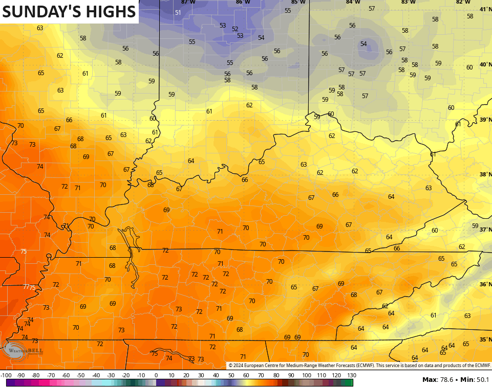
Freezing temps show up behind this tonight and early Saturday with lows deep into the 20s. Skies turn mostly sunny with temps into the 50s for most areas with a low 60 in the west. Sunday turns even milder with 60s for all, but 70 is possible across the south and west…
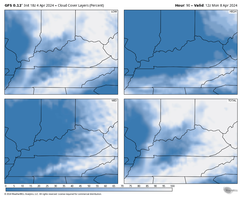
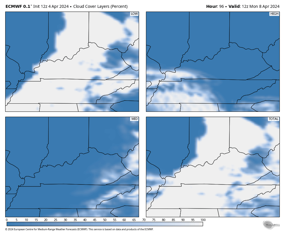
That’s ahead of a system bringing a shower or storm in from the west late in the day and through the first part of Monday. This is our big solar eclipse day and clouds may be an issue for parts of the region.
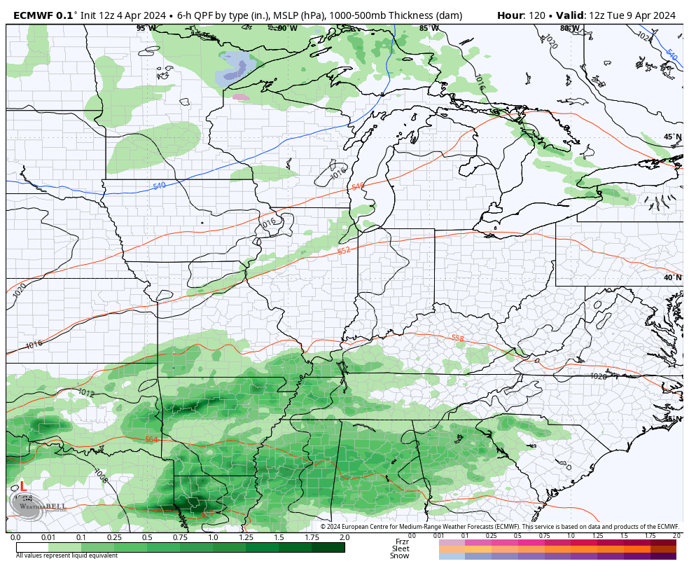
The GFS and EURO are showing the close call with clouds on Monday…
GFS
EURO
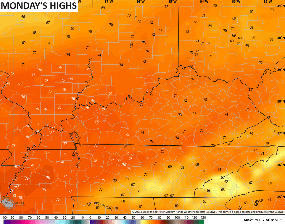
Highs on Monday surge into the 70s across the entire state…
The pattern turns active after this with scattered showers and storms going up on Tuesday. This is ahead of a couple systems working in from the west and southwest, giving us the threat for more strong storms and some heavy rains for the second half of next week…
This continues to be part of what is likely to be a very stormy spring around here. Above normal rainfall has been common since the start of the year and I expect that to continue. The control run of the EURO Ensembles show a very stormy next two weeks from our region into the deep south…
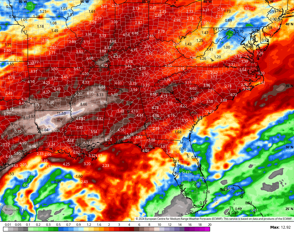
This is likely a VERY active spring severe weather season for our region.
Enjoy your Friday and take care.

We really don’t need that much rain.
Thanks Chris. What has me concerned is the PDO is beginning to phase to very negative. That could mean your forecast for a very stormy spring will varifly. This is not good, as people are struggling to get by these days. They don’t need or deserve to become homeless due to a tornado outbreak.
Let’s hope that all the young astronomy students have a nice clear day to study the solar eclipse. Warning do not look without the proper eye protection. I don’t trust any of the eye protection devices, so I stay indoors and just watch it go from day to night and back to day, and later watch it on television.
Have a great day despite the unspring like weather !
I found this very interesting article on the reversal of the polar vortex. Maybe this is going to give us a colder and snowier winter 2024 – 25. Don’t know for sure, but it happened in 1917 – 18 with La Nina in place. The coldest and snowiest winter on record. NOAA has a forecast out for a possible La Nina forming next fall and winter. Very interesting to see what happens later this summer.
https://www.space.com/earth-polar-vortex-spinning-backwards-above-arctic-reversal-event#:~:text=Earlier%20this%20month%2C%20a%20sudden,could%20impact%20global%20weather%20patterns.