Good Saturday to one and all. We have MUCH better weather blowing into the region this weekend with a surge of spring temps taking us through next week. That’s when another stormy pattern takes shape around here.
Temps are in the 20s to start today with highs reaching 55-60 in many areas with partly to mostly sunny skies.
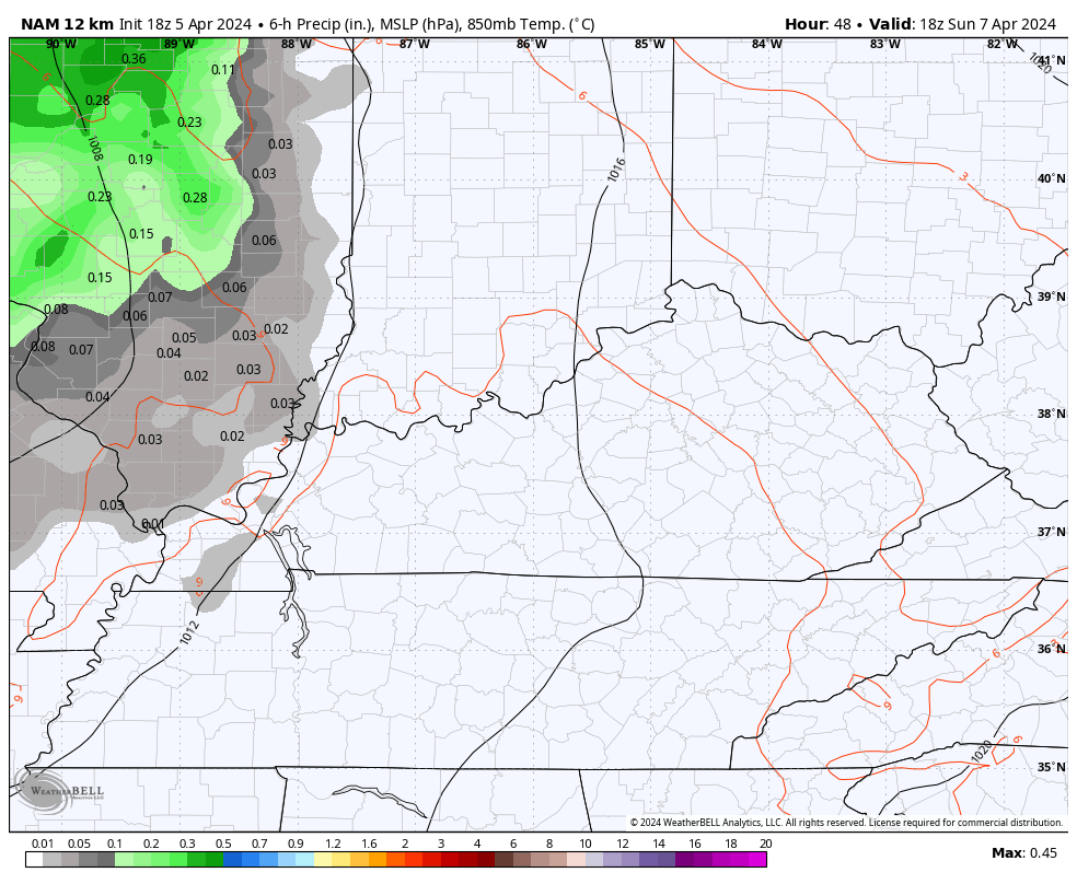
Sunday finds temps really taking off with 60s for all with a 70 in the west and south. This is ahead of scattered showers and storms moving in from the west with a weak system crossing the region. This action fades east Sunday night and early Monday…
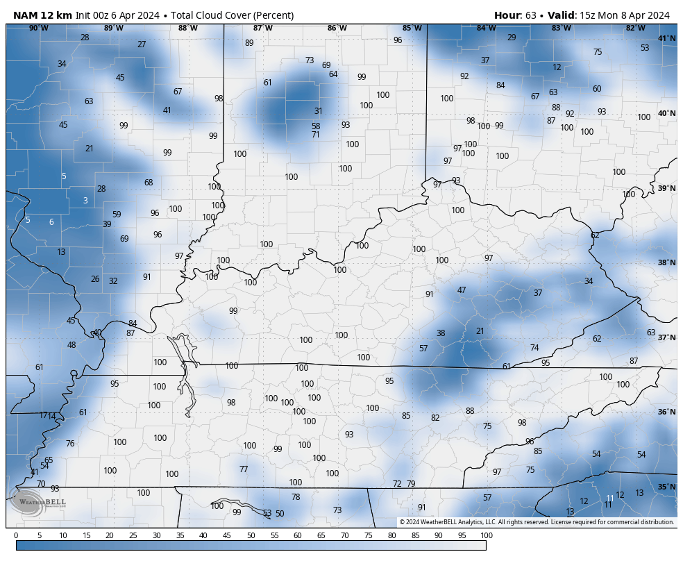
What about the clouds for the eclipse? The prime time for the eclipse is centered around 3pm EDT, give or take a little depending on where you are in the state. The NAM shows a lot of clouds early on before some thinning out occurs. This animation shows total cloud cover from 11am through 5pm…
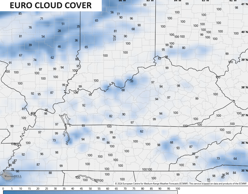
On the flip side, the EURO keeps the clouds hanging around at 3pm…
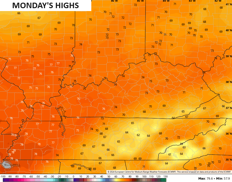
Eclipse Day Monday looks VERY mild with temps deep into the 70s…
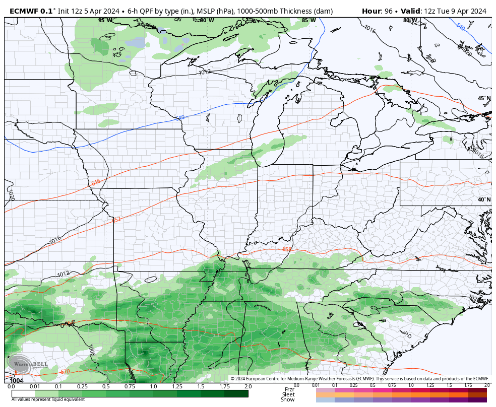
This warmer air settles in through the end of the week as rounds of showers and storms sweep through the region. This could bring additional strong storms and heavy rainfall across our part of the world…
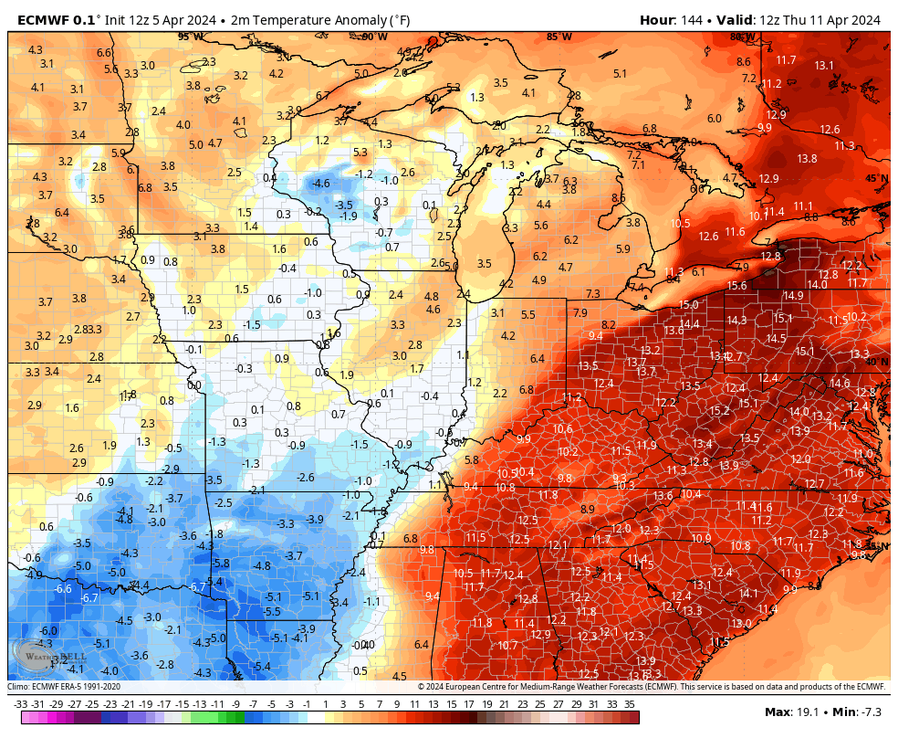
Temps look to drop a bit behind that before bouncing right back up into the warm category next weekend…
Have a sensational Saturday and take care.

I guess it’s watch and wait on the clouds. I hope it will clear out in time to see something
well that was weird. I go to log in to comment and it says I need to verify……but when that happens, the email never ever comes…so then I try to log in again and it let me..
Anyyyywayyyy…
I’ve heard even if it’s cloudy… you can still totally tell as it will get very dark… much darker than just cloudy dark… so we’ll see… Hopefully it’s clear.
Some hard freeze this morning, huh? /s
Twenty nine degrees was the low this morning here in Maple. A very heavy frost. Whatever trees and shrubs that were blooming were fried. Where I live now there’s not any plants ( that are not native ) will grow and bloom in my local climate.