Good Sunday, everybody. It’s an absolutely awesome weather day taking shape across the Commonwealth as we get setup for another busy week of weather. Does this include some clouds for the big solar eclipse? Maybe.
Let’s start with today and hit the fast-forward button.
Highs are in the 60s for the entire region with a 70 in the south and west. Clouds will increase with a few showers and thunderstorms getting into western Kentucky by evening. That action will then roll eastward across the rest of the state tonight and early Monday.
This isn’t a ton of rain by any means, but your friendly Kentucky weather radars are scanning the skies for you on this Sunday…

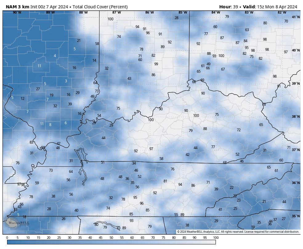
The big solar eclipse is almost here and we are hoping to keep the clouds away. We are likely to start the day with clouds with some clearing into the afternoon, but the extent of that clearing remains to be seen.
The Hi Res NAM total cloud cover animation from 11am through 5pm shows pockets of clearing…
The EURO is similar with pockets of clearing…

The lower the number, the better the chance for clear skies for that specific location.
Temps reach the 70s on Monday with another storm system rolling in with showers and storms Monday night and Tuesday. This kicks off a very stormy period that runs through early Friday…

Strong storms and heavy rains will be possible during that time. By Friday, cooler winds blow but that quickly turns around into a milder wind coming for the weekend. That is also ahead of another big thunderstorm maker…
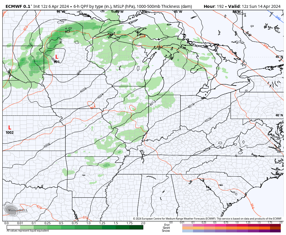
More than one round of strong to severe storms will be possible from the middle of the week ahead into the early part of the following week.
This may also result in a lot of rain for our region. Check out the the EURO rainfall forecast during this time…
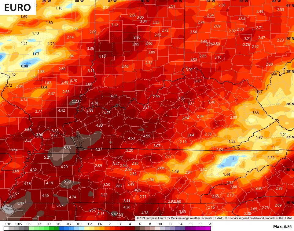
Again, we really need to be on guard for a lot of heavy rain and storms for the rest of this month.

Well it is Eclipse eve. I hope everyone gets to see it. My sister will be in the total eclipse in Indiana I am jealous lol.when do we have the winters like redbud or dogwood??
Crystal, my sister will also be in the path of the solar eclipse. Clouds are definitely going to be present, so it will just get dark and erie. In August 2017 eclipse, we had clear skies and we were able to see the stars and the birds fly into the woods to roost. Very erie.
We just finished redbud and dogwood winter here with a hard freeze yesterday morning. I’m ready for summer.
Thanks Schroeder I wonder what site I can go to to show the times for my local area looks like my area will have a lot of cloud coverage
Still no hard freeze in Richmond so there’s that.