Good Monday, everyone. It’s eclipse day, but we have to fight our way through some clouds and that may be a task for some areas. The main focus of the forecast is on a lot of rain coming over the next few days. Rounds of storms will lead to flooding concerns through Friday.
Temps today reach 70-75 in many areas as the clouds try to break. There’s still the chance for a few scattered showers and storms around, especially early today across central and eastern Kentucky. Here are your radars to follow along…

Waves of showers and storms then target the region starting Tuesday. This comes at us ahead of a potent storm system that wraps up and lifts from the lower Mississippi Valley through the western Ohio Valley and into the Great Lakes by Friday.
This system brings the threat for strong storms and a lot of rain…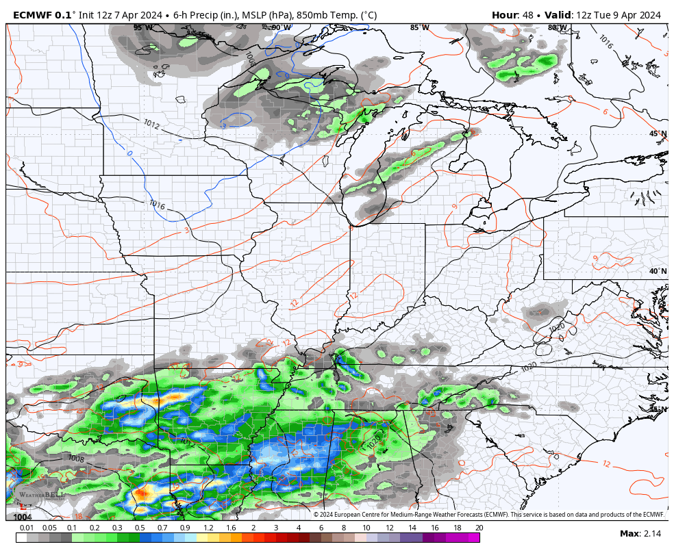
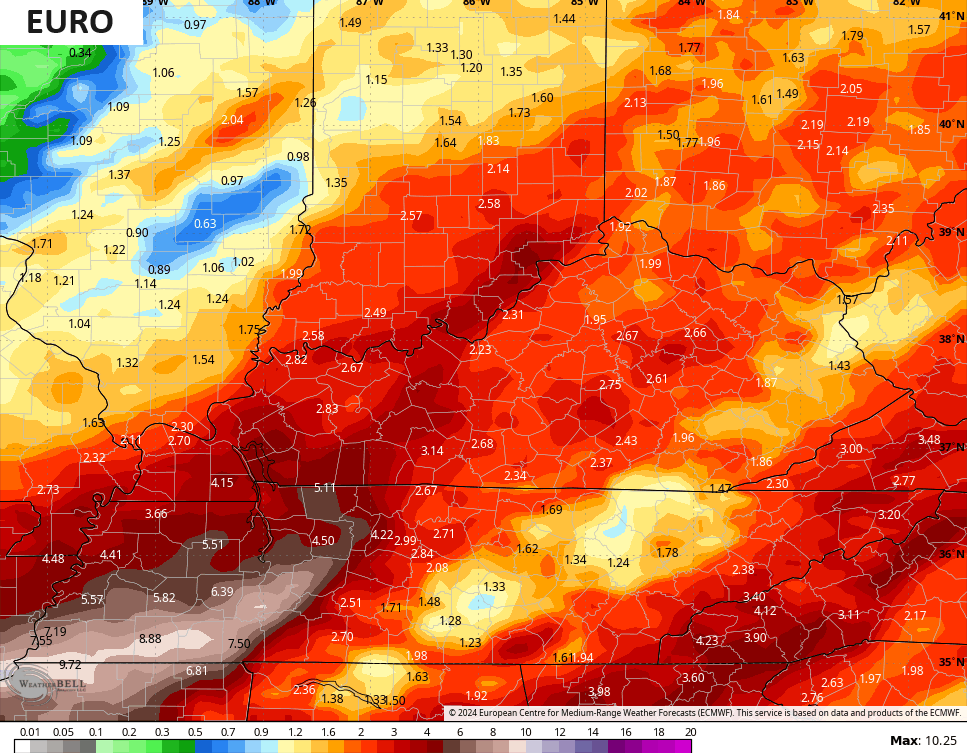
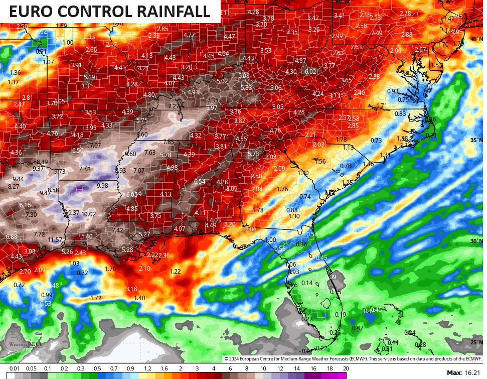
That run of the EURO is on the low side of the model spectrum in terms of rainfall. Still, this run has a general 1″-3″ of rain with locally higher amounts by Friday…
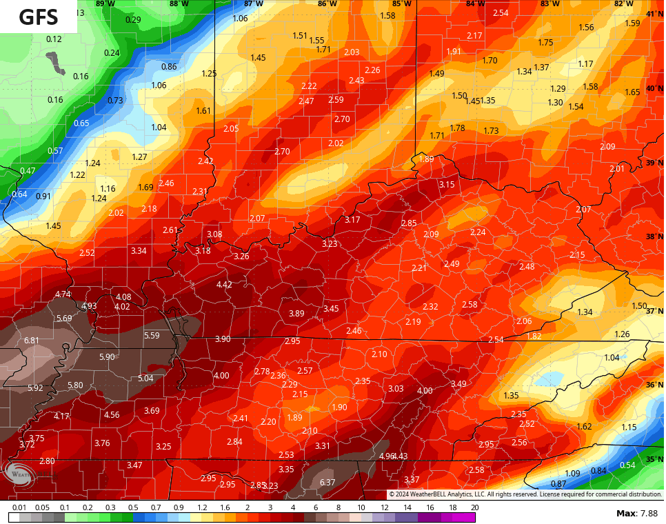
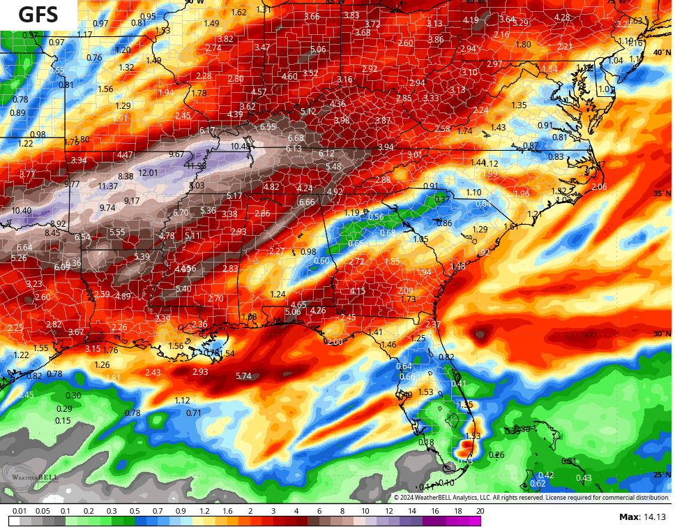
The GFS is showing quite a few areas of 3″-5″ rain amounts during this time…
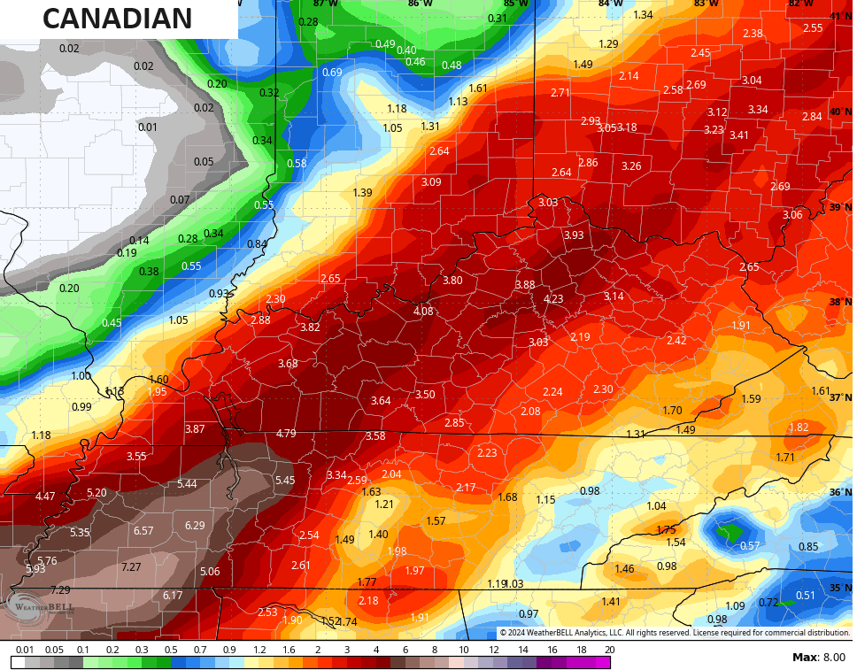
The Canadian Model is also seeing 3″-5″ amounts during this time but is focusing all this a bit farther east than the GFS…
Flooding concerns are there for the rest of the week, especially Wednesday through early Friday.
Colder winds will kick in behind that departing storm system for Friday, but the temps bounce back quickly toward 70 over the weekend. That will be ahead of another potential stormy look early next week…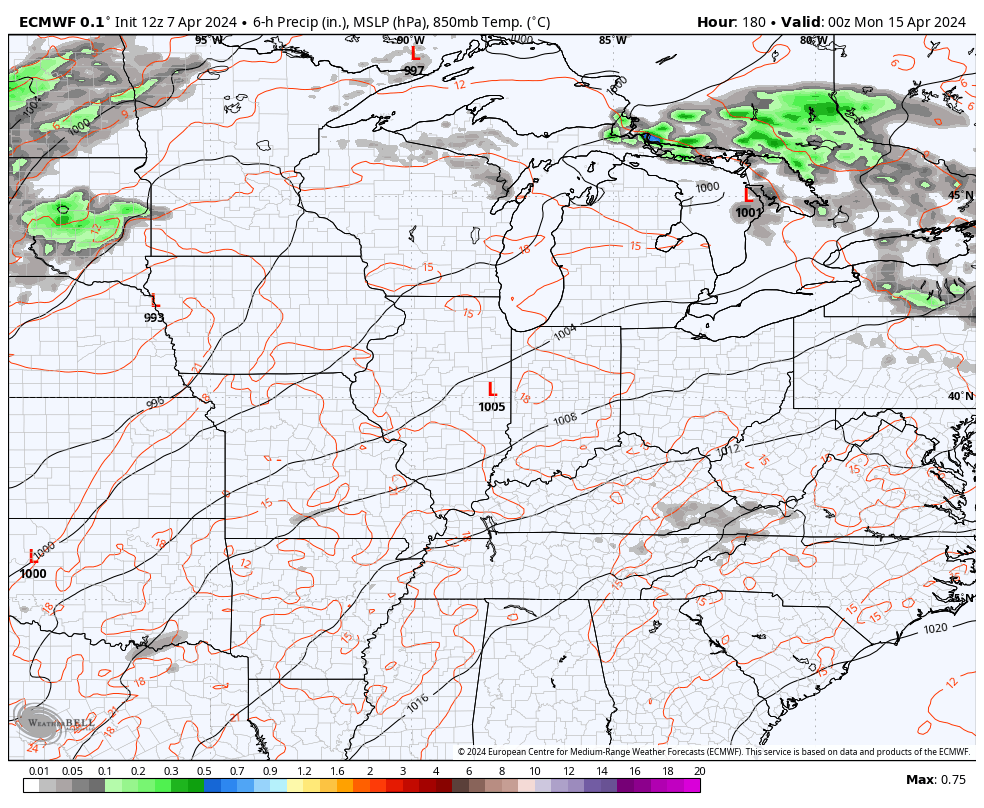
Folks, this is a REALLY wet and stormy pattern from the Ohio Valley to the lower Mississippi Valley for the next 10-14 days, at least. Severe storms and flooding rains are a concern for these areas.
The models have a strong signal for this…
Have a great eclipse day and take care.

Those rain totals are worrisome but this is the time if we get heavy rain seems like this time is it especially in my area. I hope no flooding. Have a safe and happy eclipse day not looking good for my area last I saw was 84% cloud coverage oh no !!!!
I know a little rain is needed, but nowhere near as much as the models say.