Good Tuesday to one and all. We are seeing rounds of showers and thunderstorms working across the state today, kicking off a very wet and stormy setup for the rest of the week. The potential is there for a few strong to severe storms and local high water issues.
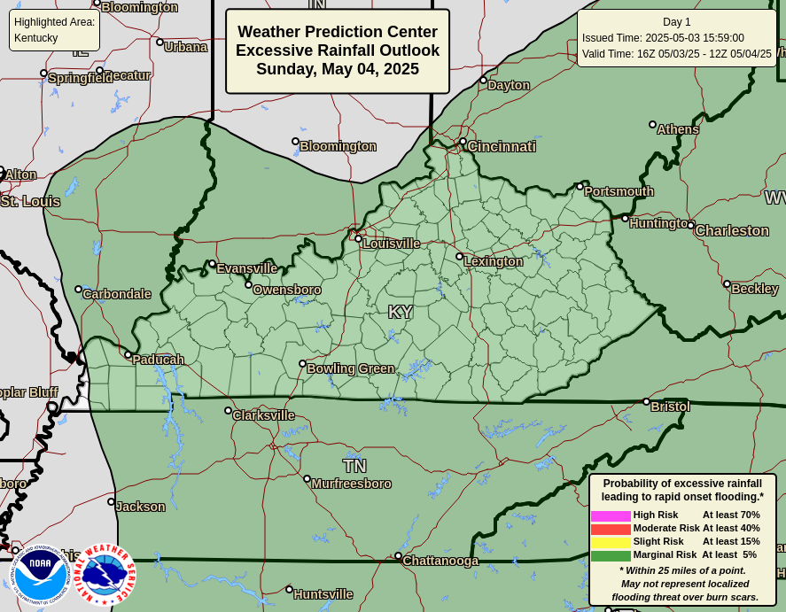
The showers and storms today are more prominent across central and western Kentucky than the east. Local 1″-2″ amounts are possible in some areas and the Weather Prediction Center has a Marginal to Slight Risk for excessive rainfall in these areas…
Here are your radars to follow along with today’s rounds of showers and storms…

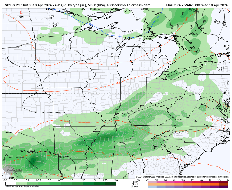
A potent low pressure system then works from the Lower Mississippi Valley on Wednesday, to the western Ohio Valley on Thursday. This will bring additional waves of rain and storms through the region with cooler showers showing up behind the departing system on Friday…
This setup means a few things for us:
- Additional heavy rainfall of 1″-3″ will be possible.
- Local high water issues may show up.
- A few strong to severe storms may also show up.
- The greatest threat for severe storms is just ahead of the low on Thursday. Central and eastern Kentucky have the greatest risk.
- Gusty winds will be likely with this storm system. 40mph gusts may show up from Wednesday night through Thursday.
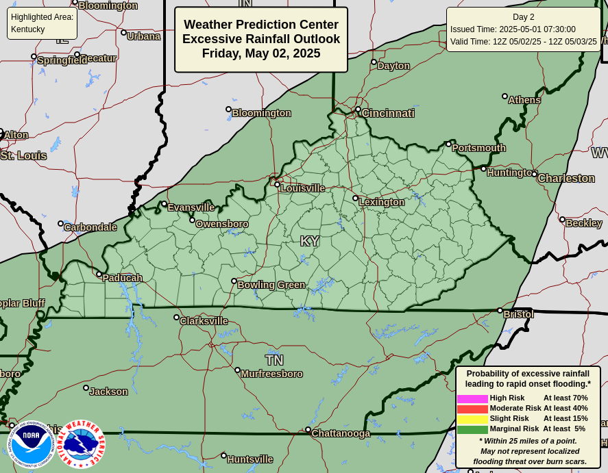
The Weather Prediction Center continues to highlight the chance for excessive rainfall on Wednesday…
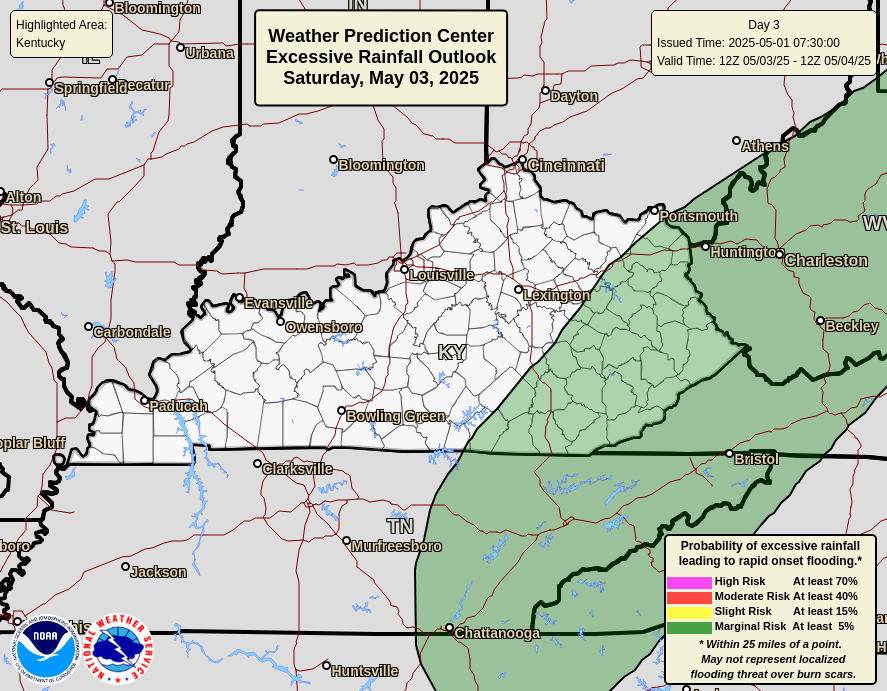
Here’s the Thursday outlook…
As mentioned, the severe storms risk is there for central and eastern Kentucky on Thursday. Here’s the Severe Weather Outlook from the Storm Prediction Center…

Much cooler showers move in for Friday as winds gust to 40mph from the northwest. That blast of cool is in and out with a great looking weekend to follow. Sunshine and temps hitting the 70s…
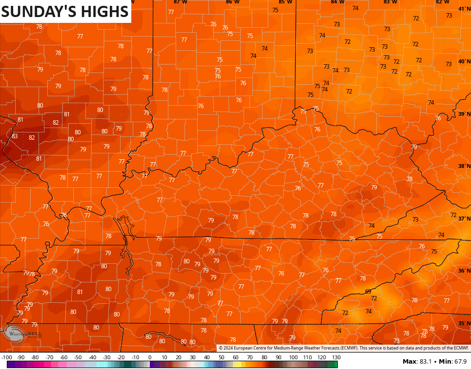
Temps next week may reach the 80s on more than one occasion. Bring. It. On.
Enjoy the day and take care.

#TeamHeat
Thanks Chris. Yesterday solar eclipse was very exciting for many. I was glad that the skies were clear enough so the youngsters could experience this rare celestial event north of the Ohio River. Here in south central Kentucky the skies were cloudy, but it did get dark and erie, and the birds all disappeared into the woods, and it was dead calm. Very erie.
Looks like we are in for a very wet period, and the best widespread rains in days may be coming. I think that the danger of having anymore frost and freezes may be over. No one knows for sure though. Hoping the summer doesn’t turn off hot and dry too soon.
Have a great day !
I have a feeling it is going to be a long hot muggy summer.
Me too… and some people actually WANT that… I prefer fall/winter/spring…. but summer heat I hate