Good Wednesday to one and all. A potent storm system is spinning into the region through Thursday, bringing rounds of showers and storms with it. Some of these storms may be strong or severe and put down enough rain to cause local high water concerns.
Let’s start with today and roll forward.
A few waves of showers and storms are lifting from southwest to northeast across Kentucky with some periods of sun in-between those. A few of the storms may be on the strong side, especially this afternoon and evening.
The Storm Prediction Center has a low-end risk for a few severe storms across parts of southern Kentucky during this time…

Low pressure then rolls from southwest to northeast across western Kentucky into Indiana late tonight and Thursday. Severe storms may show up along and ahead of the track of the low, placing central and eastern Kentucky in the best area for damaging winds, large hail and a few tornado spinups.
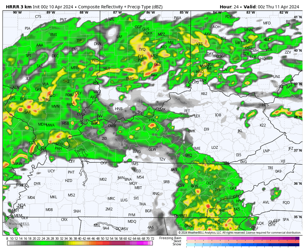
You can see this low showing up on the future radar from the HRRR…
The Storm Prediction Center continues to highlight central and eastern Kentucky in the Thursday Severe Weather Outlook…
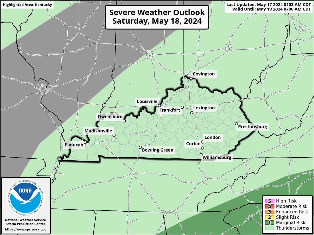
Here are the individual threats from the SPC…


In addition to the severe threat, heavy rainfall of 1″-3″ will be possible for some. That could lead to local high water issues.
Winds are also a big time player with 40mph gusts or greater possible through early Friday.
Chilly winds and showers will be noted on Friday as our low pressure works to our northeast. This looks like a rather nasty weather day for central and eastern Kentucky, but the weekend looks supberb!
Highs on Saturday rebounds into the upper 60s to middle 70s with 75-80 possible by Sunday. 80 degree temps are very possible through much of next week.
I may drop by for an update later today. Until then, I have you all set to track today’s severe weather outbreak in the south and our local severe weather chance…

Current watches

Possible Watch Areas

Make it a wonderful Wednesday and take care.

Next week sounds awesome.
Thanks Chris. I wish that I lived in an area where tornadoes were not in the meteorologist vocabulary. Almost every time they are mentioned in the forecast I get very nervous anymore. Must be an age thing. Eighty degree temperatures next week I will enjoy. We have plenty of soil moisture for this spring’s planting. Fifty five hundred ‘s of an inch in the past forty eight hours.
Have a great day !