Good Monday, everyone. It’s the last full week of April and it’s starting out on a frosty note. There’s one more frost threat lurking later in the week, but the overall temperature trend is looking up by the weekend into the start of Kentucky Derby Week.
Frost is out there this morning with low and middle 30s for many. A few spots may actually hit the upper 20s. Brr. Highs this afternoon reach the 60s with a mix of sun and clouds.
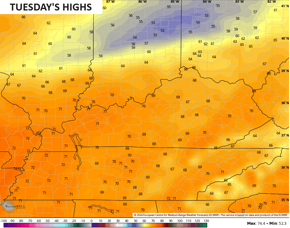
Temps of 65-70 will be noted on Tuesday as we get ready for another cold front to drop in…
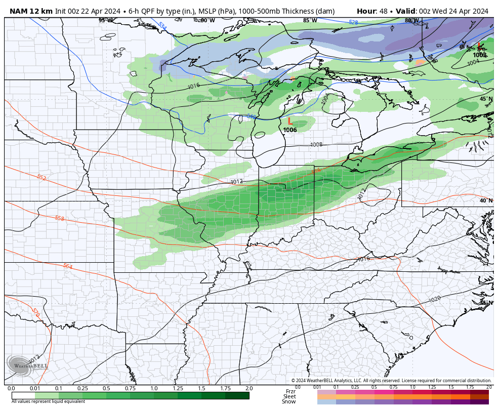
This front arrives with some showers and storms Tuesday night and early Wednesday…
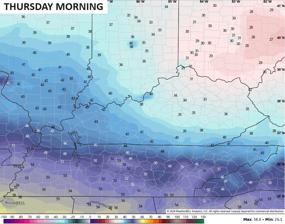
A quick-hitting shot of cold gets into central and eastern Kentucky with more frost possible Thursday morning…
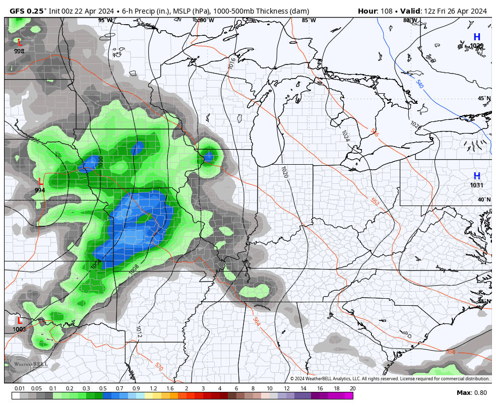
Those numbers spike back up starting Thursday into Friday and this surge in temps brings a few rounds of showers and thunderstorms starting Friday and lasting into early the following week. No, this isn’t washout stuff, but some we will need to be on guard for a few strong to severe storms…
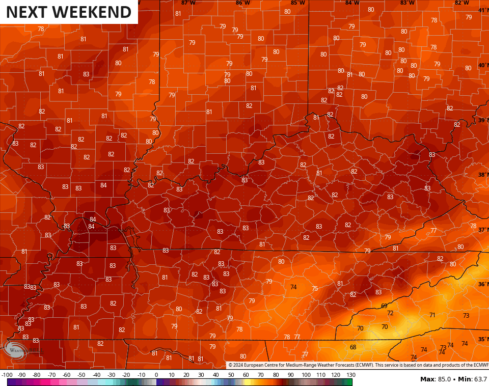
Temps with this setup can really take off this weekend with low and middle 80s possible…
Have a magnificent Monday and take care.

#TeamHeat:)
A nice spring forecast.