Good Tuesday, everyone. We have a cold front rolling into the region tonight and it’s bringing a quick-hitting brand of showers and thunderstorms with it. Another frost threat comes behind this before temps take off this weekend as another late May surge of temps takes control.
Temps this morning are mainly in the 30s with some patchy frost for some. 65-70 will be common this afternoon with some low 70s showing up in the south and west. Clouds will increase as our cold front drops in from the northwest.
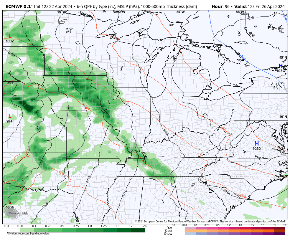
A broken line of showers and thunderstorms moves quickly through the region from late this evening into the early morning hours of Wednesday. This won’t be anything severe, but some locally heavy downpours will be possible.
Here are your radars to follow along…

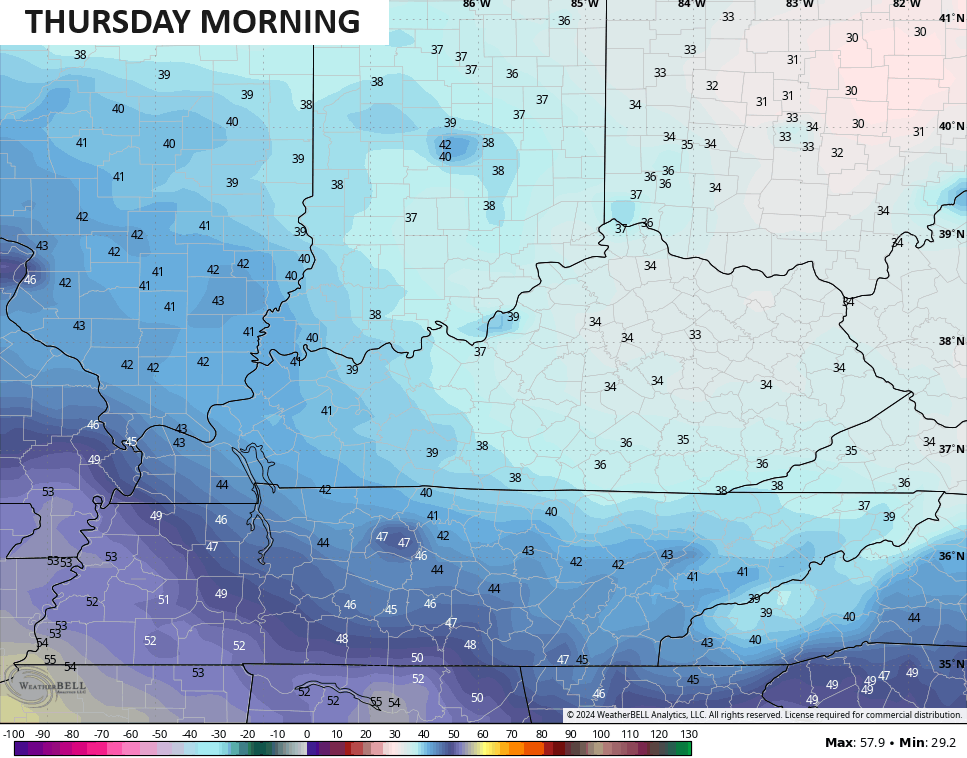
Wednesday turns partly sunny with temps in the 60s with colder air coming in later in the day, setting the stage for more frost by Thursday morning. Temps across central and eastern Kentucky drop into the 30s once again…
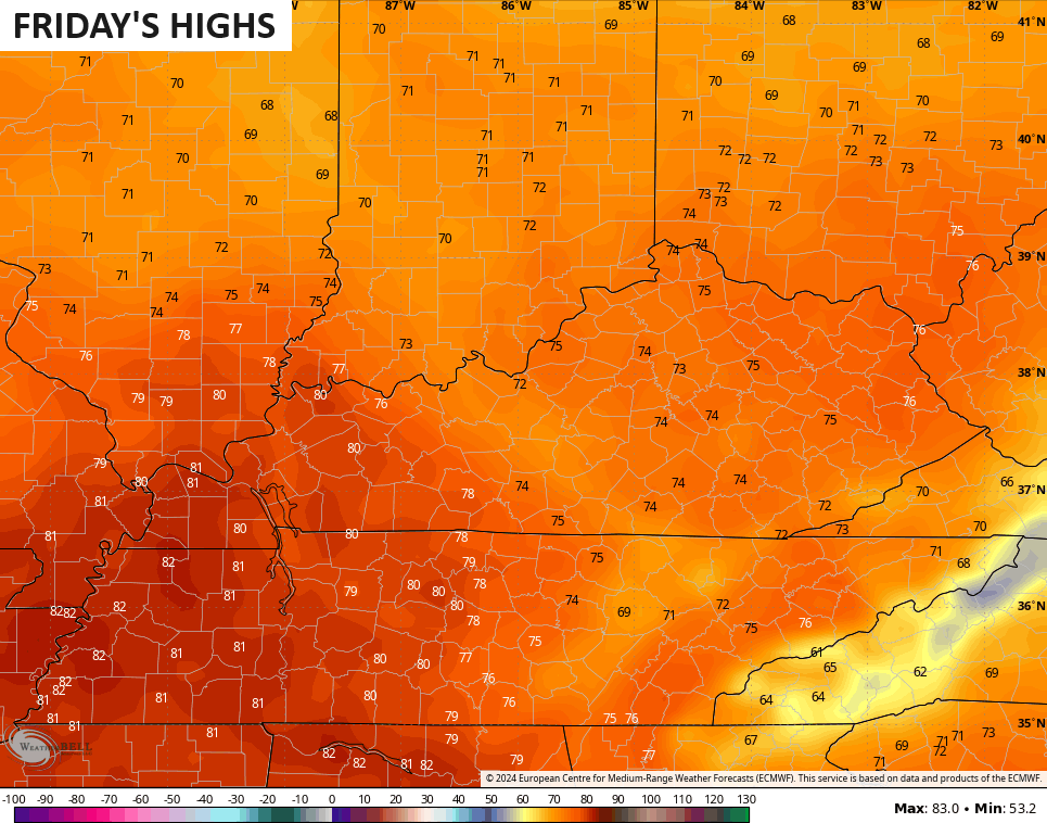
The setup for the weekend looks much warmer as low pressure rolls slowly from the Plains toward the Great Lakes. That will bring some scattered storms into Kentucky Friday and Saturday with the threat for strong storms by Monday…
As mentioned, MUCH warmer temps come into the region during this time.
Highs reach the 70s for Friday…
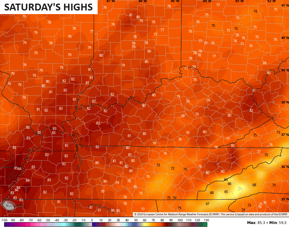
Upper 70s and low 80s then take over for Saturday…
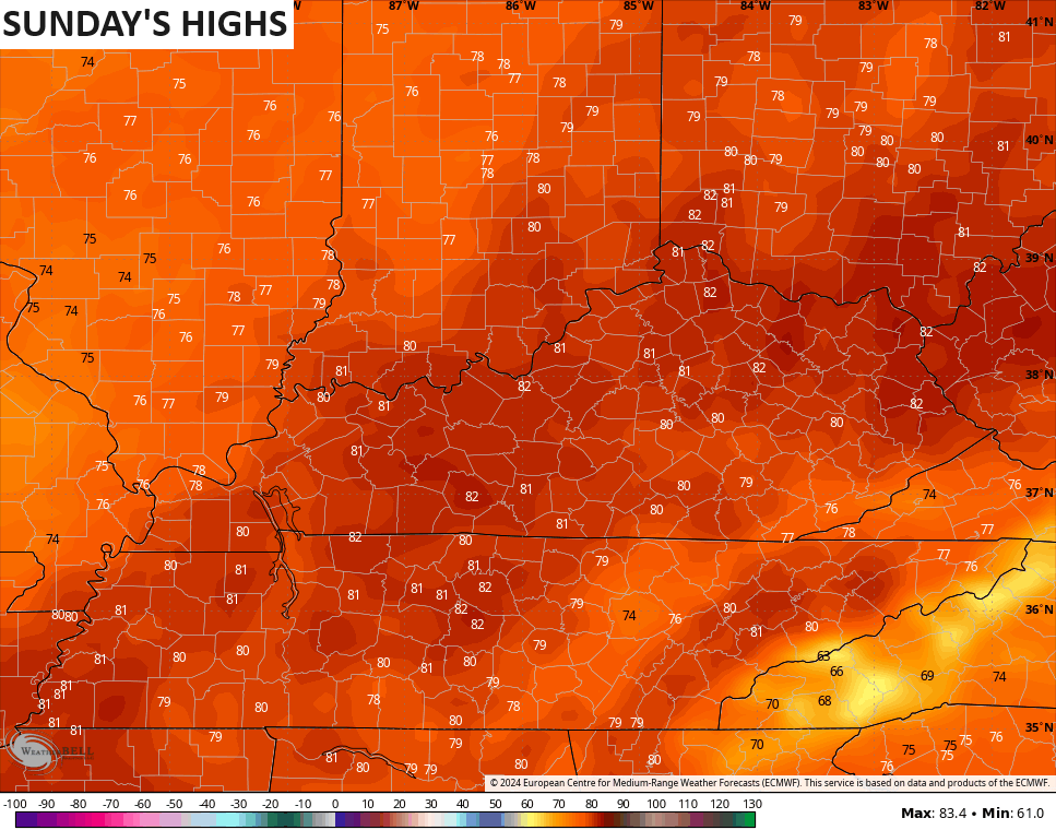
Low to mid 80s would then be possible on Sunday…
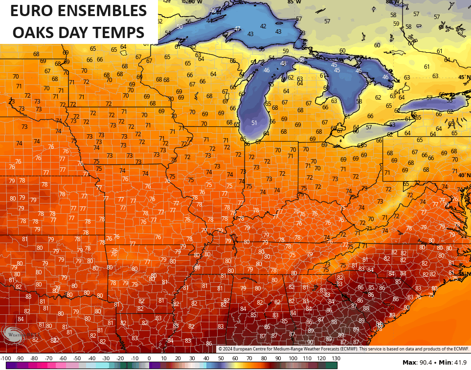
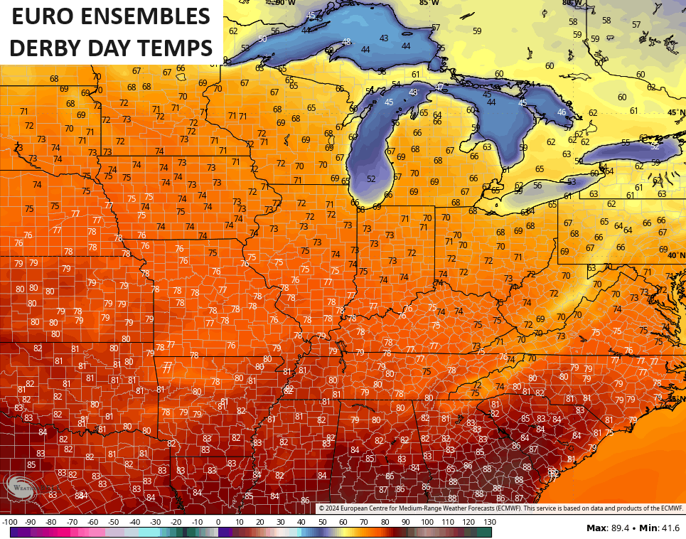
I’m already looking toward Oaks Day and Derby Day and the EURO Ensembles are, right now, showing normal temps in the 70s…
We will keep watching the trends in the coming days.
Have a great Tuesday and take care.

Hopefully this week will be the last chance for any frost.