Good Wednesday, folks. Our cold front is pulling out of town as a frost threat rolls in for tonight and early Thursday. Hang in there, we have a surge of early summer temps on the way for the weekend as we go into a warm pattern to end April and begin May.
Clouds will quickly move out early today with skies becoming partly to mostly sunny. Highs reach the low and mid 60s in the north with upper 60s to low 70s in the far south and west. Colder air seeps in tonight with frost likely across central and eastern Kentucky. Lows will be in the low and middle 30s.
The rest of Thursday features sunshine and temps in the 60s.
Much warmer air moves in from the southwest starting on Friday as a few showers and thunderstorms show up along the leading edge. Low pressure then moves slowly from the Plains toward the Great Lakes. This brings just a scattered storm for the weekend with a better chance for some strong storms by Monday…
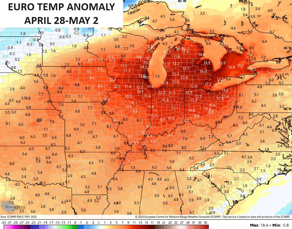
Temps this weekend reach 80-85 degrees in many areas and that likely takes us into Monday. Temps may dip a bit on Tuesday but should stay much above normal. Look at the 5 day temperature anomalies from the EURO…
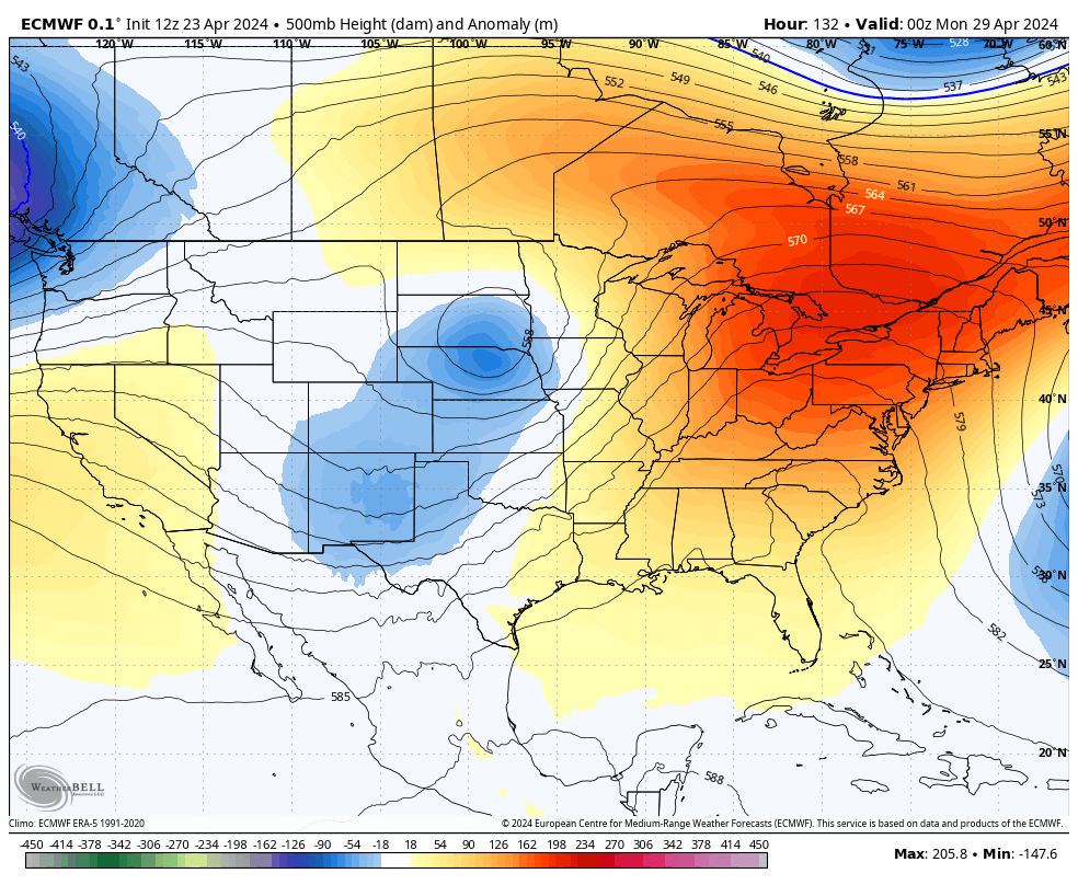
This happens as the trough coming out of the Midwest really dampens out as it moves east with another ridge building in behind it…
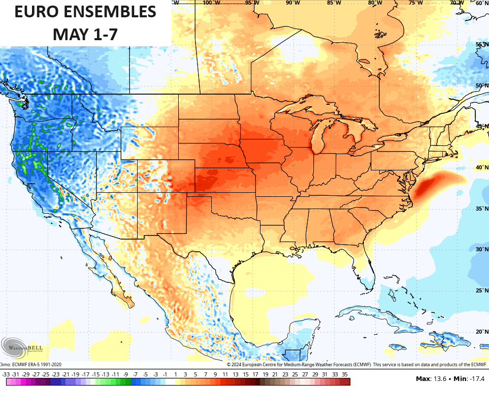
This warmer than normal setup will continue into the first week of May and that includes Kentucky Derby Weekend.
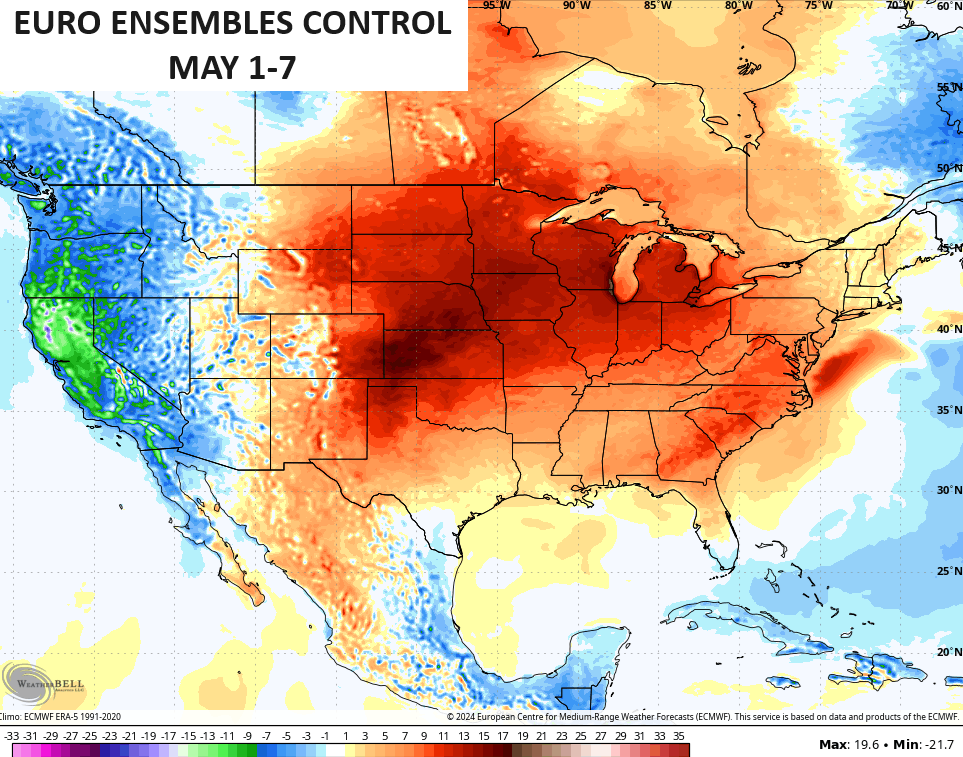
The EURO Ensembles show a lot of the country above normal for the first week of the 5th month…
The Control Run of the EURO Ensembles is even warmer…
Now, I do think there’s the chance for some thunderstorms to get into the mix for Derby Weekend and that’s something to pay attention to in the coming days.
Enjoy this day and take care.

The last frost wasn’t much. This one will likely be the same. 🙂