Good Thursday to one and all. This is the last in a long run of cooler than normal temp days across Kentucky! Woot! Once into Friday, a summer feel surges into the region for the closing days of April and that should last through the first week of May, at least.
A touch of frost is likely this morning across parts of central and eastern Kentucky with temps in the 30s. Highs reach the 60s this afternoon as our wind is still cool from the north and northeast.
A warm front pushes in from the southwest on Friday and should touch off some scattered showers and storms. This happens as low pressure develops across the Plains and slowly works toward the Great Lakes by Monday.
This setup brings mostly dry weather in here for Saturday and Sunday before thunderstorms increase a bit Monday into early Tuesday.
This animation starts Friday morning and runs through Tuesday…
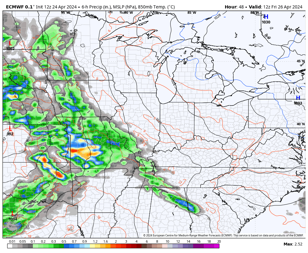
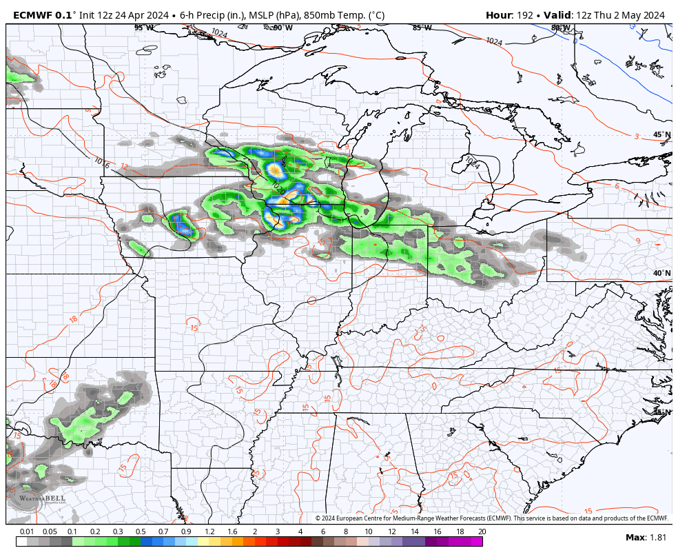
That’s quite the severe weather maker to our west.
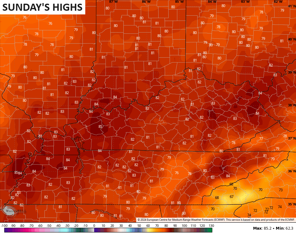
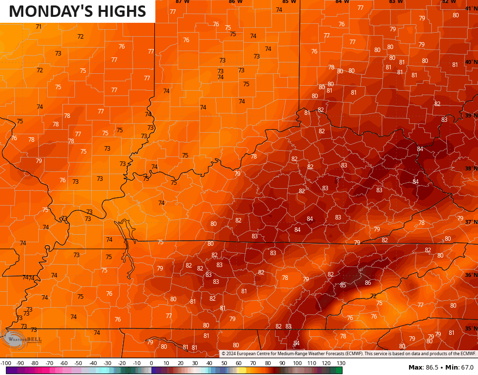
For us, it means temps reach the upper 70s and low 80s for Saturday with low and middle 80s for Sunday and Monday…
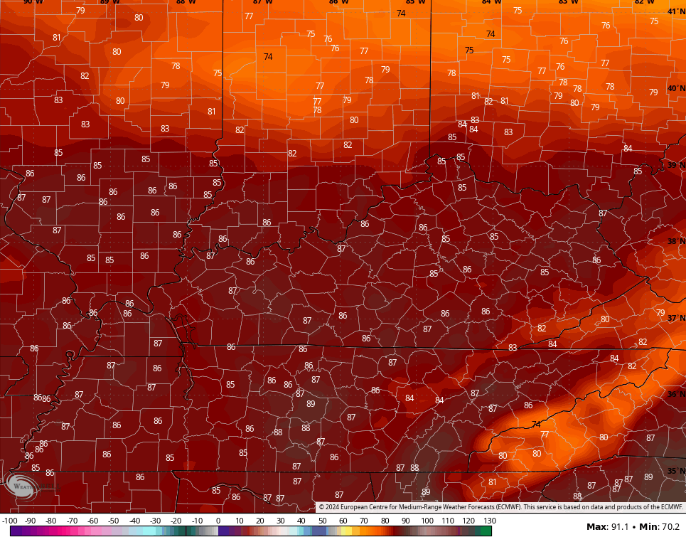
This summer feel may flex again for the middle and end of Kentucky Derby week. Temps from the EURO for next Thursday and Kentucky Oaks Day Friday are in the 80s…
Can we keep thunderstorms away? That’s the million dollar question as this warm setup may bring a few rounds of boomers along for the ride. This animation shows this well from next Thursday through the start of Derby Day…
Enjoy the day and take care.

My kind of spring forecast, minus any severe stuff.
I like the trend we are having with the severe weather this spring. A trend where the storms are weakening as they move out of the plains states, but I don’t wish any damaging storms on anyone area.
Mesonet update Pike county camera working nice view
Thanks Chris. Enjoying the beautiful spring weather, but looking forward to that summer feel.
Have a great day everyone !
I hope the next time I see frost there will be mature pumpkins laying on the ground.
During this cooler than normal period, we had a couple of frosty mornings here in Maple. Just enough to slow plant growth down a bit.