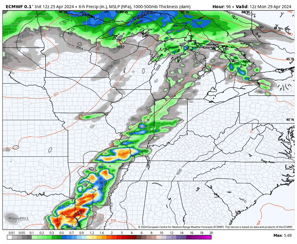
Good Friday, folks. We are rolling into the final weekend of April with a surge of summer temps ready to take over. The leading edge of this surge of summer is accompanied by a few showers and storms out there today.
These storms are along and ahead of a warm front rolling in from southwest to northeast, but this shouldn’t be terribly widespread.
Here are your radars to track today’s band of boomers…

Temps today will be all over the place with mid 60s to mid 70s in central and eastern Kentucky, and low 80s in the west.
Those 80s then show up across the entire region this weekend with mainly dry skies. There’s the chance for a few mid and upper 80s Sunday then again on Monday as a strong southwest flow continues.
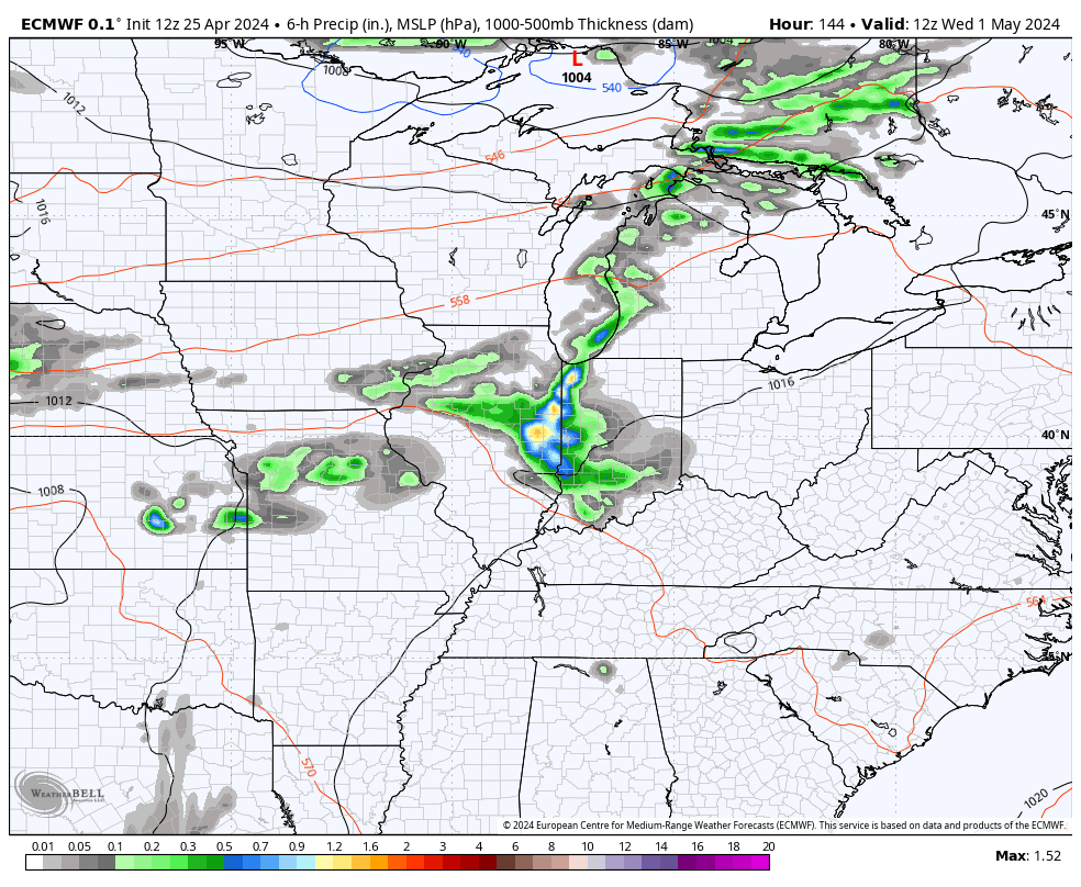
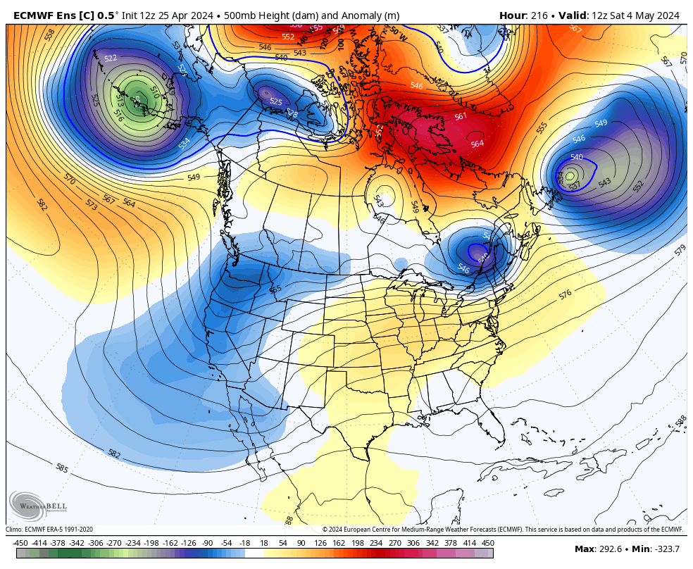
This is ahead of a storm system to our west that will bring the threat for scattered showers and thunderstorms in here for Monday and Tuesday…
As we head into May and Kentucky Derby Weekend, the pattern is toing to try to throw a few more showers and storms at us from time to time…
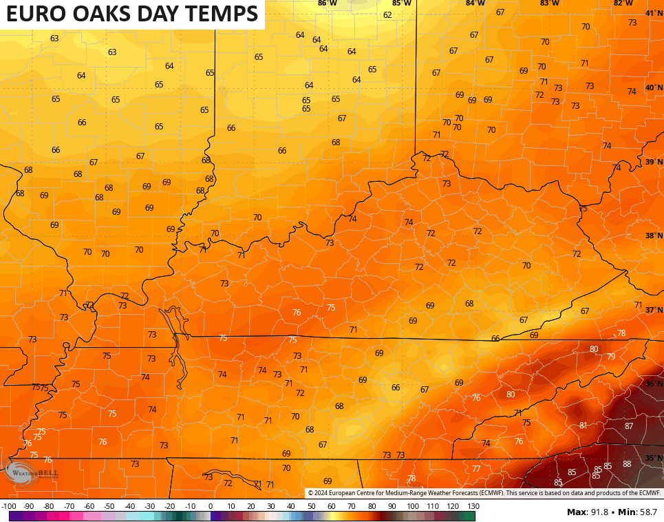
The EURO temps for Oaks Day and Derby Day are down a little bit from prior forecasts, but would still be really nice…

The EURO Ensembles forecast a ridge to build back in later Derby weekend with a trough along the east coast that develops and tries to push back toward the west a few days later…
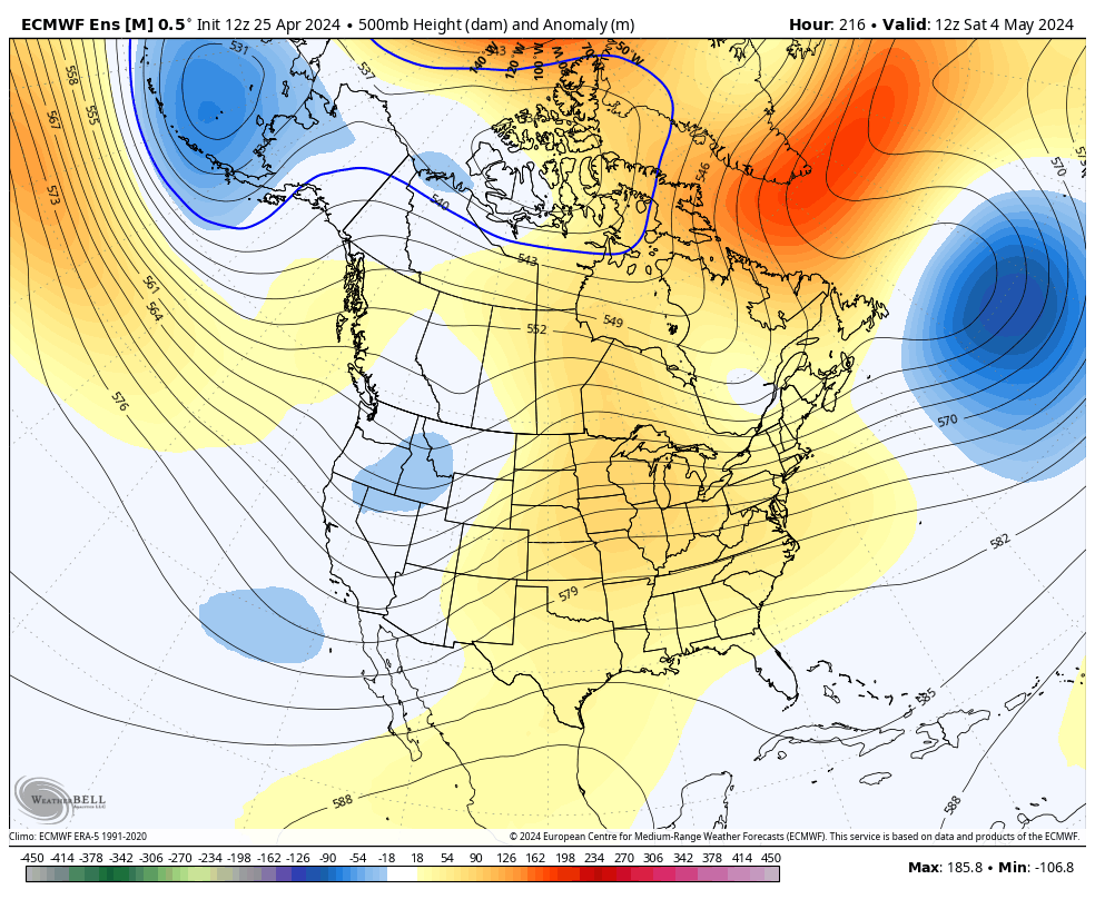
The Control Run of the EURO Ensembles is even more emphatic with this trough…
Make it a great day and take care.

Any trough in May will be laughable.
Oh no! not another crying wolf blue ball headed towards us.
If it does make it I hope we don’t see any frost.
I gambled yesterday and planted flowers and vegetables.
Yeah, it may be, but I’ve experienced cold troughs in July back in the 1960’s.
A little early for planting tender bedding plants, but you may be okay. As far as germination, the ground below two inches is not warm enough for seed.
Thanks Chris. Our period of very nice spring weather continues. We may need an ” April shower ” before long though. Never cared for the strong winds from the southwest. It brings wildfire danger to my area.
Have a great and safe day everyone !
Beneath the lush lawns is increasingly dry soil – down for a several inches now. Dry and sunny is nice, but the plants are slurping up the available moisture in competition with the sun and wind. Two weeks ago, ponds and streams were full, but those levels are falling off dramatically. Can’t seem to find convenient days to light our huge burn piles with the region’s dry, breezy conditions. Several days of soaking rains would be timely – and welcomed.
I always welcome a good soaking rain, but not floods. Maybe the Bermuda High pressure system in the coming days will weaken some and allow storm systems to come through.
Bring the warmth!!
Temps will be toasty out ahead of a cold front SUN/ MON
A few daily high temp records may be in jeopardy Monday from areas in OH to the Mid-Atlantic
♨️Regardless – a very warm stretch upcoming in the eastern US
Thanks, Chris
Maybe an early summer if the ridge doesn’t break down ?