Good Thursday, everyone. Kentucky Derby Weekend is just around the corner and it’s looking more and more like some showers and storms will be floating about the region. This kicks off a very active and stormy setup that takes us through much of next week.
Before we get to the storms, let’s talk temps. Highs today will be in the mid and upper 80s for much of the Commonwealth. Can a few spots hit 90? That’s a possibility, especially at the airports that have broken thermometers that are skewed way too warm.
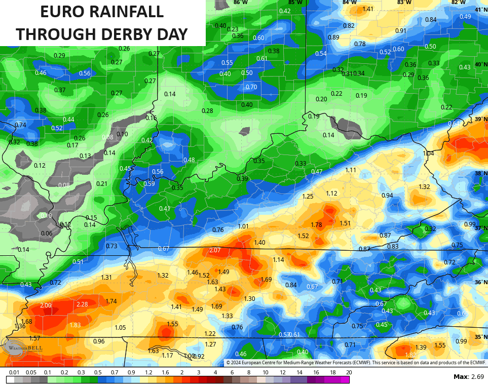
A few showers and storms will start to rumble into the region from the west and southwest later Thursday night before kicking into a higher gear on Oaks Day. While this isn’t constant rain, periods of showers and thunderstorms look to hang tough through, at least, part of Kentucky Derby Saturday.
Don’t be surprised if some areas pick up an inch or more of rain during this time, but the models disagree on where this corridor of heavier rains set up…

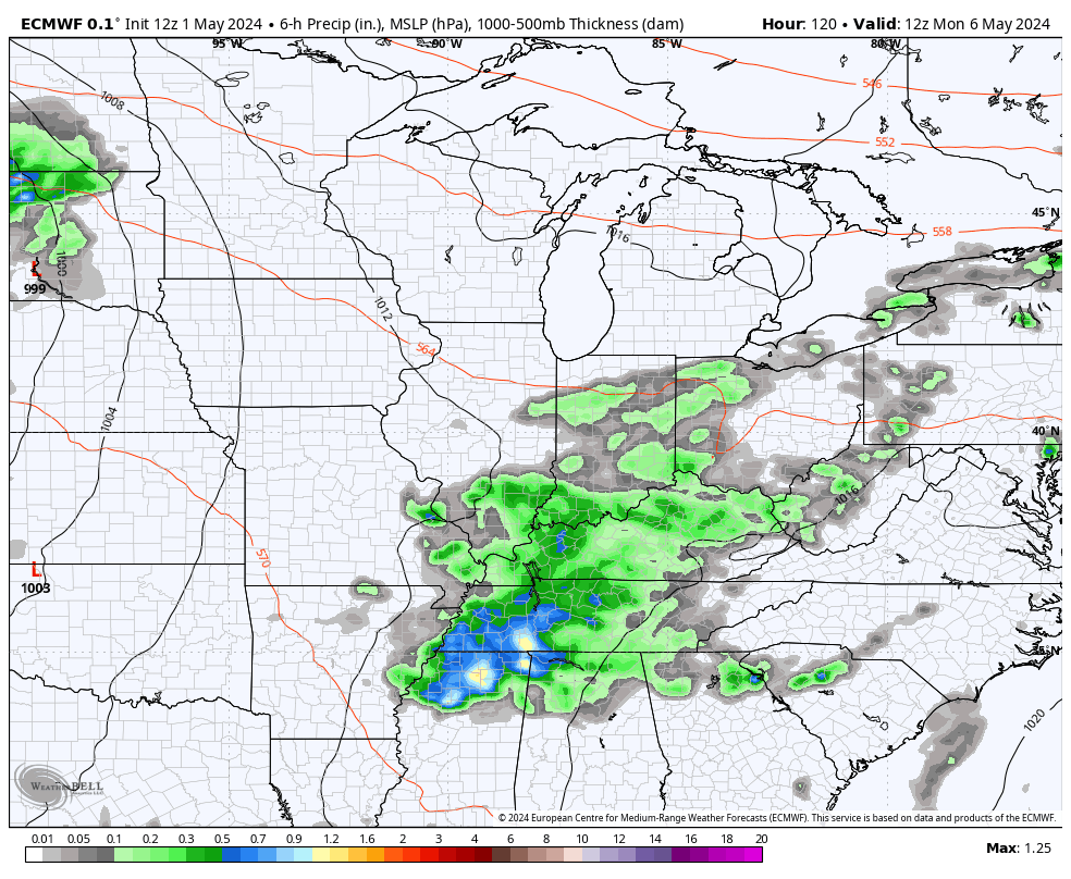
As mentioned, this pattern likely turns very storm through next week. The latest run of the EURO is showing these waves of thunderstorms that keep coming at us through next weekend…
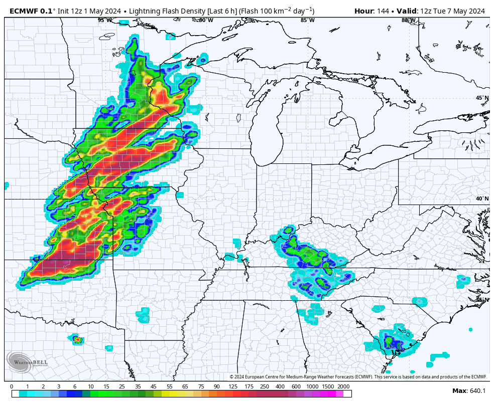
The lightning forecast from that same time period suggests the threat for strong to severe storms will be a real possibility…
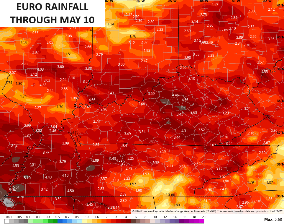
With waves of storms rolling across the region comes the potential to put down a lot of rain. Some healthy totals are showing up over the next week and change…

Stormy times ahead, my friends.
I leave you with your radars to follow the increasing storm threat from west to east…

Make it a great day and take care.

I don’t think it will be bad.
Thanks Chris. This may be the warmest day of the Spring season. April was about normal for both temperatures and precipitation in my area of south central Kentucky. The amount of precipitation next week and where it will fall depends on the weakening of a strong ridge to our east. We shall see.
Have a great and safe day everyone !
Good day to mow!
Or landscaping.
April & May my two favorite months.
Above normal temperatures will reverse the normal-to-slightly-lower trend of the past few years, but the hurricane season is likely to be the big story in 2024.
Winds have become favorable in central Atlantic and Caribbean, while water temps in the equatorial Atlantic are nearing record-breaking levels.
The Chicago area just experienced the 15th warmest April on record, with an average temperature of 52.7 degrees, which is 3.0 degrees per day above normal. Precipitation for the month was 3.47 inches. https://weather.gov/lot/April2024
Aside from the major severe weather outbreak in late February, it’s been a quiet severe weather season here so far. Scattered thunderstorms this afternoon prompted a brief Severe T-Storm Warning for the SW Suburbs.