Good Thursday, everyone. Waves of strong to severe storms have been rolling across Kentucky for the past several days and this action is finally set to calm down today. This calmer weather will also be accompanied by a blast of much cooler air for Mother’s Day Weekend.
Our day starts with heavy rain and severe storms across the southern half of the state. That’s the very part of the state that’s taken it on the chin over the past few days, with tornadoes, damaging winds, large hail and flooding.
Additional flooding is a good bet in some of these same areas early today, even as the severe storms finally slow down.
Here are your radars to follow this early day stormy setup…

Temps rebound into the 70s today ahead of a cold front dropping in this evening. That may have a narrow band of noisy showers and storms along it as it drops into Kentucky.
That opens the door to cool northwest winds on Friday with highs mainly in the 60s. There’s also a few showers that may show up on this northwest flow with another shower or storm threat with a disturbance dropping in late Saturday.
The NAM shows these two systems well…
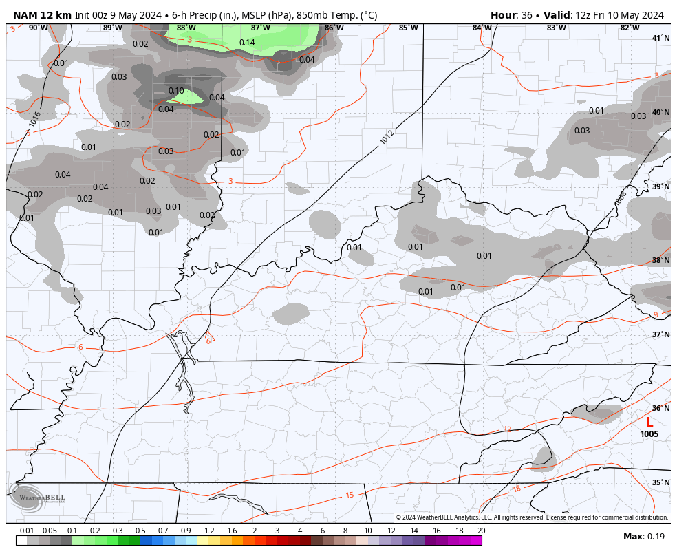
Highs over this Mother’s Day Weekend are 65-70 for much of central and eastern Kentucky with low 70s in the west. Lows will hit the 40s, especially Saturday when some low 40s will be possible…

The jet stream turns really active again into next week as we see some highly anomalous troughs digging into our region and the eastern half of the country. This doesn’t look anything like what we should be seeing for the middle of May…

That’s more of a cold weather season setup and it’s likely to feature several big storm systems rolling through here with rain and some thunderstorms next week…

A few strong storms may show up in this setup which can also mean additional hefty rainfall totals. The heavy rain threat is something to keep a close eye on into next week as temps hang below normal.
Have a terrific Thursday and take care.

Temps will skyrocket soon. These troughs are overblown.
July and August have the hotest temperatures usually.
We have family near the tornado’s path in Middle Tennessee. They’re OK but videos show the devastation when one like that sweeps through.
Glad they are ok
Glad to here your Family is Okay.
Thanks Chris. After last evening and night I’ll be ready for some of that cool, late spring weather. Very noisy with lots of lightning and loud thunder last evening. No hail, but there was some reported in Taylor county. Here in Maple we had a little over 3.00 ” of rain in the past 48 hours.
Have a great and safe day everyone !
Over the past 24 hours we ended up with 3.25 inches of rain, and a few minutes of penny-sized hail, but no tornado warnings. Several miles to the north they saw tennis ball-sized hail, and several baseball-sized stones were recorded near Hart County.
The last time I saw hailstones that big was in April of 1998. I worked at Fruit of the Looms HQ, and approximately 80% of the cars in the lot were totaled. Today, if you walk in through the main entrance, you can still see the dents left by the stones on the metal flashing. East of I-65 towards Drakes Creek, I vividly remember seeing a funnel cloud beginning to descend, which farther east turned into an F3. The height of that supercell was estimated to be over 80,000 ft.
The worse hail storm I can remember occurred in April 1960. I was in the 3rd grade at the time and we all had to evacuate to the basement because of the intensity. I remember the sky turned an erie green. The hail had accumulated to about 5 inches deep. Cars in the school’s parking lot were really badly damage some beyond repair.