Good Friday to one and all. It’s a much cooler day and calmer weather day across Kentucky and this, for the most part, takes us into Mother’s Day Weekend. Beyond that, the pattern turns much more active, even as our temps stay below normal.
Let’s kick this party off with a look at this super wet pattern we are seeing.
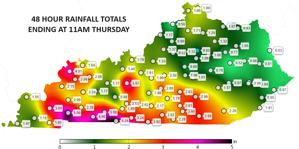
Our recent two day run of severe storms put down a ton of rain across Kentucky…
This adds to a very wet past 30 days of weather that’s featuring rainfall numbers well above normal…
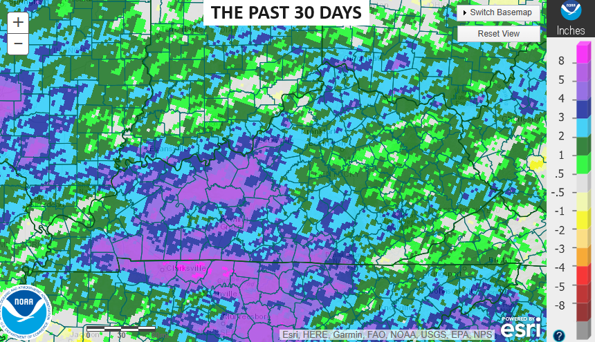
That’s a heck of a wet ground heading into the start of the summer growing season here in Kentucky.
If we look at the year as a whole, so far, we find much of the state with above normal rainfall numbers…

At some point soon we may get a 4 or 5 day stretch where it doesn’t rain much and that means the terribly dry biased drought index will show us in a drought allowing the usual suspects to yell DROUGHT!!!!!!!!! Y’all know that’s exactly how it goes, too. lol
A northerly wind is cranking and it’s bringing much cooler air in here today. Temps are generally in the 60s for highs under a mix of sun and clouds. Those clouds may spit out a shower or two with the best chance across the eastern half of the state.
Here are your Friday radars to follow along…

Temps tonight reach the 40s to start Saturday with highs ranging from the upper 60s to low 70s across the state. It’s another windy day with a front dropping in from the northwest and it may spit out a broken line of showers and storms.
Mother’s Day looks cool to start and pleasant to end with ample amounts of sun.
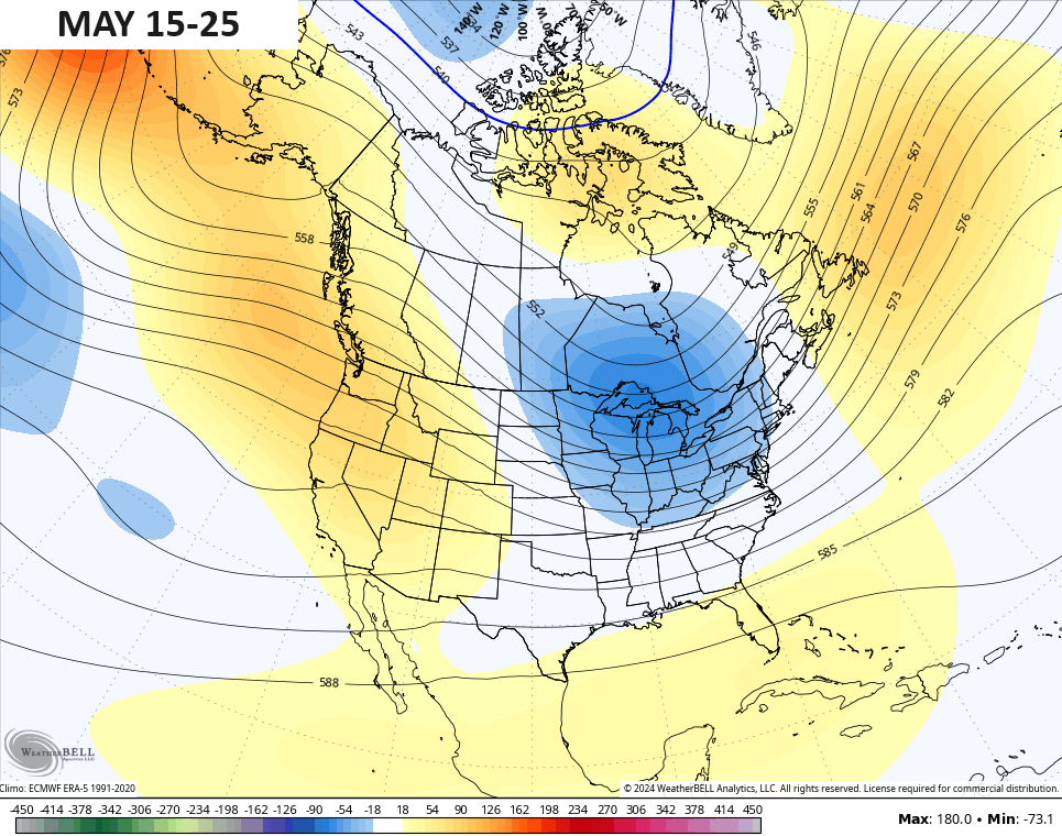
The pattern next week doesn’t look much like the middle of March as out jet stream takes some big dips into the eastern half of the country. This animation starts on Monday and goes through the following Monday…
That’s not a very good look at all.
The end result is slow moving storm systems spinning through the region with the first one showing up late Monday through Wednesday of the week ahead…
A bigger storm system may develop after that later in the week…
This setup would mean frequent rounds of showers and storms that could drop additional heavy rains.
The Ensembles keep this trough into the east all the way into the start of Memorial Day Weekend…
This weekend, I’m going to be talking about the upcoming hurricane season and any potential rain impact it may bring our way.
Make it a fantastic Friday and take care.

We need about a 7-10 day dry period and 90s for highs.
I prefer high temperatures in the mid eighties and a five day dry period.
Sounds lovely. Even my shed is smelling musty. Steady breezes with sunshine over this weekend would be nice.
Thanks Chris. We have definitely received our share of rain for the spring season. I just hope it’s all over for the severe weather, but I know better. I would say we are looking at an active Hurricane season in the Atlantic, Gulf, and the Caribbean. NOAA says we are entering ENSO / neutral and shortly after a 69 % chance for La Nina. I found out that we are already in a La Nina based on the PDO going to a negative 2.09 in April. Hence, a very active Atlantic Hurricane season.
Enjoy the calm weather everyone !
Our PWS recorded 1.53” Monday-Thursday of this week. Plenty of moisture for even the thirstiest of plants.
Yeah, my one Catawba Rhododendron just finish blooming and I sure it was very appreciative of the rain here of late.
The Northern Lights is forecasted to dive into the U.S. tonight & tomorrow. If the conditions are perfect there is possibility it could reach Kentucky.
I saw one back in the late seventies or early eighties.
The Sun is in solar cycle # 25 and has been sending huge flares towards the poles on Earth. The northern and southern lights have been outstanding the past few years in both hemispheres. I’ve seen them in the past and they always were weak and fading where I was in Indiana.
7 day total for South Corbin, 4.33