Good Monday to one and all. We are coming off a really nice Mother’s Day Weekend but things are changing as we kick off a brand new week. Rounds of showers and storms are ready to kick back in, but these won’t have the same strength as the ones that blasted through here last week.
Temps today are back into the 70s as clouds roll in from the west and southwest ahead of a low pressure. This low spins right on top of us late Tuesday into Wednesday with the end result being spiraling bands of showers and a few thunderstorms.
You can see the spin showing up on the NAM starting this evening and going through Wednesday evening…
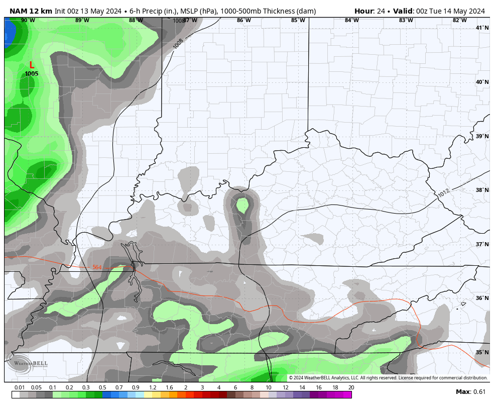
Areas of 1″+ rains are a good bet during this time as highs hang out in the upper 60s to low 70s.
After a break on Thursday, additional storm systems get set to impact our weather as they push into the Ohio Valley. These will also bring additional rounds of showers and thunderstorms with the potential for some stronger storms showing up by early next week.
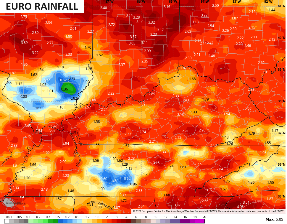
Some of the recent model runs have been pretty juicy with the rainfall numbers for the next week and change…

In recent days, we’ve shown you a lot of seasonal model support for a wetter than normal summer taking shape. One of the wild cards is always the tropics and I think that is especially the case this year as we are likely to see a super active Atlantic Hurricane Season.
The latest seasonal run of the CANSIPS shows this potential very well. If we look at the rainfall anomalies for the month of July, we find the model giving a strong signal for a lot of early season action.
Notice how the above normal rainfall stretches from the Main Development Region in the Atlantic, through the Caribbean and into the Gulf of Mexico…
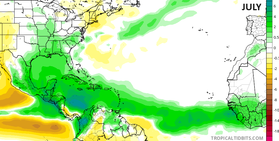
You will also notice how that above normal rainfall track sneaks from the Gulf and into our region.
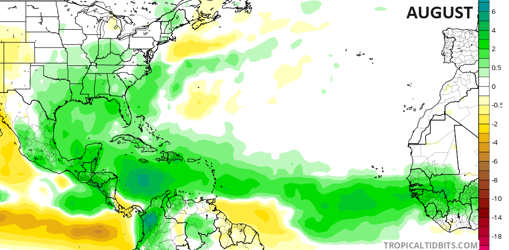
This same look also shows up for the month of August…
The Atlantic Ocean waters continue to run as warm as they have ever been, adding to the increased potential for a hyper-active season. Throw in a developing La Nina and the lid may go off this hurricane season.
I leave you with your radars to track any late day showers and storms into western Kentucky…

Make it a great day and take care.

Interesting Chris, we shall see how this all plays out as we get deeper into the Summer season. I agree with you 100 % on an active Atlantic Tropical Storm season. Looks to me like we have skipped ENSO / neutral and phased right into ENSO / La Nina. The PDO strongly indicated this in its April reading of a negative 2.09.
Have a great Monday everyone !
I’m ready for near normal precip and above normal temps.
I’ve seen many Summers with your kind weather Jeff, but with above normal temperatures there was below normal precipitation.
It doesn’t have to be super dry (nobody wants that), just close to normal.
There has been some talk about how the recent solar storm could affect our planet’s weather, and most of that interest revolves around what effect an increase in the velocity of the solar wind can have on wind flow in our atmosphere. Normally its effects are relatively constant and occur mostly in the upper atmosphere. The solar wind’s velocity averages around 250 km per second, but since the velocity surged to over 1,000 km per second over the weekend, climatologists and solar physicists are looking to see if that surge has any long or short-term effects.
Maybe Joe will change the atmosphere to where we will receive a more interesting Fall and Winter ?
I am for normal rain amounts & below normal temperatures.
I would prefer that kind of weather too, but I like the Fourth of July to be hot.