Good Friday to one and all. We’ve made it to the weekend and, unfortunately, we are dealing with more in the way of showers and storms. This latest round of wet weather won’t hang around for the entire weekend as summer air gets ready to surge in.
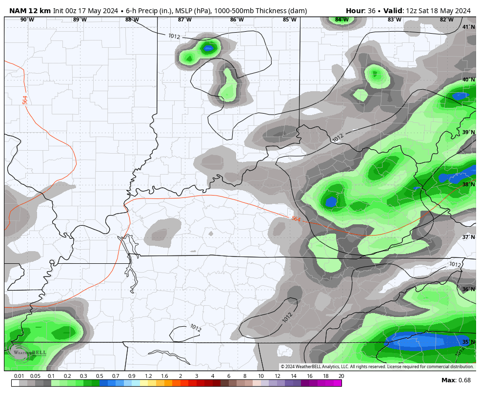
Low pressure is moving into the region today and it’s bringing more rounds of showers and storms. This won’t be all day stuff, but some locally heavy rains are a good bet for parts of the Commonwealth. There’s even the low-end risk for some high water issues showing up on a local scale.
Here are your radars to follow today’s wet weather…

Temps range from the middle 60s to middle 70s today.
Leftover showers and storms linger into Saturday, especially in the south and east, but we will see lots of dry times. Those dry times become much more common on Sunday as this system pulls farther away to our east.
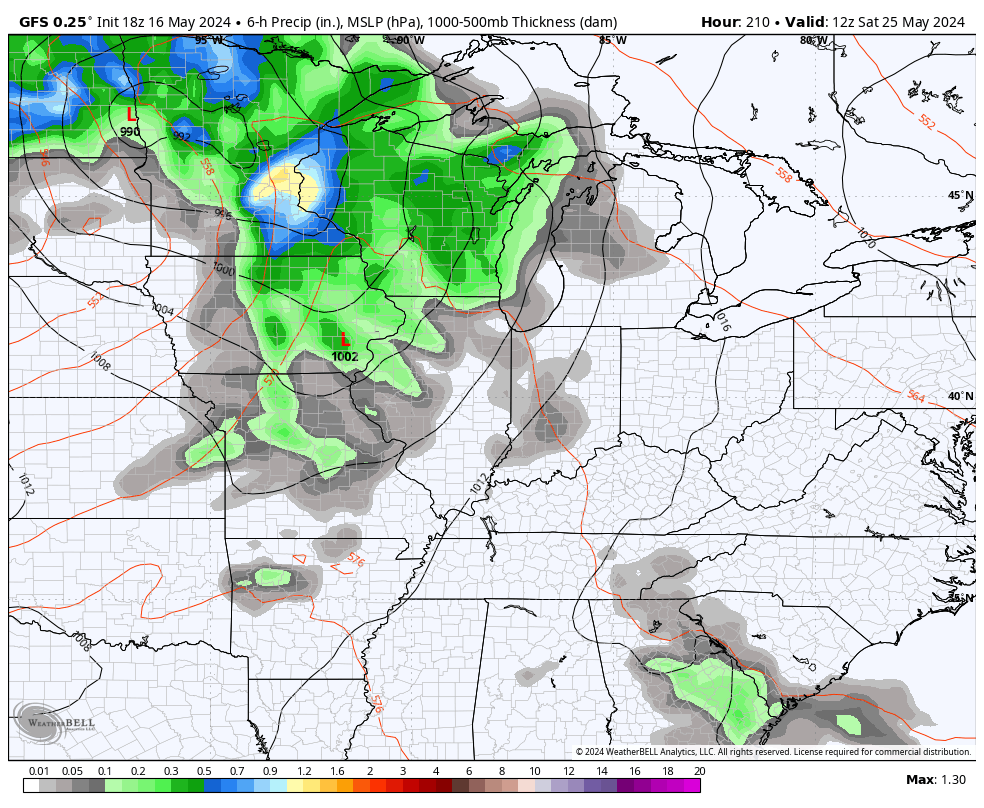
Here’s the NAM for Saturday and Sunday…
Highs Sunday reach 80-85 in the west with upper 70s to near 80 in the east.
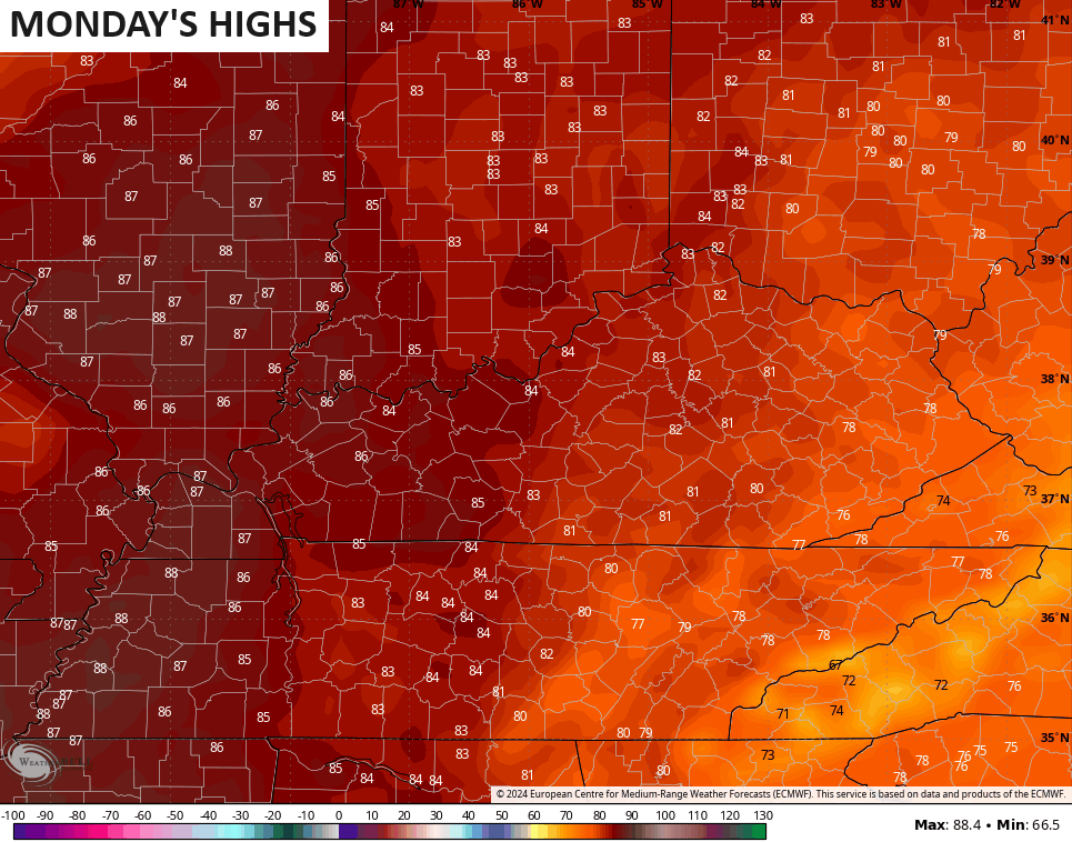
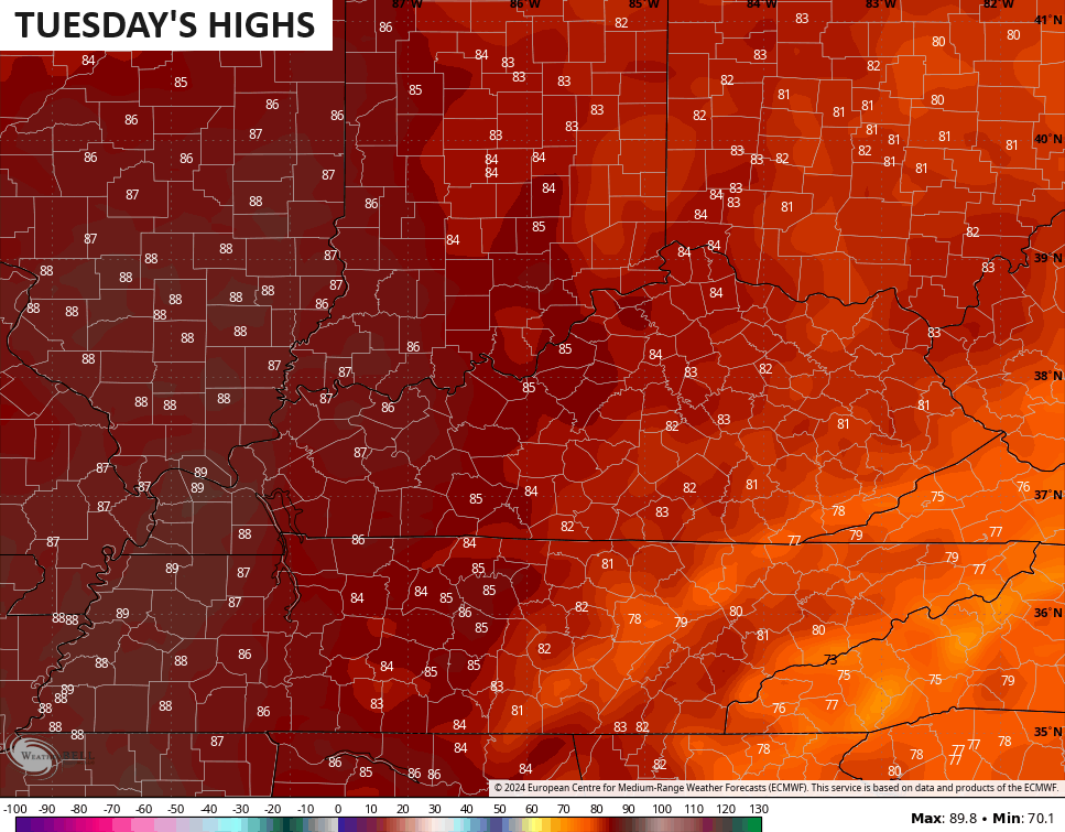
Temps from there really take off into Monday and Tuesday with highs deep into the 80s. There’s even the chance to tickle 90 in the west…
This is ahead of another system that looks to bring our next threat for strong to severe storms by the middle of next week…
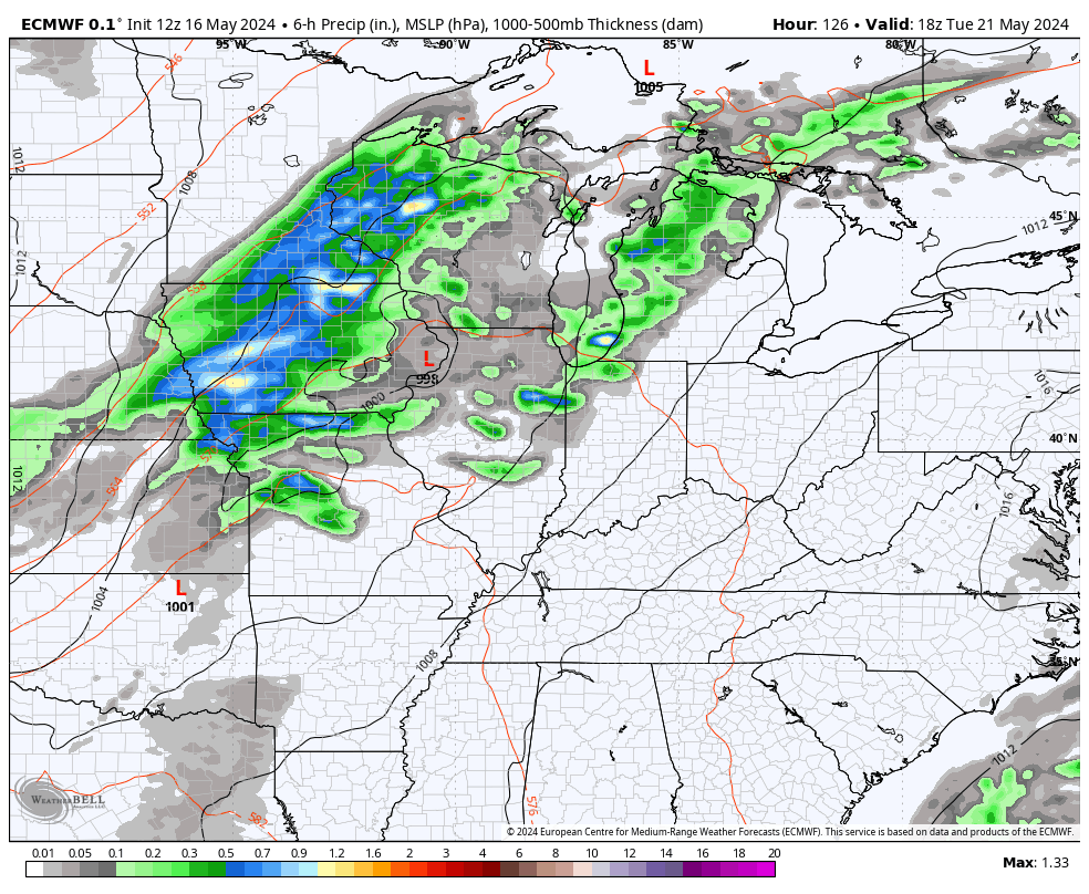
Looking longer range toward Memorial Day weekend, we could find ourselves in the battle zone between some cooler air to the north and warm air to the south. That’s not where we want to be because it could lead to waves of showers and storms and that’s showing up on some of the forecast models…
Here’s hoping that change.
Make it a fantastic Friday and take care.

I hope it changes.
There’s changes coming Monday and Tuesday as we have an early taste of Summer weather, but I would be surrprise if the high temperature reaches 90 degrees those days.
Thanks Chris. Will be looking forward to some Sunny, warm days early next week. We need a week of dry weather, or rotting of crops will occur. Seems like it’s too much rain or not enough.
Have a great and safe day everyone !
As long as the humidity remains low I am all in on the forecast.
Need to loose the cloudy skies and bring on the Sunshine.
Yes!
Good news for those of you who are wishing for a hot summer… according to The Weather Channel, virtually the entire country will average above to well above normal temperatures from June through August, except for the west coast of California. July and August could really be scorchers, especially in the Midwest.
https://weather.com/news/weather/video/temperatures-expected-to-be-hottest-late-summer
I hate to hear that.
The Aleutian Low was much farther east this year, and a huge dome of high pressure covered the central and north Pacific ocean causing the cold waters off the west coast. Yes, this could cause above normal temperatures especially in the midwest. Thanks for sharing Mike. Very interesting, but being a Snow lover, I would want this to reverse before Fall and Winter.