Good Saturday and welcome to the weekend. A few lingering showers and storms will be noted today in parts of the region, but the pattern is about to turn much warmer with a taste of summer temps. Those summer temps may lead us into another stormy setup as we get closer to Memorial Day Weekend.
Let’s talk about today and roll forward.
Highs range from the upper 70s and low 80s in the north and west where sunshine will be noted. Farther south, temps will be in the low to middle 70s with a few showers and storms hanging around from time to time.
Here are your radars to track today’s scattered stuff…

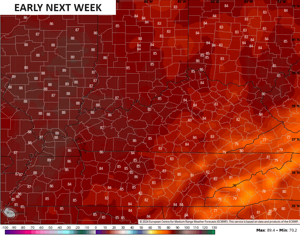
Sunday looks mainly dry with temps surging into the low 80s for many. Temps by Monday and Tuesday will take off even more with highs reaching the middle and upper 80s…
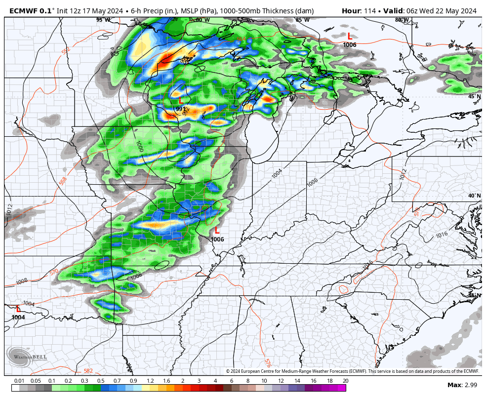
This setup from the middle of the week into Memorial Day Weekend can throw rounds of showers and thunderstorms at us. That’s because we find ourselves in the battle zone between cooler air in the north and that summer sizzle in the south.
The first threat for some hefty storms shows up Wednesday and early Thursday…
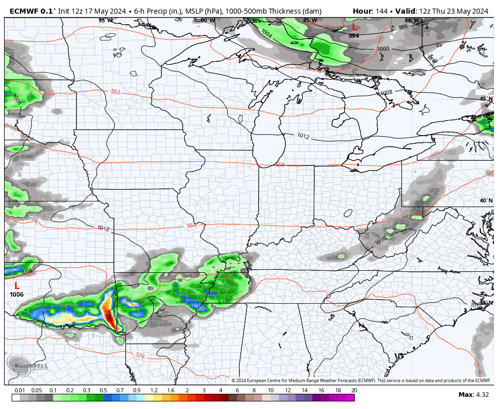
Watch the additional waves of showers and storms rumble at us from late Thursday through Memorial Day…
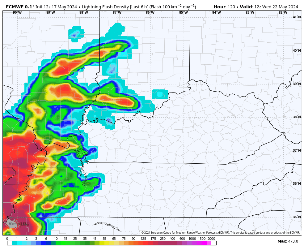
The lightning forecast from the EURO is pretty amped up…
Have a great Saturday and take care.

Thanks Chris. I’ll take the mid to upper 80’s with Sunshine. Not liking the return to Stormy, with all that Rain and Lightning.
Have a Wonderful Saturday Folks !
The “Day 4 to 8 Severe Weather Outlook” maps from the Storm Prediction Center is projecting a lot of severe potential for the middle of next week. This forecasting tool has been more accurate than most over the past several months, and indicates to me that a severe weather outbreak is likely next week.
https://www.spc.noaa.gov/products/exper/day4-8/
Particularly over Illinois on Day 4 there may be a major severe weather outbreak. With temps predicted to be in the 80s here in the Chicago Metro Area for the next four days, the possibility of severe weather Tuesday will definitely have to be watched.
Looks dangerous for the plains, but with the weakening trend that’s been in place, it’s been a very quiet severe storm season so far here in central Kentucky.
According to IR satellite image at the present, the convection is really ” blowing up ” along the Gulf Coast states.