Good Sunday to one and all. Summer air is surging into the Bluegrass State and it’s sticking around for several days. This should lead us back into a stormier setup later in the week ahead with cooler weather lurking for the end of the month.
There’s nothing cool about the weather out there today. Highs are in the upper 70s to low 80s across eastern Kentucky with 80-85 likely in the west.
Monday’s temps are deep into the 80s for the entire state with the potential for a 90 in the west on Tuesday…
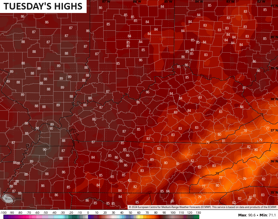
That’s some toasty stuff for the second half of May, but I’m not going to complain!
The threat for showers and storms will then increase Wednesday into Thursday as a cold front moves in and slows down…
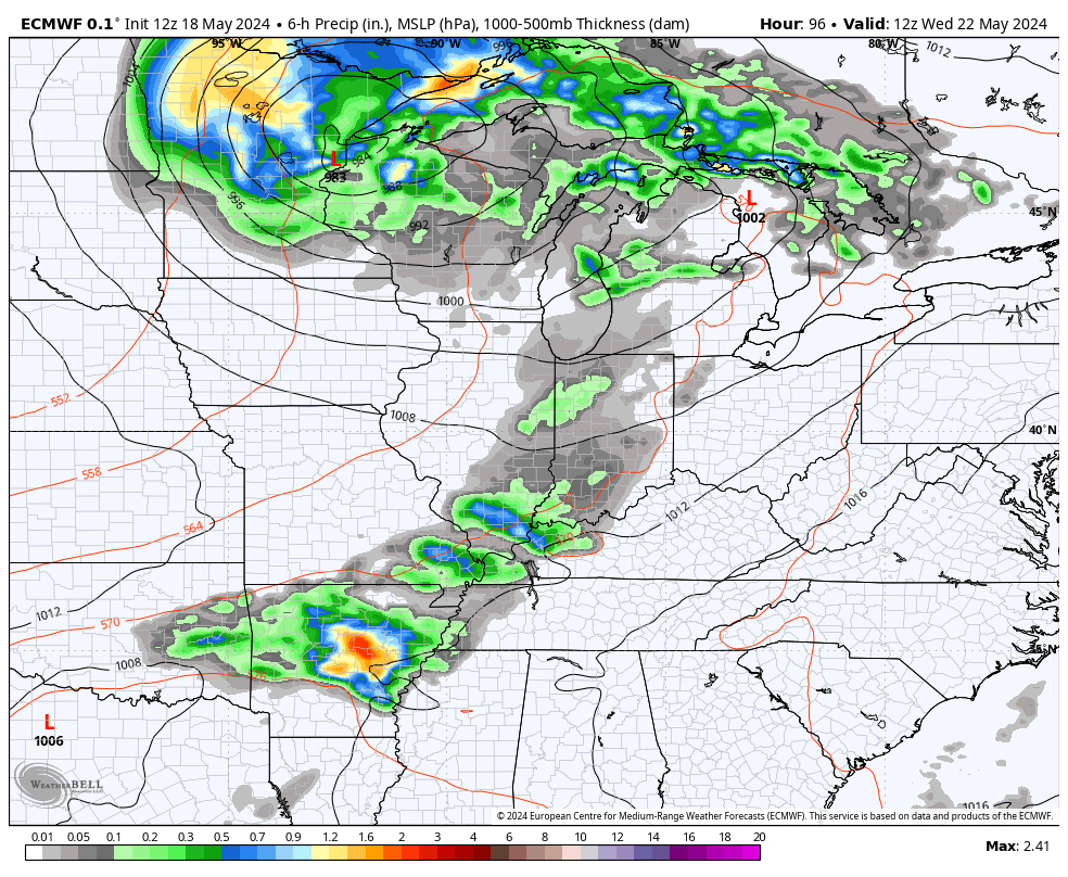
A few strong storms will be possible.
As mentioned, the front slows down with a few waves of low pressures rolling eastward along it into the Ohio Valley late in the week into Memorial Day Weekend…
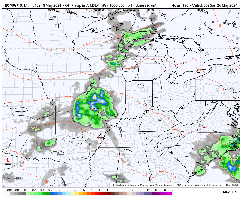
That setup can fire off some big storms that can also put down heavy rains from time to time. No, that’s not a washout of a look, but it’s one that can cause some issues for outdoor activities.
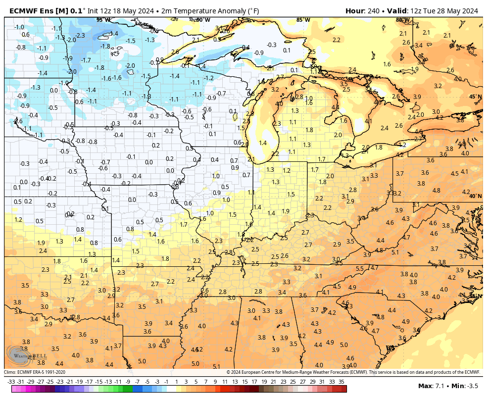
This is ahead of what may be another period of below normal temps moving in for the closing days of May into the start of June. You can clearing see that on the GFS Ensembles…
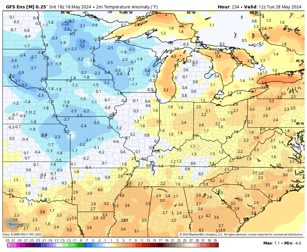
The Euro Ensembles look very similar…
Have a great Sunday and take care.

Rooting against the ensembles. 🙂
Thanks Chris. I will enjoy the 80 – 85 degree highs the next few days. Hoping it will come with Sunshine. The cold fronts slowing down with waves or rain seems to be a difficult pattern to break.
Have an enjoyable and peaceful Sunday !
Yesterday was the day that confirmed to me that summer was upon us.
I could feel the extra intensity of the sun while I was outside doing some outside activities.
84 in Richmond. Fantastic.