Good Monday, everyone. Summertime air is back in the bluegrass state as we start the week but rounds of storms are set to take center stage once again. These storms may be strong later this week and into Memorial Day Weekend as we also watch for the possibility of heavy rains.
Let us begin things with what’s going on out there today.
Sunny skies with temps in the mid and upper 80s. That’s your Monday.
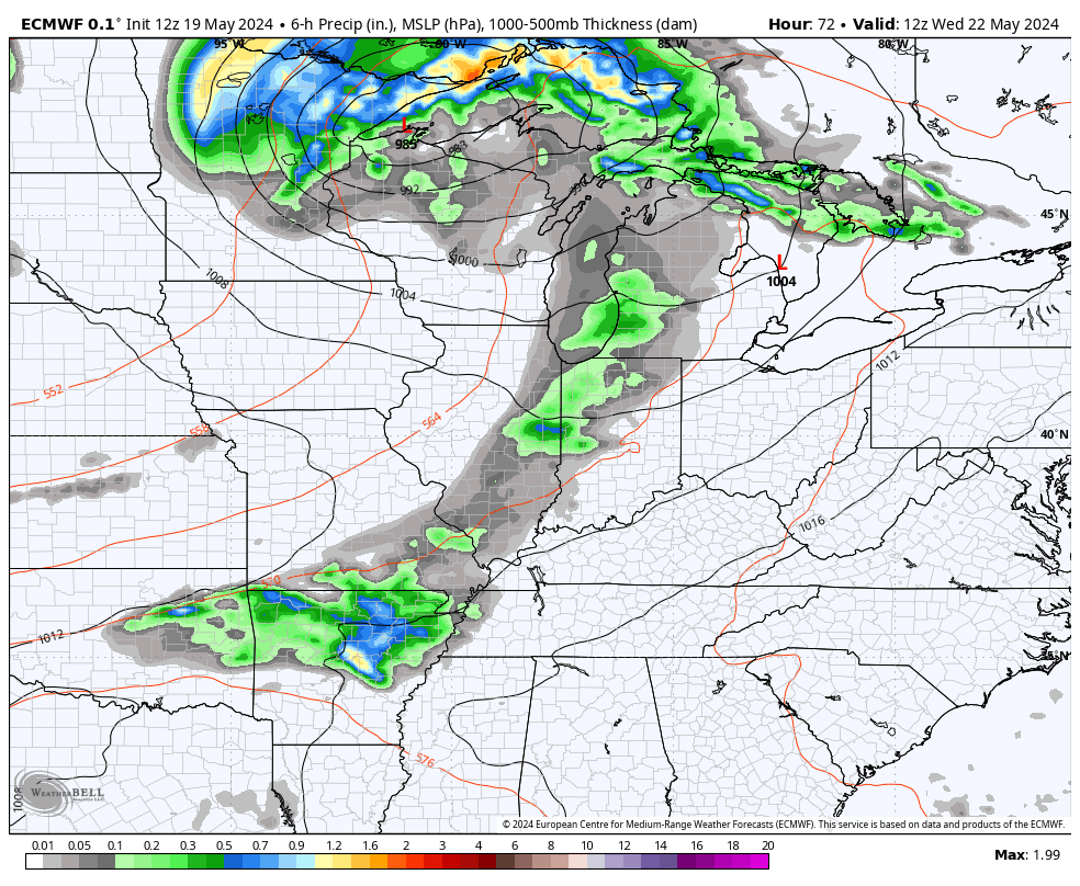
Tuesday features temps again in the mid and upper 80s with a 90 in the west. Skies are partly sunny with some late day clouds increasing in the west. Those clouds are ahead of a storm system that brings a cold front into the region by Wednesday. This front touches off storms, some of which can be strong or severe, before it slows down right on top of us into Thursday.
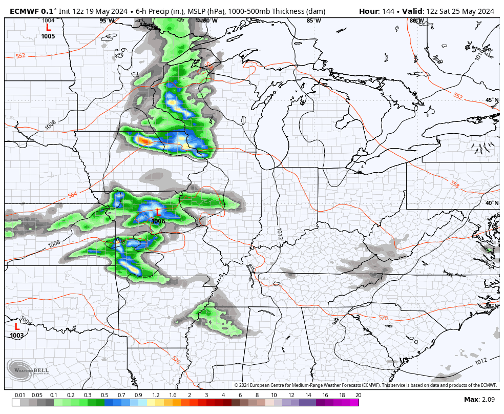
As the front slows, waves of low pressure roll along it through Friday, producing additional waves of showers and storms…
The Severe Storms Threat for Tuesday is to our west, but there’s a chance some of those could sneak into the far west late in the evening. Here’s the Tuesday Severe Weather Outlook from the Storm Prediction Center…

That threat then expands farther east for Wednesday…

Memorial Day Weekend continues to see the trend for waves of showers and thunderstorms rolling through the region…
You’re still going to have a lot of dry times, but rounds of storms may very well cause some issues.
In addition to the strong to severe storms threat, this setup may put our region in the line of fire for heavy rainfall.
The EURO and GFS are showing some decent totals…
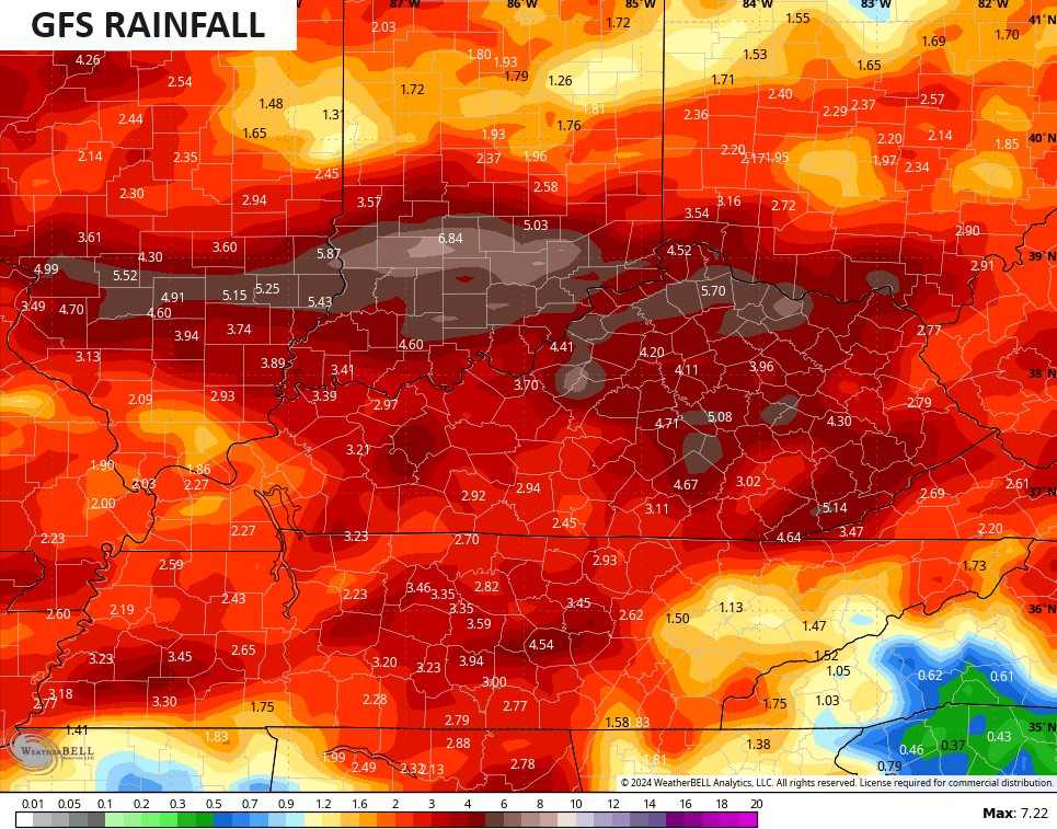
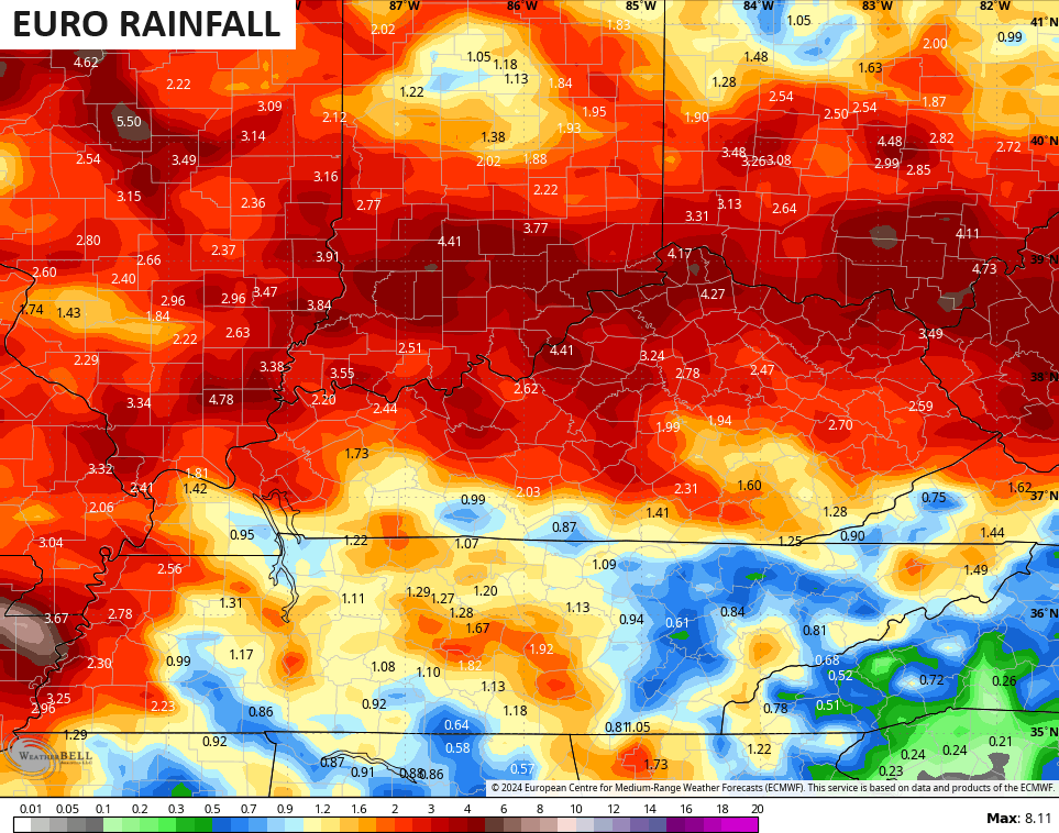
This is a setup we need to keep a close eye on.
Make it a magnificent Monday and take care.

Thanks Chris. In the meantime, I will enjoy the early Summer weather, and hoping the severe weather doesn’t materialize along with the heavy rains predicted.
Have a great day everyone !