Good Tuesday to one and all. It’s another summertime feeling day across Kentucky as we wait for round of showers and storms to kick back in. This action begins late tonight and Wednesday before kicking into high gear later this week and into the holiday weekend
Temps today are deep into the 80s for the entire state with the chance for a 90 in the west. There’s a small disturbance crossing the state and this can crank out isolated showers and thunderstorms across the eastern half of the state.
A line of storms rumbles into western Kentucky tonight before fading as it moves across central and eastern Kentucky early Wednesday. After a break for much of the day, a few storms fire up later in the afternoon with a greater cluster of storms rumbling in Wednesday night.
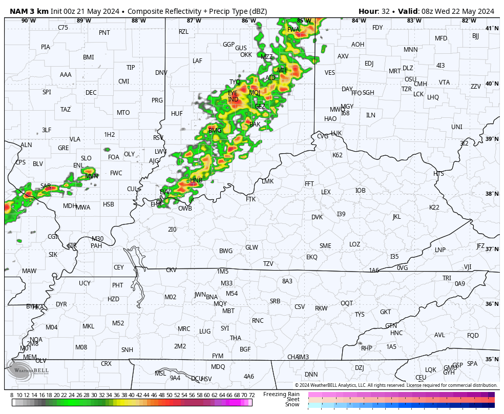
Here’s the Future Radar from the Hi Res NAM from late tonight through Wednesday night…
The severe storms threat on Wednesday is mainly across northern and western parts of Kentucky. Here’s what that looks like on the Severe Weather Outlook from the Storm Prediction Center…

Here’s the Severe Weather Outlook for Thursday…

As a boundary slows down on top of us, waves of showers and storms look to rumble through here from west to east Friday through Memorial Day. It won’t be all day rains by any means and you will get some extended dry times, but these storms could be strong and put down heavy rain…
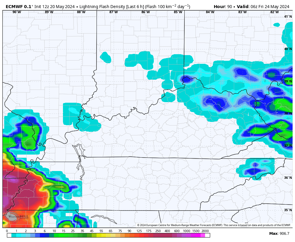
Check out the lightning forecast with these clusters of storms…
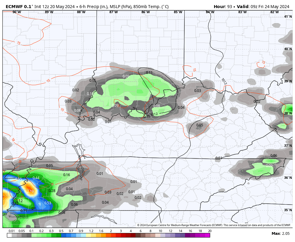
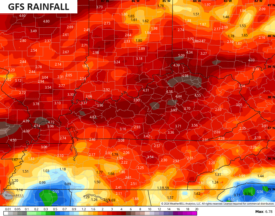
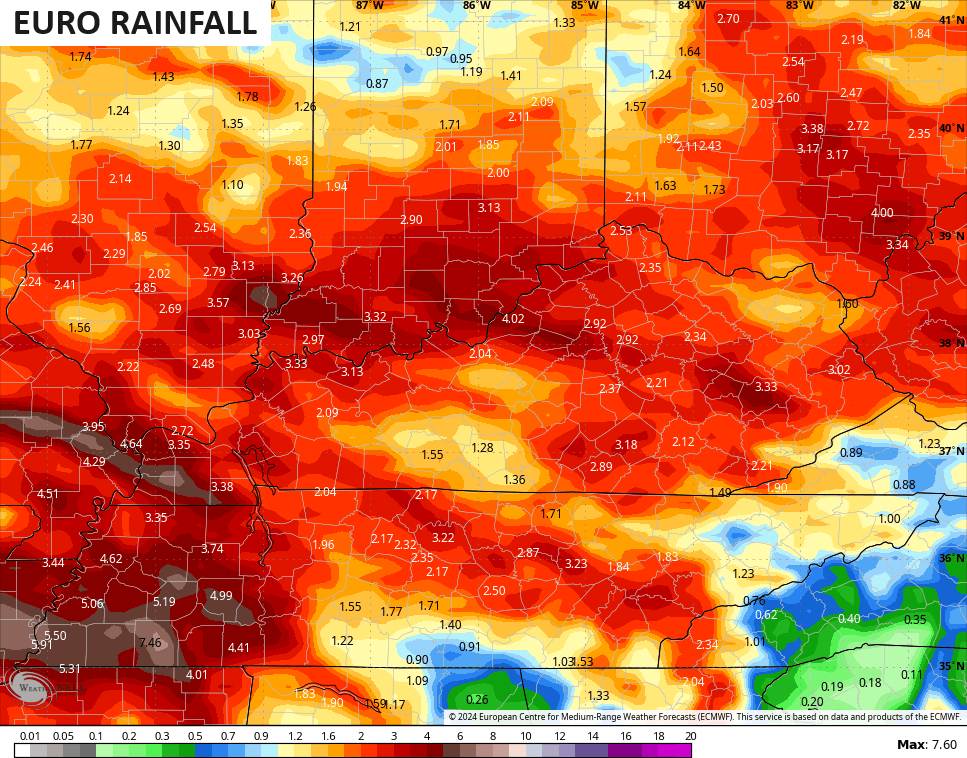
As mentioned, in addition to the strong storms, torrential rains are also likely with the action that rumbles through here. The models continue to spit out some big time rainfall numbers over the next week…
Ugh.
I leave you with all the tools you need to tracs the severe storms outbreak to our west today…

Current watches

Possible Watch Areas

Make it a terrific Tuesday and take care.

Thanks Chris. Your Blog this morning reads like your ready for Fall and Winter. I’ll be ready after the Fourth of July.
Make it a great day !
As simply an observer, maps showing anticipated rainfall totals always seem overcooked. More often than not, the actual never comes close to the projected. What am I missing here?
Not only that… I’ve seen this happen many times where we have several systems coming at us over a period of days….and end up getting the MOST rain from the system projected to be the weakest and the least rain from one projected to be the strongest.
It’s just a guide showing the difference between the GFS projection and the European, and there’s no agreement between the two projections. Therefore not happening.
I need your guidance about an Azalea plant.
I bought it off Amazon. I planted it into the ground and after a couple of weeks the leaves have become droopy. Yesterday I added some water & put new mulch around the plant.
The plant is receiving about 4 to 5 hours of sunlight.
I am apprehensive to water it everyday because I am scared it could lead to root rot.
Can this plant be saved?
What is the name of the Azalea hybrid ? Did it come in a container, or was it out of the pot and placed in a plastic bag ? If it’s still green and springy it can be saved. Sounds like the rootball just needs water until the plant gets established. I’am interested, let me know more about this plant.
Thanks, it was an Autumn Rouge.
It wasn’t in a bag. It came in a pot approximately 6to7 inches high.
I have already watered the plant this morning.
Autumn Rouge is one of the Encore Azalea and should be hardy in Louisville USDA ( zone 6b ) The questions I have 🙂 Did you loosen the rootball before planting ? Did you amend the soil with Canadian peat moss plus pine bark mulch 50/50. Azaleas like to be planted with the top 2 inches of the rootball out of the medium in very well drained soil. Water everyday until the plant establishes itself. Don’t fertilize until next Spring. I recommend Nitro form slow release ( Urea Formadehyde ) for good growth and bud formation.
No I just planted it into a pre mulch bed.
I might of made a mistake because I added Miracle Grow immediately after planting it.
The Chicago NWS is already warning about a potentially dangerous severe weather outbreak for the Chicago Metro Area late this afternoon and evening for “widespread, and potentially significant, damaging winds and tornadoes”. The Metro Area is in the Enhanced Risk area (level 3 of 5) for severe weather this evening, while W and NW IL are in the Moderate Risk area (level 4 of 5).
Meantime, we could come close to our first 90-degree day in 8 1/2 months this afternoon, after a high of 86 Monday.
I checked the IR satellite map, and a lot of convection just to the west of Chicago. Our highest temperature has been 86 degrees so far this Spring. Stay safe Mike.
You need to take the Azalea up and loosen the pot bound rootball. I used a garden hand rake ( three or four pronges ) score the roots, so they can grow out from the rootball. Azaleas can be moved anytime during the growing season. I use to grow my Azaleas in a 11″ x 15″ x 4″ deep flat in pure pine bark mulch. By the end of the growing season I had a saleable plant. I told my customers to spade up the area where the Azalea will be planted and don’t dig a hole, just set the plant on top of the spaded ground, no need to score the roots as they were not tied up, as they would be in a container pot, and fill around the plant with pine bark, and let the Azalea dig it’s own hole. Don’t use cypress or hardwood bark mulch only pine bark mulch will work for Azaleas. This way the plant is at the right level for growing. The pH of range for Azaleas is between 5.0 to 6.0 You can use Miracid 1/2 teaspoon per gallon in distilled water.
Thanks for your expertises
I will pull it up and look at the ball.
I have my pocket knife in my pocket.
You are welcome. Don’t hesitate if you have anymore questions. Glad to help.