Good Wednesday, folks. Our stormy setup is kicking off with a severe storms threat for parts of Kentucky out there today. Rounds of showers and storms then become common right on through Memorial Day Weekend.
Here’s a breakdown of how this whole period looks:
- A few storms rumble in and weaken early today before partly sunny skies take over.
- A few strong to severe storms then develop by late this afternoon in the west and roll to the east and northeast this evening.
- Damaging winds and large hail will be the primary players.
- A few more showers and storms develop late tonight into Thursday morning. Those hang around through the day, but it’s not a washout.
- Additional showers and storms will be noted on Friday.
- Saturday appears to have the best chance for extended dry periods with just a few storms scattered about the state.
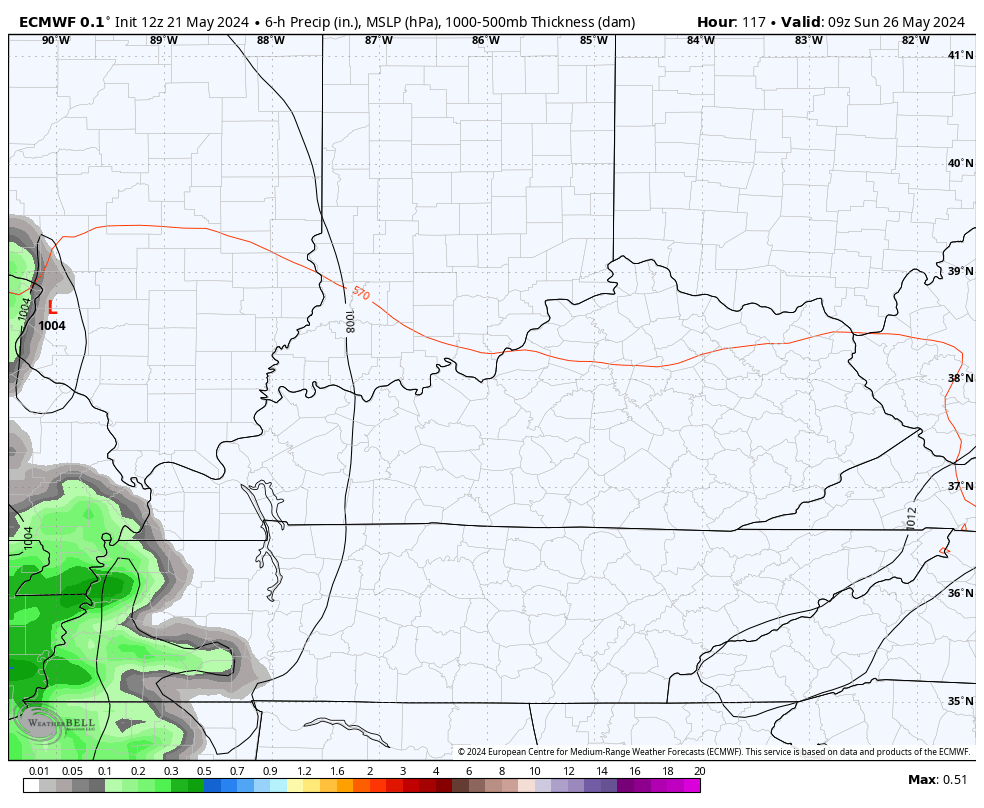
- Severe storms may very well show up Sunday into Sunday night as another system works in from the west. This is one to watch.
- Memorial Day may start with a few storms and end with a few storms, with drier skies in between.
- Heavy rains are a good bet through Monday with some areas picking up several inches of rain. This leads to an increased flash flood risk.
In terms of today’s storms, watch how the HRRR Future Radar fires up some strong to severe storms this evening. This animation starts at 5pm and rolls through midnight…
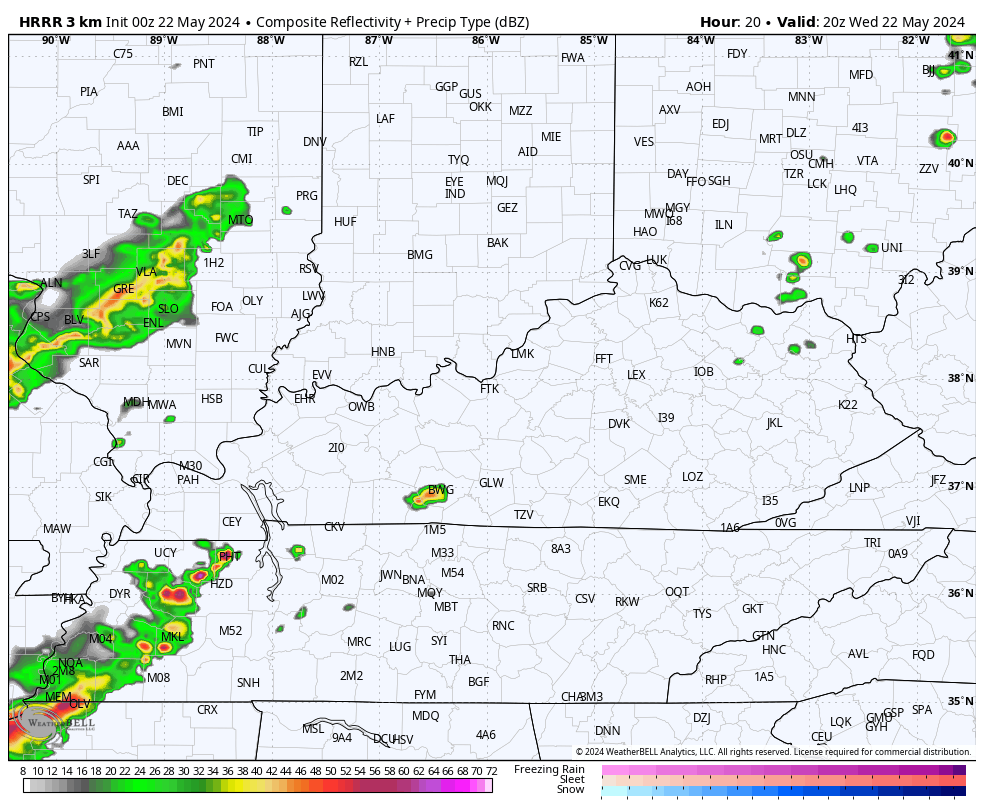
The Storm Prediction Center has much of the region in a Marginal Risk to Slight Risk for the day with a greater threat possibly getting into the west…

Damaging winds and large hail are the main players with the late day storms…


The tornado threat is much lower…

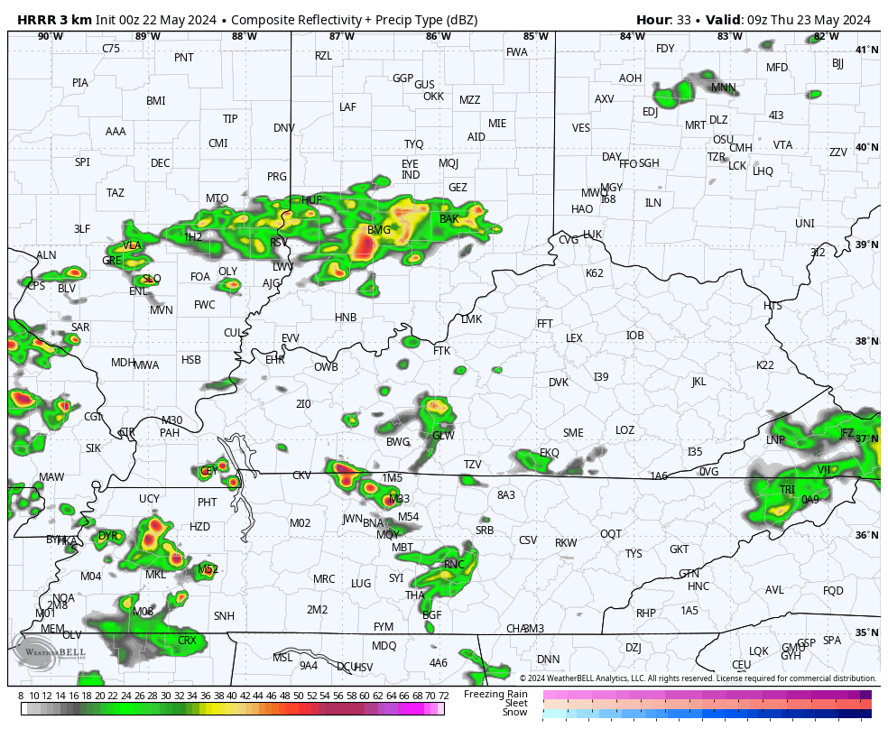
Additional showers and storms fire up tonight into Thursday. Here’s the HRRR Future Radar from Thursday morning through Thursday evening…
The severe threat for Sunday is getting more of my attention with the chance for another round of stout boomers showing up from the northwest Monday evening…
Check out the lightning forecast from this same time period…
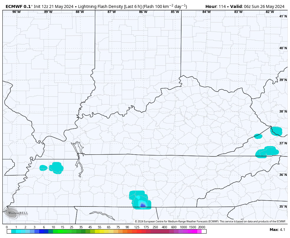
This is outside of the traditional 3 day Severe Weather Outlook from the SPC, but they are indicating a Sunday severe threat…

Here are your storm tracking tools for the day…

Current watches

Possible Watch Areas

Make it a wonderful Wednesday and take care.

Despite all the dire predictions Tuesday morning from the local forecasters here and the SPC of dangerous severe weather for the Chicago Metro Area Tuesday evening (including a Tornado Watch that was issued for the W and NW Suburbs), not a drop of rain occurred at all in the area! All the severe weather and tornadoes were well to the west and northwest several hundred miles away in IA and WI, and to a lesser extent in NW IL. That just goes to show that Mother Nature has a mind of her own and will not always follow computer models or future radars.
High temps reached 89 degrees Tuesday at O’Hare Airport, just three degrees from a record, and also 89 at the NWS Forecast Office in the SW Suburbs, so at least the forecasters got that right.
There is definitely a modification in the convection as it moved east. Here’s the report on the storms yesterday and last night :
https://weatherstreet.com/weather-forecast/storm-reports.htm
Thanks Chris. I’ll be glad when severe weather anywhere is out of all local forecast. Yesterday, there was an area in Missouri that recorded 8 inches of rain per hour. Wow, that would wash away all crops.
Enjoy the day everyone !
Hard to believe this is Memorial Day weekend time flies. Well looks like Saturday will be our driest day. I guess I will pick that day to take my flowers and I think they use to call it decoration day or my Grandmother did. Looks like the driest day Maybe Monday a cookout might be squeezed in before the rain in the evening. Hope everyone has a nice and safe Memorial Weekend.
I’m old enough to remember when they called Memorial Day Decoration Day, and my Family on May 30th ( the old date of Decoration Day ) placed Peony blossom on the graves of Loved ones.