Good Thursday to one and all. We have another day where a few rounds of showers and storms rumble through the region. This is part of the rather stormy setup that takes us through the Memorial Day Weekend. Circle Sunday on your severe weather calendar as a potential big outbreak in our region.
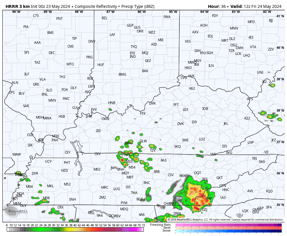
Clusters of showers and storms are out there today with the greatest concentration across the southern half of the state. This is the area that picked up on several inches of rain yesterday, so we will need to watch the local flash flood threat.
Farther north, the action is much more scattered. THIS IS NOT A WASHOUT, FOLKS!
Can we get a few severe storms? Meh. There’s a low-end risk across the southern half of the state today…

We should get a lot of dry times on Friday with temps approaching 80 degrees. This may lead to a late day cluster of storms riding in from the west and northwest by Friday evening. That shows up on the future radar from the HRRR…
The Storm Prediction Center has another low-end risk for severe storms in the west…

Saturday is a mainly dry day with temps reaching the 80s. This is the day to try to hit the lake or the pool because storms look fairly scattered again.
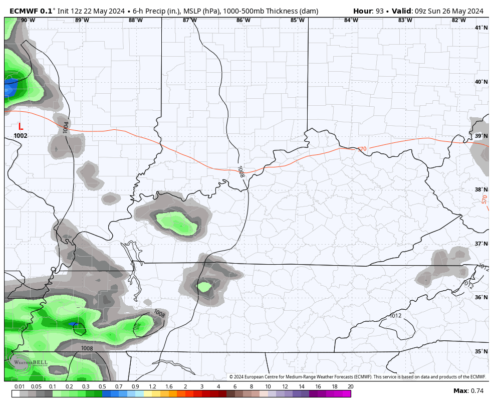
The setup from there features the increasing threat for severe storms to rumble across the region Sunday and Sunday night. This action decreases from northwest to southeast on Memorial Day and you can see all this on the EURO…
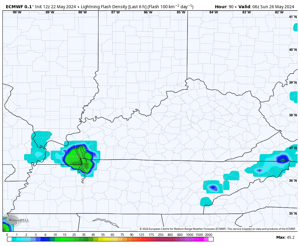
The lightning forecast is pretty telling…
Sunday is just outside the traditional 3 day Severe Weather Outlook from the Storm Prediction Center, but the SPC is already showing the increased risk for a potential widespread event…

All modes of severe weather will be possible Sunday through early Memorial Day.
I leave you kids with your daily dose of storm tracking toys…

Current watches

Possible Watch Areas

Make it a wonderful Wednesday and take care.

We need sunshine.
Maybe next week Jeff, but don’t hold me to it.
Thanks Chris. Convection is really exploding just to our south and southwest. Seems to not weaken like it has been when it approaches our area. This is indicating a change. We had about 0.30 ” of rain yesterday, with a loud and lightning filled storm. Concerned about what may happen this Sunday.
Enjoy the day everyone !
From the SPC for this weekend
https://www.spc.noaa.gov/
The only factor missing from Sunday’s outlook is a strong upper-level jet stream, but every other factor making severe weather likely on Sunday is present. That includes high levels of CAPE and dewpoints projected in the mid-70°F range, making the atmosphere extremely. Adding the proximity of a surface Low near our region, points to formation of supercells and a line of severe storms. I’ve got a bad feeling about this…
I am with you and Schroeder I have a bad feeling too on this one but I am sure Chris will keep us informed. Looks like it will be a busy memorial weekend for our weather people.
Me too Joe.
It’s been a very rainy morning here in Maple. With thunder and lightning, but very little wind gust which is a good thing. Maybe Saturday we will have a respite before Sunday’s event ?