Good Wednesday to one and all. Even in a really nice weather pattern, we are still dealing with a storm or two popping up out there today. The main focus is on the cooler than normal temps to round out May. June looks to start out on a familiar note with an increase in storm chances.
Speaking of storm chances, we have that chance showing up out there today. Highs will generally be in the low and mid 70s for most but may drop into the 60s as a few clouds and scattered stuff moves in during the afternoon. The best chance of this is in the north and this will show up on Kentucky radars…

Winds are gusty out there today and may hit 30mph at times.
Thursday starts in the 40s and ends with highs from 70-75. Friday morning looks even cooler with lows reaching the low and middle 40s across central and eastern Kentucky…
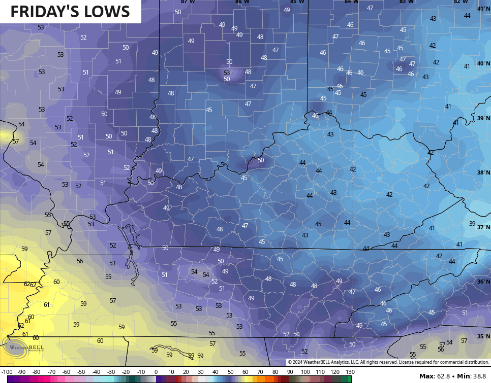
Can one of the colder valleys reach the upper 30s? Hmm
Friday afternoon highs in the low and middle 70s will make for one amazing weather day!
Temps climb closer to normal this weekend and early next week as June looks to start with a few showers and storms rumbling back into town. This may kick off another active pattern through next week before another deep trough tries to develop next weekend…
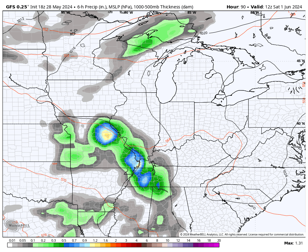
The potential for a significant cutoff low is there…
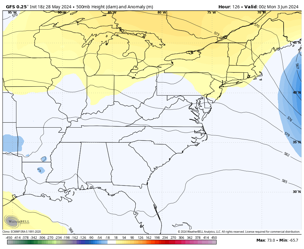
If that verifies, temps would be well below normal. That run of the GFS went Barney on us…
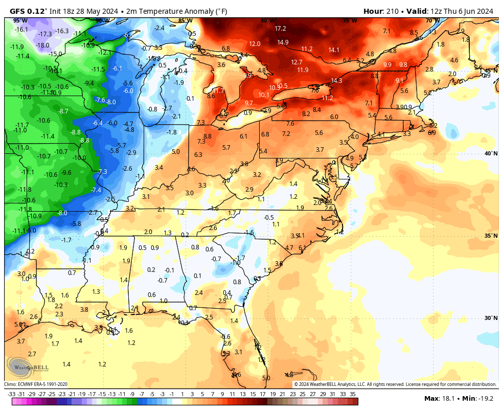
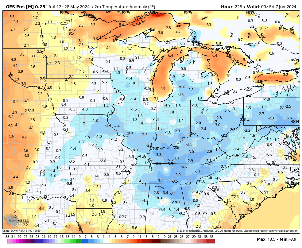
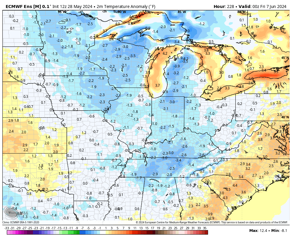
The Ensembles are a little more tame, but are still showing well below normal temps…
GFS ENSEMBLES
EURO ENSEMBLES
Have a wonderful Wednesday and take care.

None of those will verify.
Do you ever agree with Chris? You’re always so negative lol
I often do and am not always negative.
In all fairness this isn’t Chris’s forecast.
He is only showing us model runs.
Sometimes they pan out and many other times they don’t.
But I do hope Barney is for real this time not another false narrative like we saw through out the past winter months.
First time EVER in my life I am cheering on anything Barney I’m ready for fall!
I’m ready for Autumn after the Fourth of July.
Thanks Chris. The opposite reaction to the warm, dry weather we had earlier in the month.
Enjoy the day everyone !
The year without a Summer occurred in 1816. Here’s the link to all the details :
https://en.wikipedia.org/wiki/Year_Without_a_Summer
#TeamSummer #TeamHeat
I’m positive Jeff that the three H’s of Summer ( Hazy, Hot, and Humid ) will be here ( the Ohio Valley ) arround mid – to late June.
I read yesterday that the sun spots storms that’s occurring will be stronger than they have over 20 years. That been said wonder will it cool the earth down somewhat
The solar maximum activity is forecasted to peak in the 3rd quarter of 2024, but like every other forecasted event, there can be delays and outlier events. The Sun makes a full rotatation on its axis every 27 days, so I’ve been waiting for the big sunspot grouping that gave us the auroras to reappear. So right on time, it’s visible (#3697) in the lower left quadrant on this link.
https://soho.nascom.nasa.gov/data/synoptic/sunspots_earth/mdi_sunspots_1024.jpg
You’ll notice that there are two other large groupings at the top left center, so we could be in store for some incredible activity, over the next couple. I’ve been observing sunspots for many years, and this is the most activity I’ve seen in decades!
Days,Months or Years?
Days!