Good Thursday, everyone. We continue with a much cooler than normal air mass as we get ready to put the wraps on the month of May. As we look into early June, the pattern takes on an all too familiar look as rounds of storms get ready to show up.
Temps out there today start in the 40s and end in the 70-75 degree range with a mix of sun and clouds.
Temps by Friday morning can reach the low 40s in several spots with the outside chance for a few upper 30s in the colder valleys. Highs are in the 70s with a mostly sunny sky. That’s my kinda weather, folks!
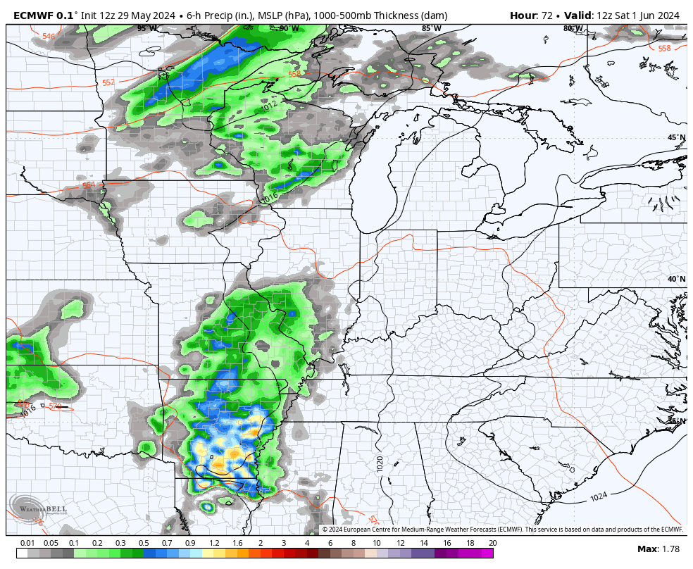
June begins with a few showers and storms rolling from west to east on Saturday, kicking off another stormy look that takes us into next week. These waves of showers and storms don’t look as rough as last week, but a few severe threats can’t be ruled out.
This animation shows the storms from Saturday morning through Monday evening…
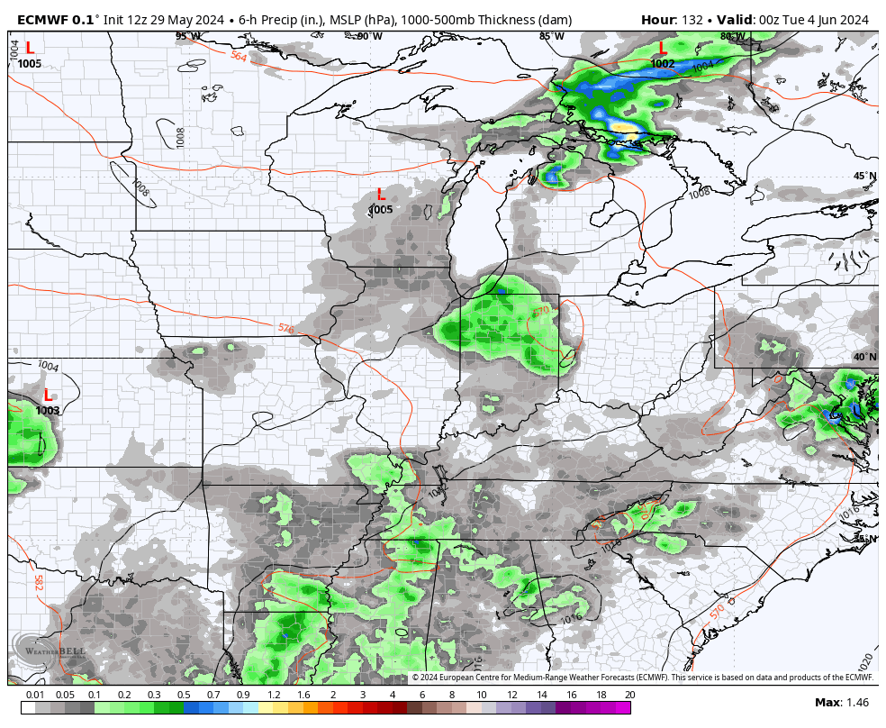
That stormy look just keeps on rolling through the end of next week as a deep trough looks to dive in from the northwest…
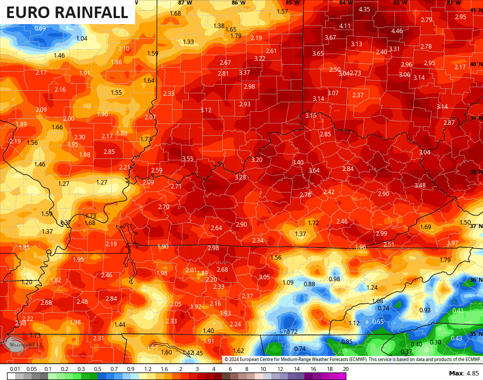
The models, especially the EURO, are showing some very hefty rain totals over the next week or so…
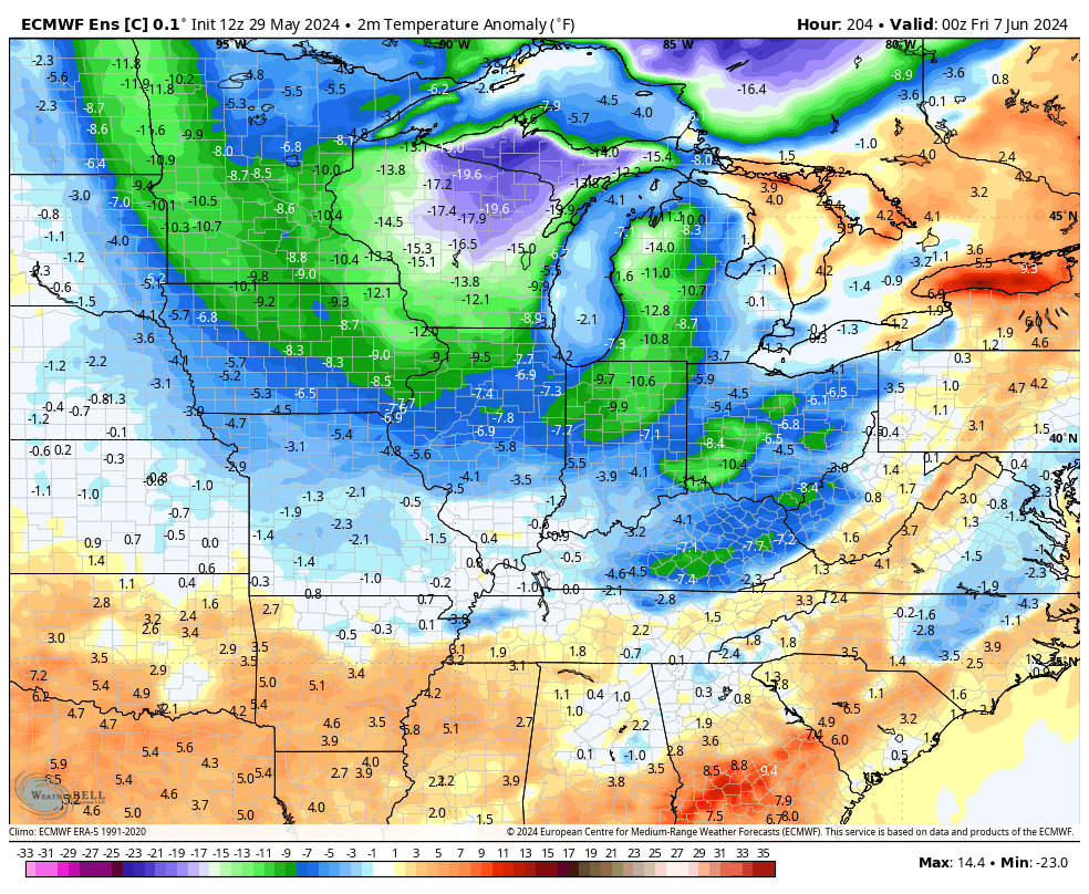
While temps do recover to near normal this weekend into the first half of next week, another big drop could be on the way late next week into the following weekend. The EURO shows the numbers going well below normal…
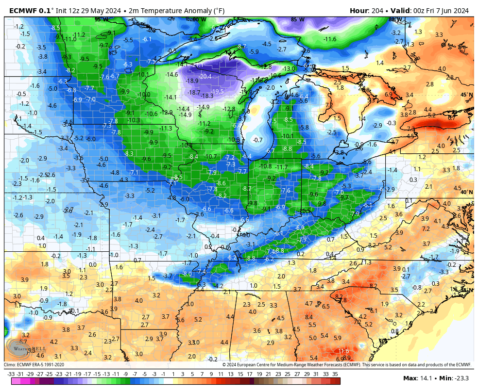
The Control Run of the Euro Ensembles have this same look and they keep it going into the following week…
Ugh.
Make it a great day and take care.

I hope those ensembles are dead wrong. #TeamSummer
OMG why? these temps are totally comfortable.
Summer needs to be Summer, Spring Spring, and so on, although I don’t mind 50s for lows one bit.
Some like it Hot, and some like it Cold. Everybody has different comfort levels.
Thanks Chris. This weather is a great reaction to what we had earlier in the month. An ” equal and opposite reaction. ” Not liking the return of wet weather this weekend and next week. Enough is enough.
Enjoy the day everyone !
Joe, here’s some more information on the Solar Cycle # 25. I wish sometime we would be looking at a Solar minimum like Maunders Minimum before going into Fall and Winter.
https://ntrs.nasa.gov/api/citations/20190028769/downloads/20190028769.pdf
Unfortunately the summer months are the worst time to view the Aurora because of longer daylight time.
I made an observation years ago that when we are in an active Solar Cycle ( Sun Spots ) our Winters are mild and Snowless.
They say the strongest sun spots occur in December of 1977 that’s when we had stretch of coldest and harsh winters afterwards.
I was wrong. here’s the proof :
https://www.aavso.org/sites/default/files/solar_bulletin/AAVSO_SB_1977_09.pdf
Isn’t that a year off though? I thought the really bad winters started in 1976 and lasted through 1979
Mark, You are right, the cold Fall and Winters started in 1976 through 1978. The pattern changed back to a negative PDO ( La Nina ) in 1979 and since then the Winters have been mostly tame.
Good info Schroeder. The problem with using sunspots as a solar output indicator is that it usually doesn’t correlate with the Sun’s energy output, which is determined by processes at the Sun’s core. The energy output is what directly affects our weather.
Sunspot activity can directly affect weather when the generate flares and especially CMEs, which can affect the temperature of the stratosphere. During the Winter, stratospheric heating has been shown to directly affect Polar Vortex activity, so it will be interesting to see how this Spring and Summer’s activity will affect Winter!
Here’s another great article on Solar flares :
https://www.scientificamerican.com/article/should-you-really-worry-about-solar-flares/#:~:text=CMEs%20can%20and%20do%20pose,that%20sometimes%20last%20for%20hours.
NOAA’s forecast for this coming Atlantic- hurricane- season :
https://www.noaa.gov/news-release/noaa-predicts-above-normal-2024-atlantic-hurricane-season