Good Friday, folks. It’s the final day of May and we are sending the month out on an absolutely gorgeous weather note. This nice weather won’t carry us into the weekend when some showers and storms get back into the mix to start June.
Temps this morning are into the 40s for much of central and eastern Kentucky with low 50s elsewhere. By the afternoon, temps reach the 70s again with a few clouds filtering in from the west.
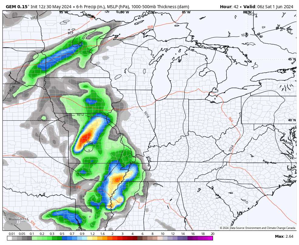
Low pressure slowly works into the region over the weekend, bringing a few showers and storms with it. This looks to continue into Monday, but no one day is a washout…
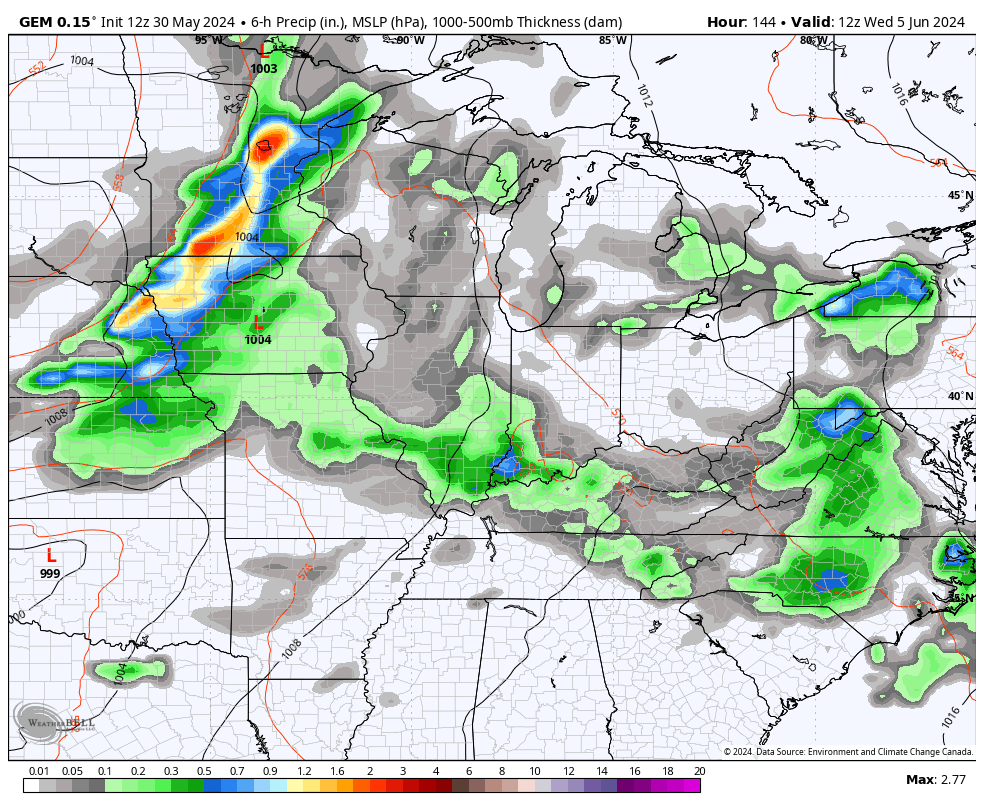
Another, more powerful, storm system will move our way by the middle and end of next week. This will keep more in the way of showers and storms going during this time with the chance for some stronger storms by Wednesday and Thursday as a cold front sweeps through. Behind that front will be a powerful upper level system with a few showers along for the ride…
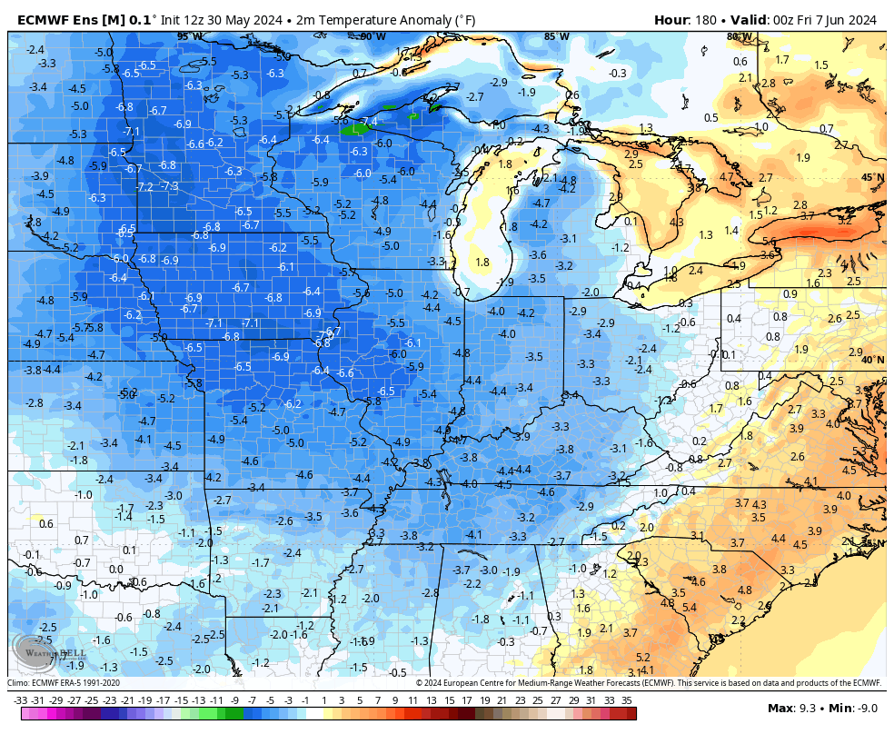
Much cooler air comes in under that system and may very well stick around into the middle of the month. The EURO Ensembles have a good signal through June 14th…
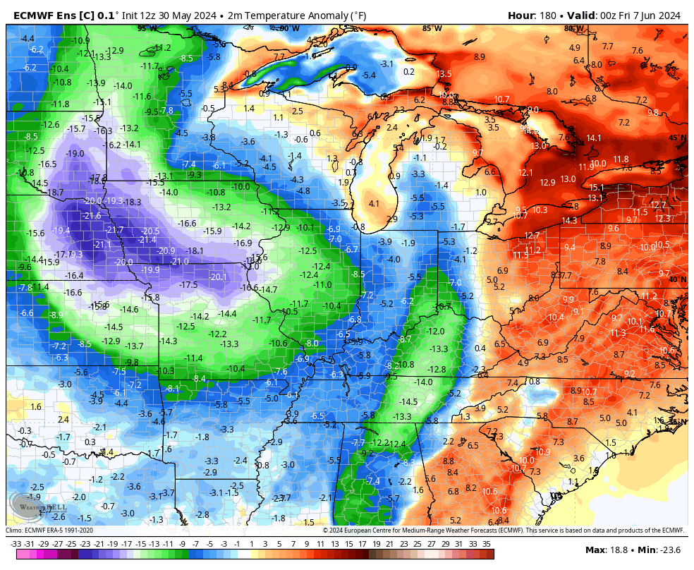
The Control Run of the EURO Ensembles is even more emphatic with the below normal temps…
Have a fantastic Friday and take care.

I hope the ensembles are wrong.
It’s going to get Hot Jeff. I can’t remember a year where it didn’t.
Thanks Chris. I’m hoping it doesn’t rain at all until we need it for the crops, but as we all know that isn’t going to happen.
Enjoy the last day of May everyone !
My perfect summer is enough rain for crops and water supply plus about 25 or so days with 90s for highs, lows in low 60s.
Sounds like great Summer weather Jeff.
I like to get outside and enjoy life as much as possible especially as man in his mid sixties.
So I am going to go outside today an take advantage of the comfortable weather.
We don’t have many great days like this one throughout the calendar year.
That’s true. How’s your Azalea coming along ?
Sadly it did not make it . Before I planted it I had a weed bush
I *might* of spray 2-4-d before physically removing its deep roots .
Also I try to plant an Impatient in the exact same spot and it didn’t make it.
The Impatient was kept over the winter indoors.
I have a wild American Holly growing in my backyard.
My plan is to try to plant it in the exact same trouble spot in the fall.
Sorry to here that the Azalea didn’t make it. I would try it agin. The wild American holly may be hard to transplant. Be sure to transplant the whole root system and give it plenty of water.
Thanks
If I did sprayed the herbicide in that area hopefully It will be fully diluted by the fall.