Good Monday, everyone. Warm temps are returning to the region today as we gear up for another pattern change later in the week. As we go back to a cooler than normal setup, some healthy showers and storms are likely to usher in this change.
Temps today rebound into the 80s for much of the state. Humidity will be high so we are going to feel a bit muggy as well.
This humidity can also fire up a scattered shower or storm but we shouldn’t see this as widespread as the past few days…

Tuesday is another day in the 80s with a storm or two blowing up as the day wears on.
Showers and storms will become much more common Wednesday into Thursday as a cold front drops in from the west. At the same time, a wave of low pressure develops along the boundary. This will help enhance the chance for heavy rain producing thunderstorms, which could also be strong.
Here’s the EURO from Tuesday morning through Thursday morning…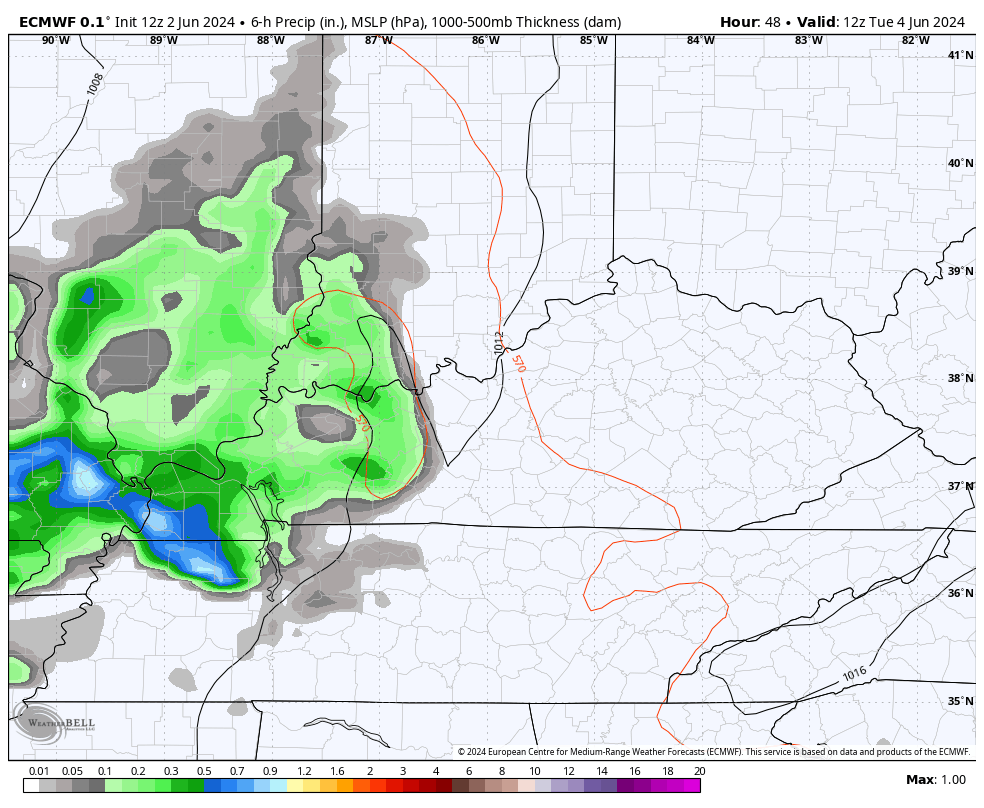
Locally heavy rainfall will be a good bet during this time and that could lead to a few issues.
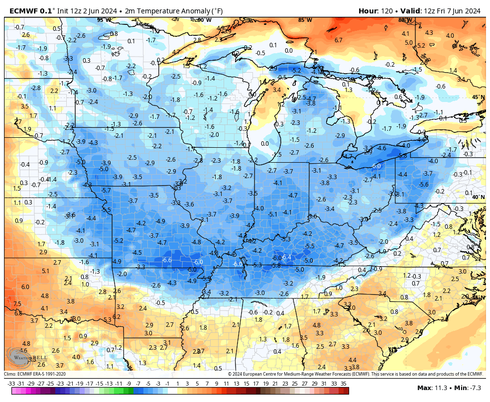
Much cooler than normal temps will then slide through here late this week into the weekend. That likely gets reinforced by another cool blast early next week. Watch the below normal temps take control on the EURO…
And the GFS which goes deeper into next week…
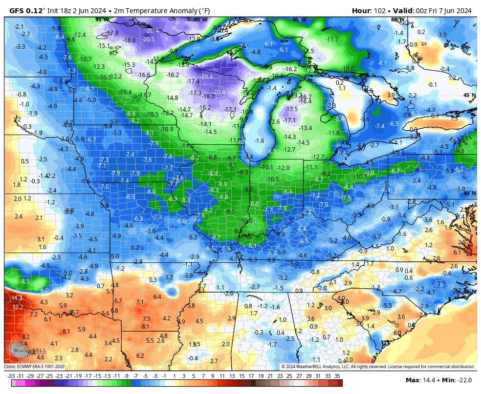
That’s another extended run of below normal numbers and it could also feature scattered showers and storms going back up early next week.
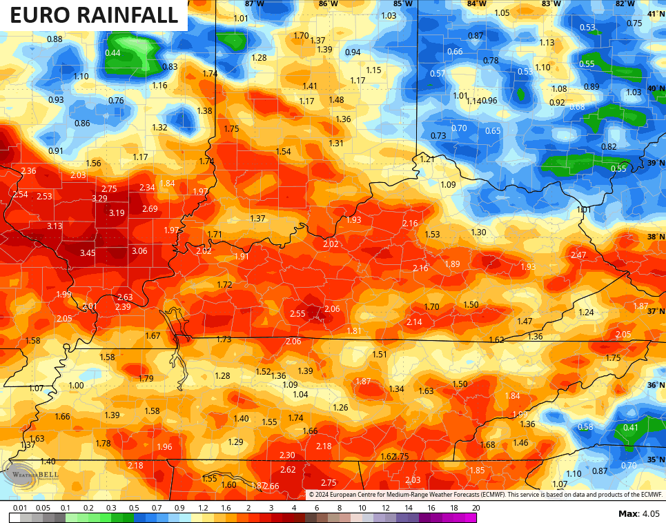
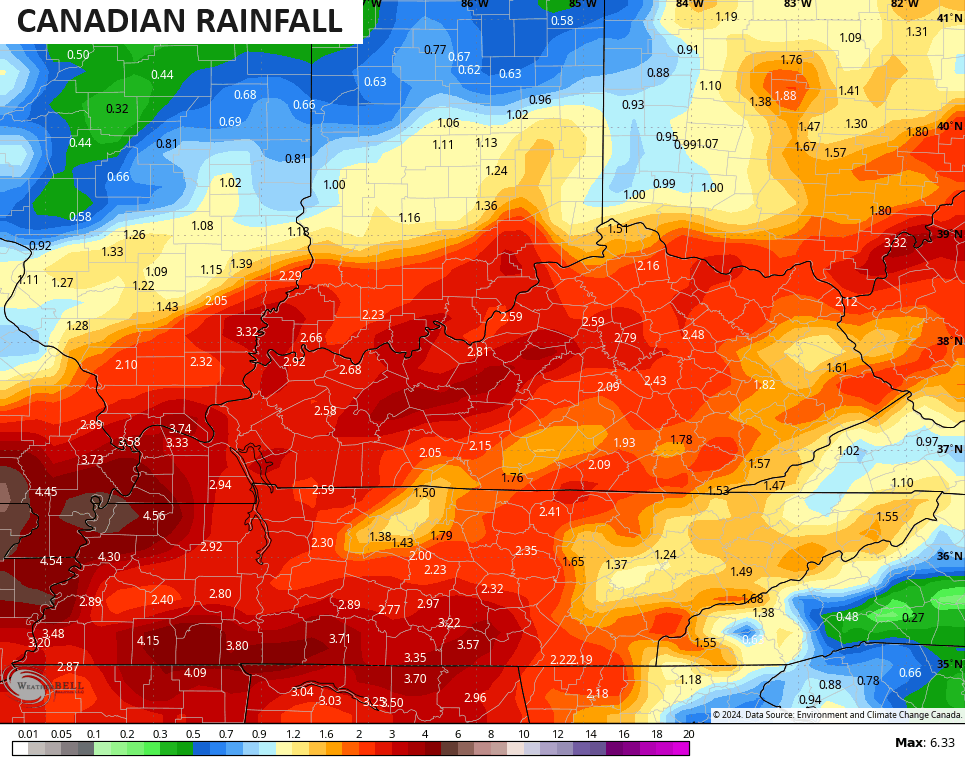
The next 7 days of rainfall from the models shows decent totals once again…
Make it a great Monday and take care.

I think when the tropics start is when we’ll see our real heat. I feel like more often than not June isn’t a super hot month… It’s when July comes around and all the way through Sept when the tropics start doing their thing causing systems to stall or not move….then again, every year can be different.
Very true Mark.
Bring on the heat.
The real deal heat usually comes in July and August. I think the rainy periods this month will keep temperatures in check.
When will it snow
According to the ensembles, probably mid-July.
The last huge Snowstorm for me occurred on December 23rd, 2004. Snow depth topped 24 inches. Beautiful White Christmas, but when New Years day came the Snow was all gone.
Here’s the link to an interesting article on the ” year without a Summer. ” The year was 1816.
https://www.nps.gov/articles/000/1816-the-year-without-summer.htm#:~:text=1816%2C%20also%20known%20as%20the,ground%20and%20the%20ocean's%20surface.