Good Saturday, everyone. It’s a gorgeous day taking shape across Kentucky as we get ready for a surge of summer steam. This starts Sunday and locks in for the week ahead, but some tropical moisture is going to bring some showers and storms to keep the serious heat away.
Skies are partly to mostly sunny out there today with temps reaching 80-85 for much of central and eastern Kentucky. Temps will be a few degrees above that in the west. Humidity levels will be in the comfy category once again.
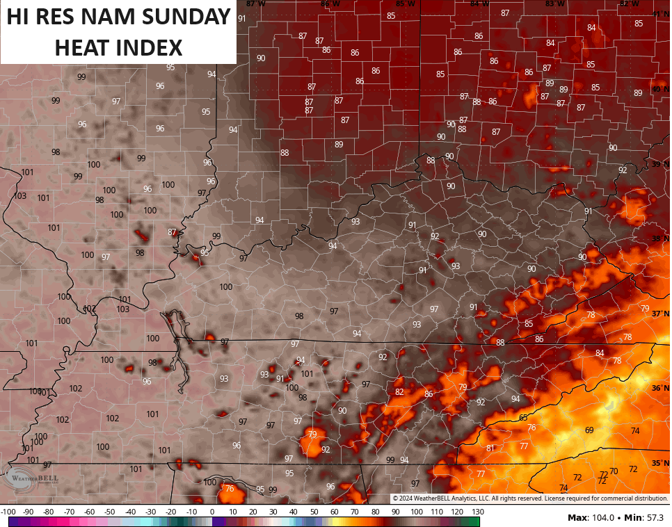
Our tropical feel starts to stream in on Sunday, especially in the west. Actual temps make a run into the 85-90 degree range for many with a low 90 in the west. Throw in the increase in humidity levels and we our Heat Index takes off in the west. It will feel the part of 100 in the west with 90 or low 90s in the central and east…
A couple of showers and storms will also go up during the afternoon and evening as this pipeline of tropical moisture starts to show up around here. This comes up the Mississippi River Valley then curves into our region.
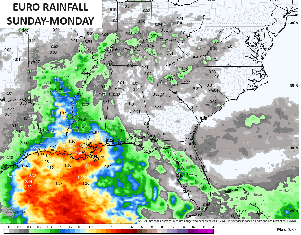
If you recall, the EURO and the GFS have been on totally different planets with the pattern for the week ahead. The EURO has been showing endless days of 100 degree days in our region with barely a drop of rain to be found.
The EURO is now finding the rain. This shows the rainfall from Sunday into Monday and you can clearly see the showers and storms following the path we’ve been talking about. Check out the Mississippi Valley to Ohio Valley connection…
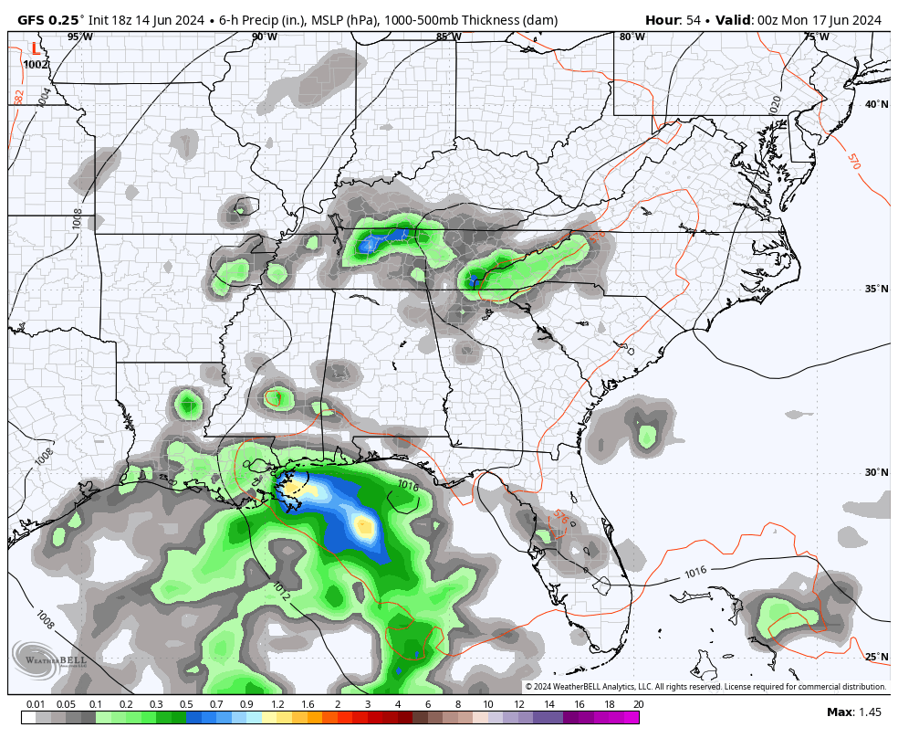
This is something the GFS has been showing all alone and it continues to do so. It keeps the threat for scattered showers and storms going through the week. This animation starts Sunday evening and goes through Friday evening…
This is why the GFS has been noticeably cooler than the other models.
The ENSEMBLES are still showing quite the spread with the GFS much cooler than the EURO or Canadian, but all agree with the core of the heat being to our north and northeast…
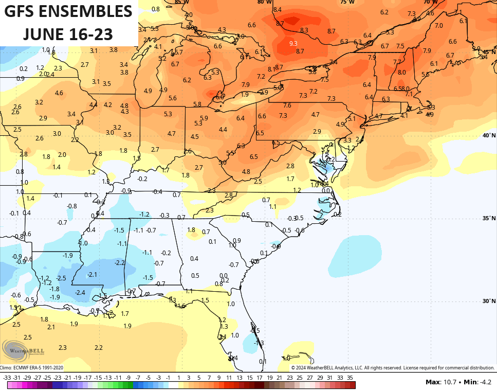
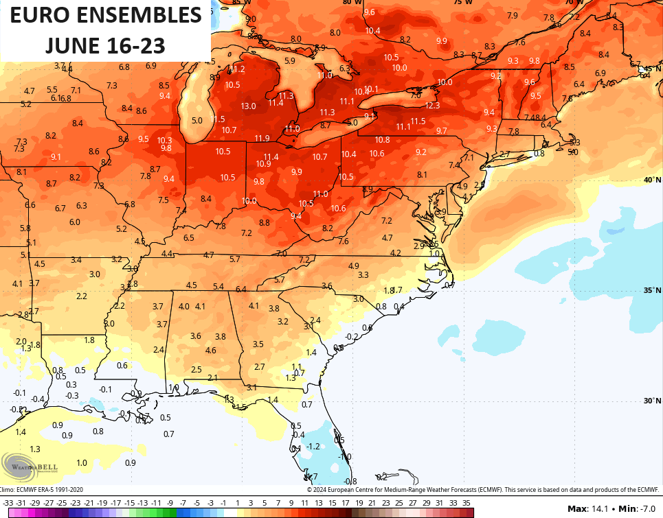
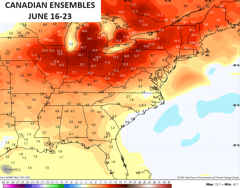
The truth is likely somewhere between the GFS and what the EURO and Canadian are showing.
My thoughts haven’t changed on the week ahead. Any day featuring full sunshine can reach 90-95 with a heat index much higher. Wednesday and Thursday have the best chance of that happening as of now.
The tropics continue to feature that system off the east coast and another system developing deep in the Gulf of Mexico…

Make it a great day and take care.

You are underpaying the heat.
*underplaying
Thanks Chris, for the update.
Enjoy the weekend everyone !
There’s no Barney coming to our rescue.
I hope at least we see some rain.