Good Sunday, everyone. Summer sizzle is starting to take control of the pattern today and will be with us through the upcoming week. Tropical moisture from the Gulf will also join in on the summer fun, bringing some showers and storms into the state from time to time.
Temps out there today are very nice to start across the eastern half of the state with some of us into the 50s. The heat builds across the west with temps reaching 90-95 with humidity that really climbs. Heat index values will be around 100 or so in a few spots. For perspective, Paducah averages 21 days every summer with a heat index hitting 100 degrees. Every. Single. Summer.
Temps across central and eastern Kentucky are 85-90 with lower humidity and a much lower heat index value.
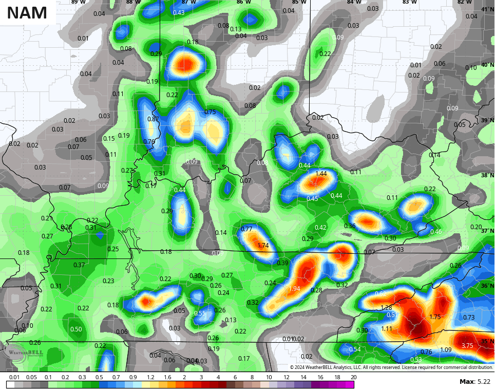
The threat for scattered showers and storms will show up from late this afternoon into the evening, especially across the southern half of the state. This kicks off a setup featuring a better chance for a few showers and storms into Monday.
The GFS has been on this from the start and now has other models finally seeing the chance for scattered stuff…
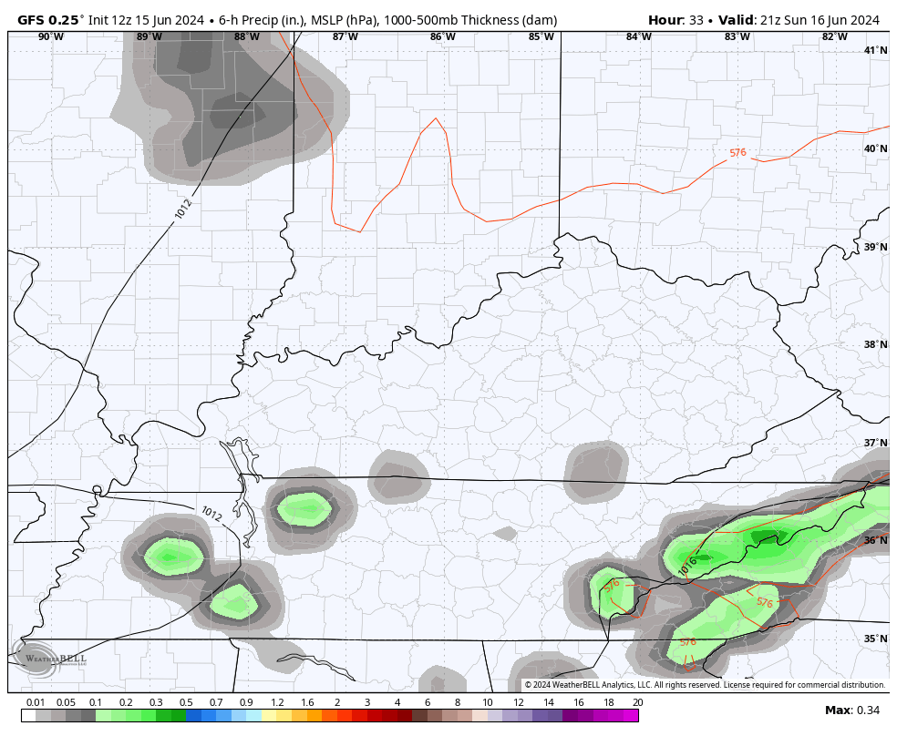
With ample moisture available, a few storms may put down enough rain for local high-water issues. I could also see a pulse severe thunderstorm or two trying to go up.
A few of the short-range models are now seeing the chance for pockets of heavy rainfall through Monday night…

Here are your radars to track today’s scattered stuff going up…

With more clouds and greater coverage of showers and storms, temps on Monday will likely be down a bit compared to today.
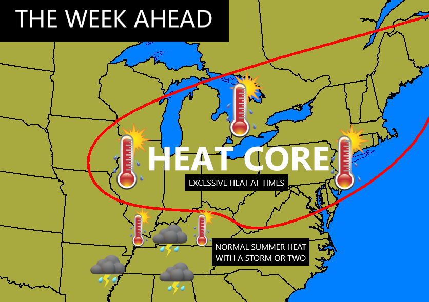
The pattern for this week ahead features the core of the heat just to our north and northeast with a more typical brand of summer heat across much of Kentucky and points south…
Once again, we have to put things into perspective as Kentucky averages (depending on location) 25-50 days where the thermometer hits 90 degrees or higher in the summer months.
The supply of tropical moisture wanes just a bit Wednesday and Thursday and those two days may be the toastiest of the week. Watch how some additional showers and storms then go up by the end of the week into the weekend…
A lot depends on the tropics and there’s the chance for 2-4 systems to threaten to develop over the next few weeks. The National Hurricane Center continues to monitor two for development…

Make it a great Sunday and take care.

The heat is being underestimated still.
Astronomers estimate that we’ll reach solar maximum activity in late 2024/early 2025, and there is evidence of a link between the solar cycle and average temperature. The previous solar max peaked in mid-2012, and that is when we had an unforgettable stretch of record heat from June 28th through July 1st in BG, hitting 106°F, 110°F, 108°F and 105°F on those days!
Interesting Joe. I just wonder if the solar cycle is causing the Pacific Decadal Oscillation to remain negative since 2020 ? This subject needs to be explored further.
Thanks Chris. Yesterday was about as warm as I like it. One of my air conditioners ( heat pump ) has died. The upstairs unit needs to be replaced soon. It’s beginning to get uncomfortable.
Enjoy your Father’s Day everyone.
This would be a great forecast if I still had a swimming pool.
Here’s an interesting article on ENSO, plus a comment by me on solar cycles and the PDO being negative since 2020. Seems like I answered my own question months ago. LOL…
https://www.climate.gov/news-features/blogs/enso/march-2024-enso-update-award-season#comments
An extended heat wave is starting today here in the Chicago Metro Area, with highs predicted to be in the 90s for at least the next six days! The Metro Area is also under a Slight Risk for severe weather this afternoon. Other than that, just isolated to widely scattered storms are in the forecast this week.
Looks like the hot summer that NOAA predicted is right on schedule.
Jeff looks like you may just get your heat I will be inside with the air conditioner lol. Looks like a hot week ahead. I guess we have been lucky to hold the really hot temperatures off till now.
Happy Fathers Day Chris and all the Fathers on the blog!