Good Wednesday to one and all. It’s another steamy day across the Commonwealth as clouds help keep our temps in check once again. Temps will rebound a bit for the end of the week, but all the nasty heat is still well away from our region.
Those clouds today likely hold many thermometers into the mid and upper 80s once again. Areas seeing a little more sun can spike to 90 or a touch above. Heat index values are still nothing to write home about.
Just like the past few days, a few showers and storms will go up today with locally heavy downpours with isolated severe weather possible.
Here are your Kentucky radars…

Temps into Thursday and Friday are back into the upper 80s and low 90s for many. Heat index values will be a few degrees warmer than that with some mid and upper 90s from time to time.
That said, there’s still the chance for some clouds to help things out. Those clouds may still spit out a stray shower or thunderstorm and the GFS is showing this…
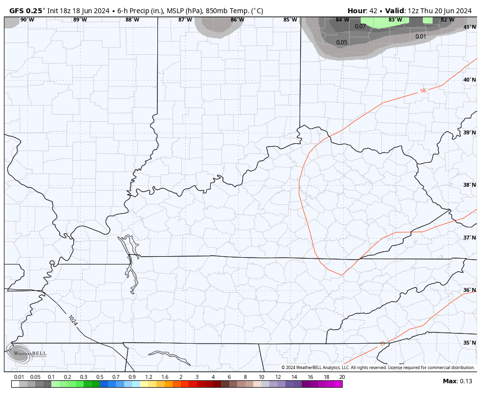
The GFS has performed wonderfully this week as it was never showed excessive heat or anything close and was on top of the scattered storms we have been seeing.
Alberto is forming in the Gulf and heading into Mexico tomorrow…

The satellite shot from the Gulf shows our system and clearly shows a pipeline of moisture streaming from the Gulf toward our region…

Two more systems have a chance to develop behind this over the next week…

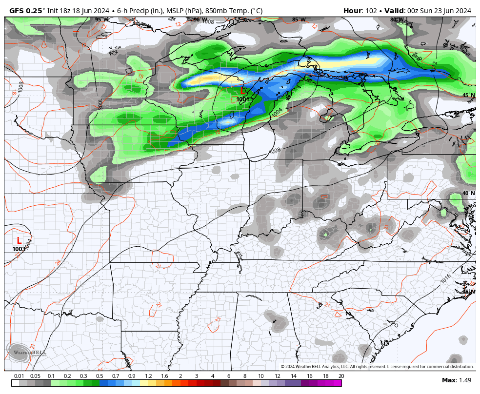
Saturday is another steamy day with upper 80s and low 90s with a heat index deeper into the 90s. The chance is there for a shower or storm to go up with a greater chance coming late Sunday into Monday as a cold front moves in. That knocks the numbers down and, as the front stalls, we wait for a second system to move in next week. All of this means a greater chance for showers and storms…
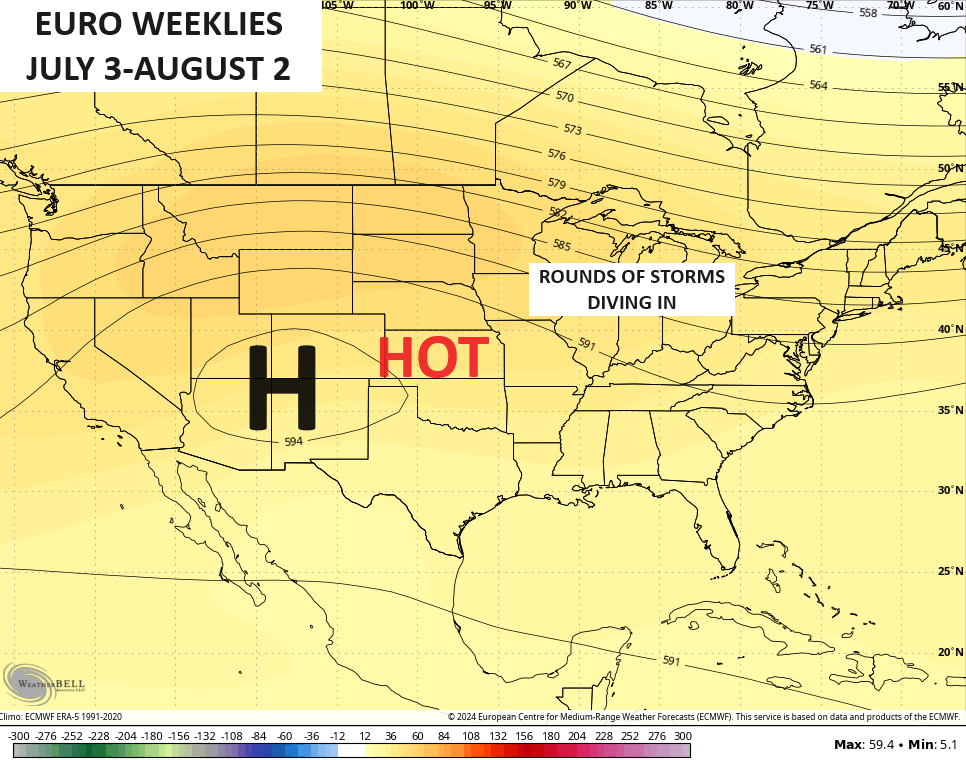
If we look deeper down the weather road into July and the start of August, we find the Euro Weeklies trying to set up a massive heat ridge across the Plains states with our region on the eastern edge of any big heat. That would also put our region in the line of fire for some hefty thunderstorm complexes dropping in from the northwest…
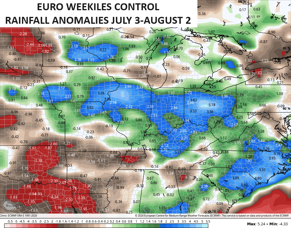
The Control Run of the Euro Weeklies is showing these clusters of storms with above normal rainfall during that same period…
Have a wonderful Wednesday and take care.

The heat is still underestimated.
lol…you crack me up.
Goofy take
Thanks Chris. Hoping there is enough soil moisture to sustain the crops through this very dry period. Waiting for the opposite reaction to the drought and heat wave.
Stay safe and cool everyone !
We might not see any major cool downs this summer like we did last year.
The CMC long distance forecast appears to be a bust.
You might say it was “A One Hit Wonder”
Severe Weather to Increase Ahead?
When: ~June 25-29th
Where: central Plains, Ohio valley to mid-Atlantic.
Hazards: damaging winds, large hail, isolated tornadoes & localized heavy rainfall.
It reads like you’re all in on the Euro.
Guys, it’s not going to be that bad.
I remember growing up in Brevard NC… We rarely ever dealt with 90s temps… Yes, it would get to the 90s there at times, but it was very rare… Our Mid summer hot days would be mid to upper 80s… and we would almost always have thunder every afternoon.. we would have storms some days, miss storms some days… but every day you could almost always hear thunder in the distance and it would be cloudy from the surrounding storms…. My grandma did not have AC… My dad had it, but only a window one in his bedroom. I think back and wonder how I stood it.. It’s so standard now everywhere I can’t imagine not ever having it.. It’s crazy how different the weather is in the mountains
I been to Brevard many times, but that’s been many years ago. What a beautiful place to grow up. I always had an attraction to western North Carolina because all the Rhododendrons and the waterfalls.
It’s another hot one in the Chicago area today, as the high reached 93 degrees at O’Hare Airport and 95 degrees at the NWS Forecast Office in the SW Suburbs. It’s not terribly humid though, as dew points are generally in the mid to upper 60s with the Heat Index in the mid to upper 90s. This is the fourth day in a row with temps in the 90s.
In response to Crystal’s question from last night… no, it doesn’t always get this hot here in the Chicago area this early in the summer. When the wind comes off Lake Michigan from the E or NE, it provides a cooling effect to the immediate Chicago area close to the Lakefront, as water temps are still in the upper 60s. The last several days though, the wind has been blowing straight from the south, with no cooling effect from Lake Michigan.
Mike I have a feeling we are in for a long dry hot summer.