Good Thursday, folks. Temps are starting to steam back up out there today and will peak as we go into the start of the upcoming weekend. Beyond that, we track a pattern more favorable for showers and storms with more heat waiting in the wings.
The clouds on Wednesday helped keep out temps in the 80s across the entire state. Some of us barely made it to the middle 80s!
Temps out there today rebound into the upper 80s to around 90 for many with a few spots reaching the low 90s with enough sun. Clouds won’t be as widespread as Monday, but we will see them out there today and those may spit out a shower or thunderstorm once again.
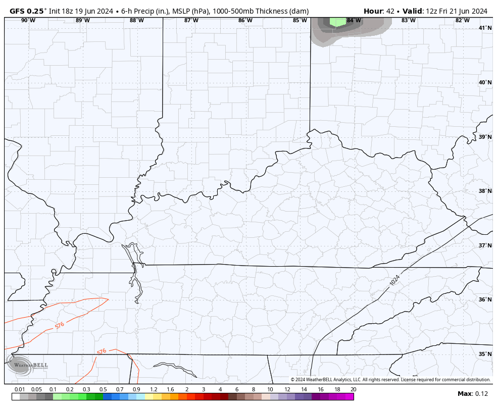
Here is your daily dose of Kentucky weather radars…

As we’ve talked about for the past week, the core of the heat is to our north and northeast this week…
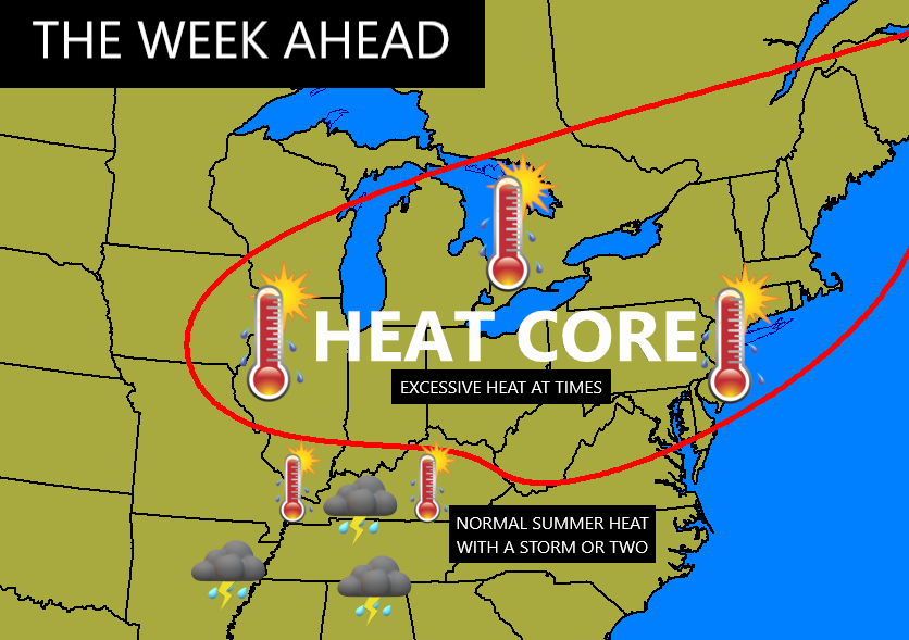
Temps around here are nothing excessive or extreme and are typical for summer heat in Kentucky.
Temps Friday and Saturday may very well be the hottest of the week with 90-95 in several areas with a heat index a few degrees above those numbers.
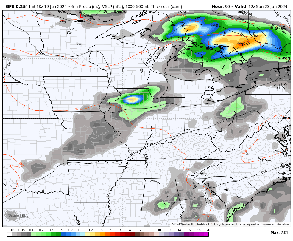
Can we find a few showers or storms fire back up to help out some areas? The GFS sees a few…
A cold front then approaches the region from the northwest late Sunday into Monday, bringing a few showers and storms. Temps come down behind this boundary into early next week. Another system then drops in a few days later with some more showers and storms possible…
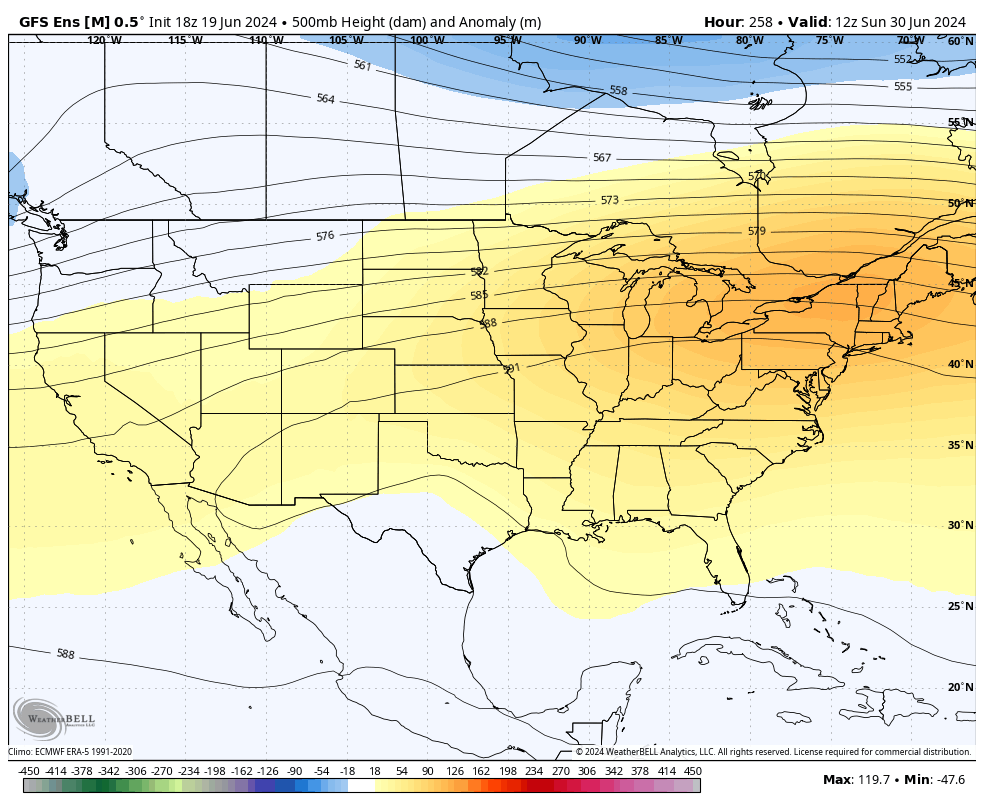
The setup as we close June and roll into the 4th of July week may turn pretty darn hot around here and for much of the country. The Ensembles agree with a heat ridge developing over our region then retrogressing back toward the west…
GFS ENSEMBLES
EURO ENSEMBLES
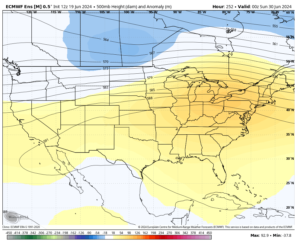
That’s where this heat ridge likely sets up for much of July. The end result means the plains are likely to absolutely bake with the heat taking shots at us from the west. The chance for some excessive heat is there in this type of a setup. Real deal heat doesn’t come on a flow from the Gulf like what we have this week. Real deal heat for Kentucky comes in more of flow from the Plains states.
Let’s talk tropics for a bit.
Tropical Storm Alberto is moving into Mexico but it’s bringing a ton of rain into Texas as well…

Another system is likely to develop in a similar location to Alberto and there’s a swirl heading toward the Florida Atlantic Coast…

The spaghetti plots from the GFS Ensembles all take this Atlantic system toward north Florida…
We shall see if that becomes a full blown storm or not.
The latest Seasonal Forecast from the EURO is out and shows a very active hurricane season. The July through September Mean Sea Level Pressure anomaly forecast shows a lot of low pressure across the Gulf and into the Caribbean…
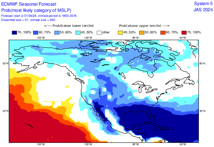
Years like these often bring systems that directly impact our weather here in Kentucky.
Make it a great Thursday and take care.

Test
There is not much to be excited about this forecast.
A lot of days will be spending indoors.
Gra$$ mowing during the evening.
Thanks Chris. We will be needing a storm like Alberto in the coming days, but only a 2 to 3 inch rain.
Enjoy the afternoon and evening everyone !
Bring on clouds and storms please…. I hate boring weather that’s the same one day after ANOTHER… especially if it’s HOT
We don’t need a ton.
533 pm… KLEX temp 93….
Mesonet # 1 87
Mesonet # 2 88
That’s a difference of five and six degrees…. Yes, that’s right. FIVE and SIX DEGREES!