Good Friday, everyone. Temps are toasting back up across the region today into Saturday, but the focus is on two cold fronts arriving in the coming days. The first slides in late Sunday with the second pushing into town by the middle of next week.
Temps this week have been about what I thought with a lot of the state failing to even crack 90 degrees. You just can’t get sustained heat with green, lush vegetation and with a high in the position it’s been in, bringing moisture in here from the Gulf.
That said, the orientation of that high has changed just enough to allow temps to jump today. Many areas hit the low 90s, but we will still see a few spots staying in the upper 80s. Humidity levels won’t be crazy high by any means, so the heat index isn’t much above what the temp is.
There’s the small threat for a storm or two going up…

Temps on Saturday should be very similar to today with a slightly better shot at a storm or two.
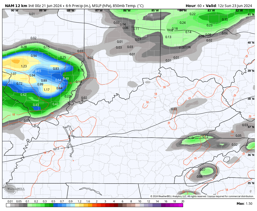
A cold front arrives on the scene from northwest to southeast late Sunday into Sunday night. A few rounds of showers and storms zip across the state and a few of these may be strong…
Temps are better for Monday, but that front lifts back to the north as a warm front with a surge of heat for Tuesday. A strong southwest wind kicks in for Tuesday and I’ve seen similar setups in the past produce low and mid 90s for highs.
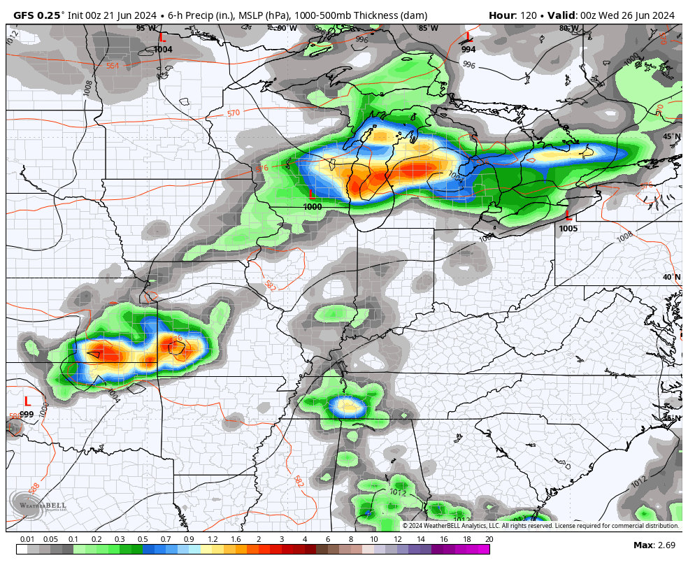
This southwest wind is ahead of a stronger cold front moving in on Wednesday. This brings some decent showers and storms with it…
That front has much cooler air coming in behind it. The numbers for later Wednesday and Thursday may go below normal…
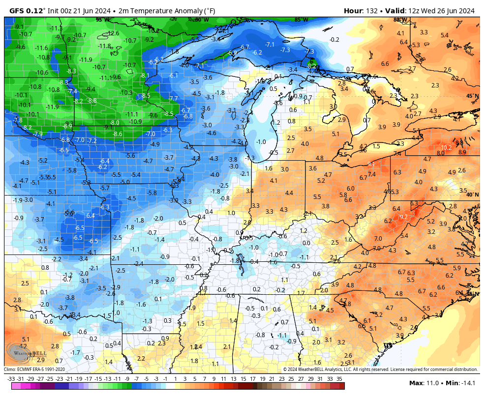
Highs have a chance to stay in the 70s if clouds are thick enough and rain is around Wednesday and Thursday.
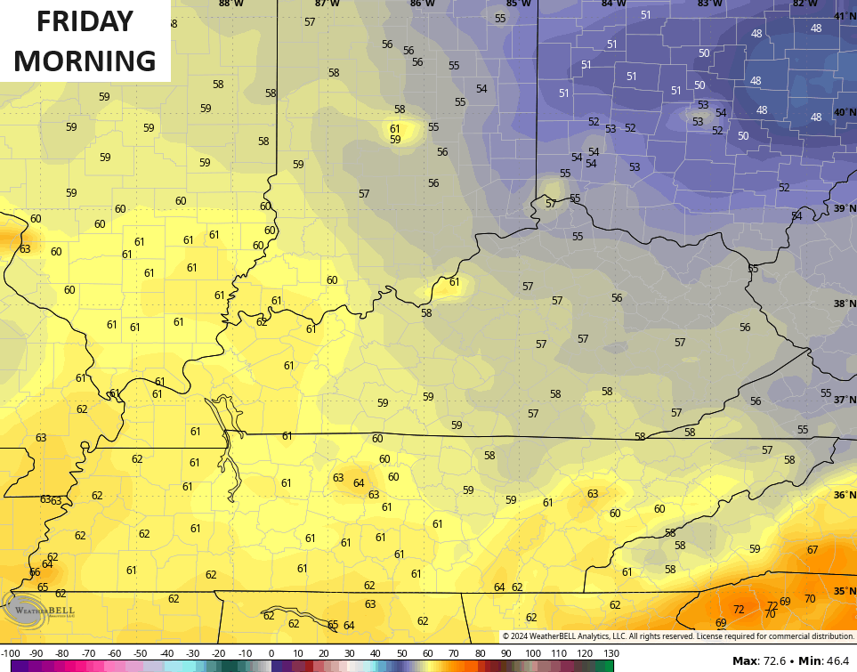
The GFS is spitting out lows reaching the 50s by Friday morning…
Sign me up for that!
I have no changes to my thoughts on July as the real deal hit is likely to make a couple of runs at us.
Tropical Storm Alberto has come and gone but we have two more systems of note. The one off the Atlantic Coast of Florida is first on the agenda…

This may very well become a Tropical Depression today. It may also become Beryl before hitting around the Jacksonville to Daytona area. This has a nice look to it on satellite…

The GFS Ensembles spaghetti plots look like this…

Have a fantastic Friday and take care.

Sounds good
Thanks Chris. Normal Summer temperatures, but abnormal on precipitation. I don’t recall any Summer month not having any rainfall. Wish there was better chances next week. I just wonder if the activity in the Atlantic and Gulf is decreasing our rainfall pattern ? Maybe it’s La Nina amplifying the Bermuda High and changing it’s position ?
Have a great day everyone !
Yesterday’s high temp at my PWS near Bowling Green was 95.2°F at 4:50 pm CDT, and the heat index at that time was 106.4°F. We’ve hit 99° twice over the past week, and it wouldn’t surprise me at all to see actual air temperature break 100° over the next few days. Foliage is starting to take on a tinge of brown, as we enter our 14th day without rain.
I live 25 miles south of you and we have had rain just yesterday and are above normal for the month, it is wild how just a few miles make such a big difference.
That is a fact! Another good example is comparing readings from the Bowling Green “5 S” with the Bowling Green “6 NE” Mesonet stations.
“5 S” is at the Western Kentucky farm, near Nashville Rd. and I-165, while “6 NE” is up near GM’s Corvette plant. It seems like 6 NE nearly always gets more rain.
High temperatures in my area since the ” heat wave ” started have been less than 92 degrees, and lows in the upper 60’s because there are a lot of trees in the area, and population is low. Last good rain was sometime in May.