Good Monday to one and all. Much cooler and drier air is out there across the state to kick off the last week of June. The overall pattern is turning stormy to close out the month with a steamy and stormy July waiting on us.
Temps today hang out in the 80-85 degree range for many with the chance for the southeast to stay upper 70s in a few spots. Humidity levels absolutely tank, giving us a breath of fresh air.
The numbers rebound Tuesday but not to the levels I had feared with 85-90 across central and eastern Kentucky and low 90s in the west. Humidity levels jump back up with the chance for a scattered shower or storm going up.
A potent cold front sweeps in Wednesday with the potential for severe storms and heavy rains into Wednesday night…
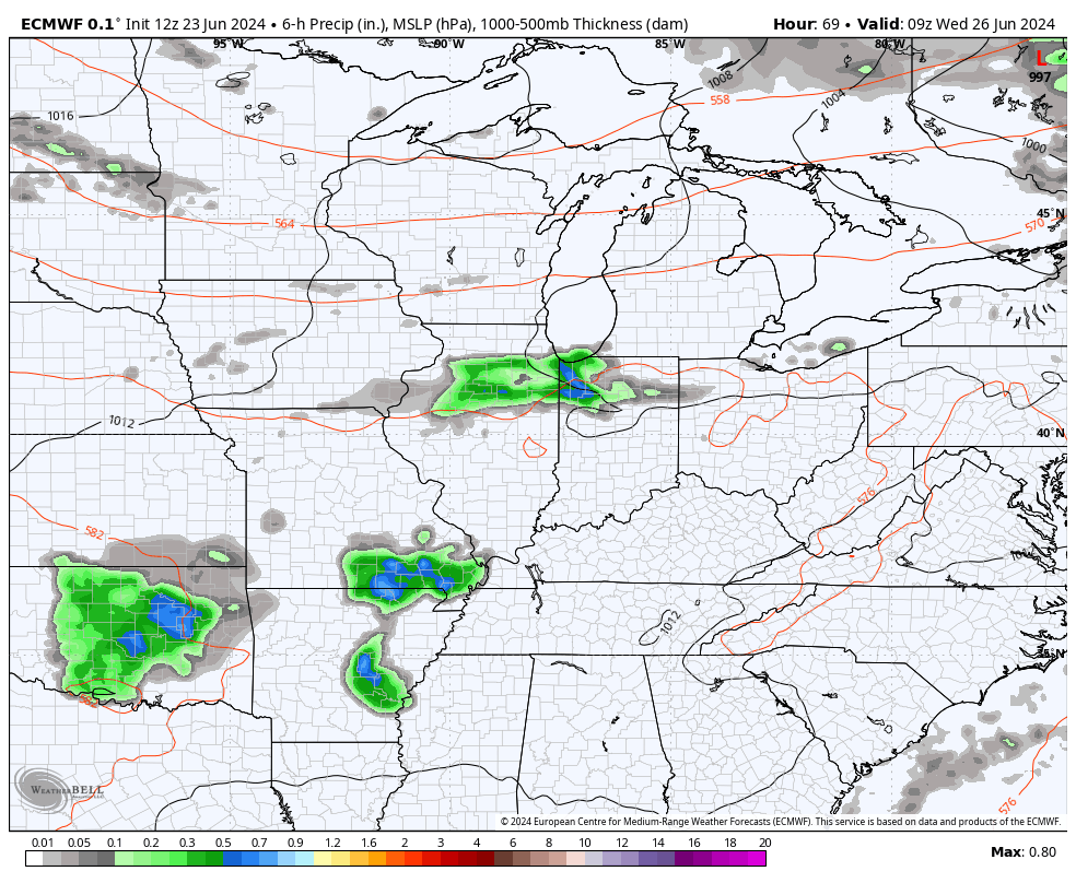
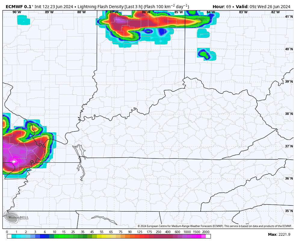
The EURO is really cranking out a lot of lightning with this scenario…
Damaging winds are a decent threat with these storms zipping across our region.
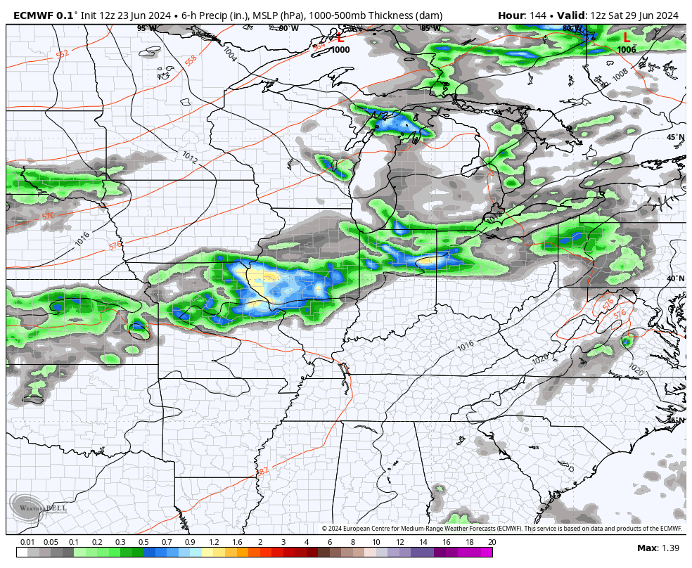
Another front moves in behind this with more showers and strong storms for Saturday with another showing up a few days later early in the 4th of July week…
The overall setup as we head into July hasn’t changed in my eyes. We will see a monster heat ridge going up across the Plains states with this throwing some shots of hefty heat our way. I don’t think this is constant because we will likely be in the line of fire for some big complexes of storms to push in from the northwest…
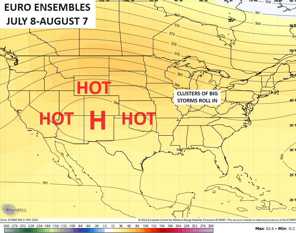
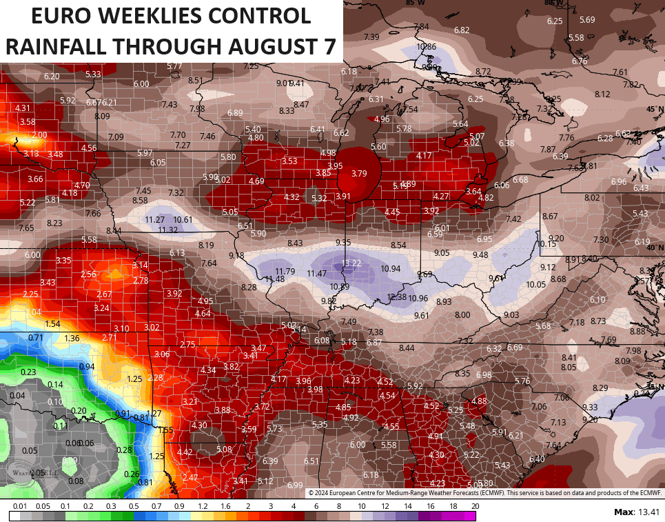
If the heat ridge sets up as the EURO Weeklies are forecasting, severe storms and flash flooding threats set up in our region. The rainfall forecast from the Control run of the weeklies shows this potential…
Have a magnificent Monday and take care.

Those northwest to southeast storm clusters can be crazy sometimes…. I remember moving here in the mid 1990s and I wasn’t sure what the weather would be like… I remember driving down new circle road around the woodhill area….It was about 3 or 4pm in the middle of summer and the northwest sky was pitch black scary looking. I remember thinking I had never in my life seen a sky that dark… ever!
I really hope that high sets up way out west and doesn’t end up too close to us.
Jeff would probably LOVE it parked right over us with 100 temps
Maybe a little good heat, but nothing like 2012.
2012 was a genuine scorcher. All-time records for Bowling Green were set on 4 consecutive days, from June 28th, through July 1st, with 110°F on June 29th.
Yep….the devastating derecho was Friday evening June 29th.
A few days forecasted to be in the low 80s.
I will take it.
I didn’t see any substantial rain yesterday.
I need the Wednesday system to come through.
Richmond got nothing from the early Sunday stuff. We did have a brief shower around 7 and a decent, but still brief shower after 10.
Thanks Chris. Hoping it won’t be as bad as the various ensembles are indicating. Yesterday was cloudy, with just a few drops of rain in my rain gauge. Temperatures through the day however, hung out in the low to mid 80’s.
Enjoy the day everyone !
Could use some rain without the “fireworks”. Getting pretty crispy here in north Salvisa.
Today was a nice break from the bad heat. I was lucky enough to get a pretty good shower last night I thought am I hearing rain? It could have lasted longer but I will take what I can get. Jeff quit doing the heat Dance lol