Good Tuesday, everyone. As heat makes a run at us from the west, we are watching for clusters of thunderstorms to develop and roll in from the northwest. The first potential comes this afternoon and evening with additional rounds on Wednesday.
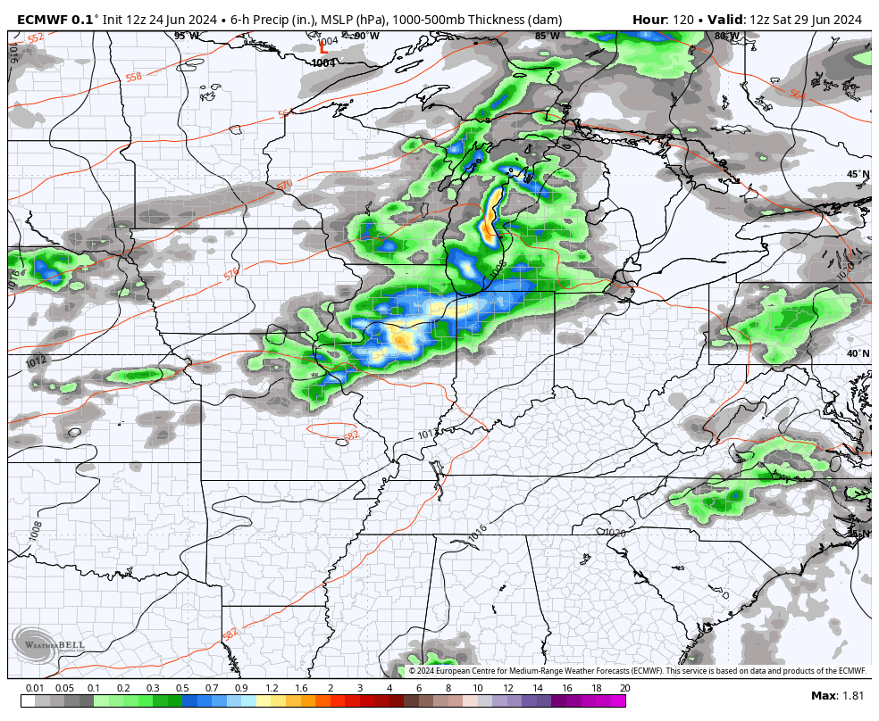
Temps today reach 85-90 across central and eastern Kentucky with 90-95 in the west. As this is happening, some massive thunderstorm complexes are roaming across the northern Ohio Valley. One or two of these may drop south of the Ohio River into parts of central and eastern Kentucky late this afternoon and evening.
If those do make their way into the Bluegrass State, damaging wind will be the main threat.
Here’s today’s Severe Weather Outlook from the Storm Prediction Center…

A better chance for showers and thunderstorms will be noted late tonight through Wednesday evening. While this isn’t constant stuff, this does bring the chance for more in the way of damaging wind producing storms.
Here’s the Wednesday Severe Weather Outlook from the Storm Prediction Center…

Much cooler and drier air comes right back in for Thursday with highs from 80-85 in many areas, similar to what we just had Monday.
We will steam it up again as we go into Friday and Saturday with the next front ready to drop in from the northwest late Saturday and Sunday. This will bring the threat for more showers and storms into the region…
With the flip of the Calendar to July, we find heat building in from the west with clusters of thunderstorms dropping in from the northwest into the 4th of July…
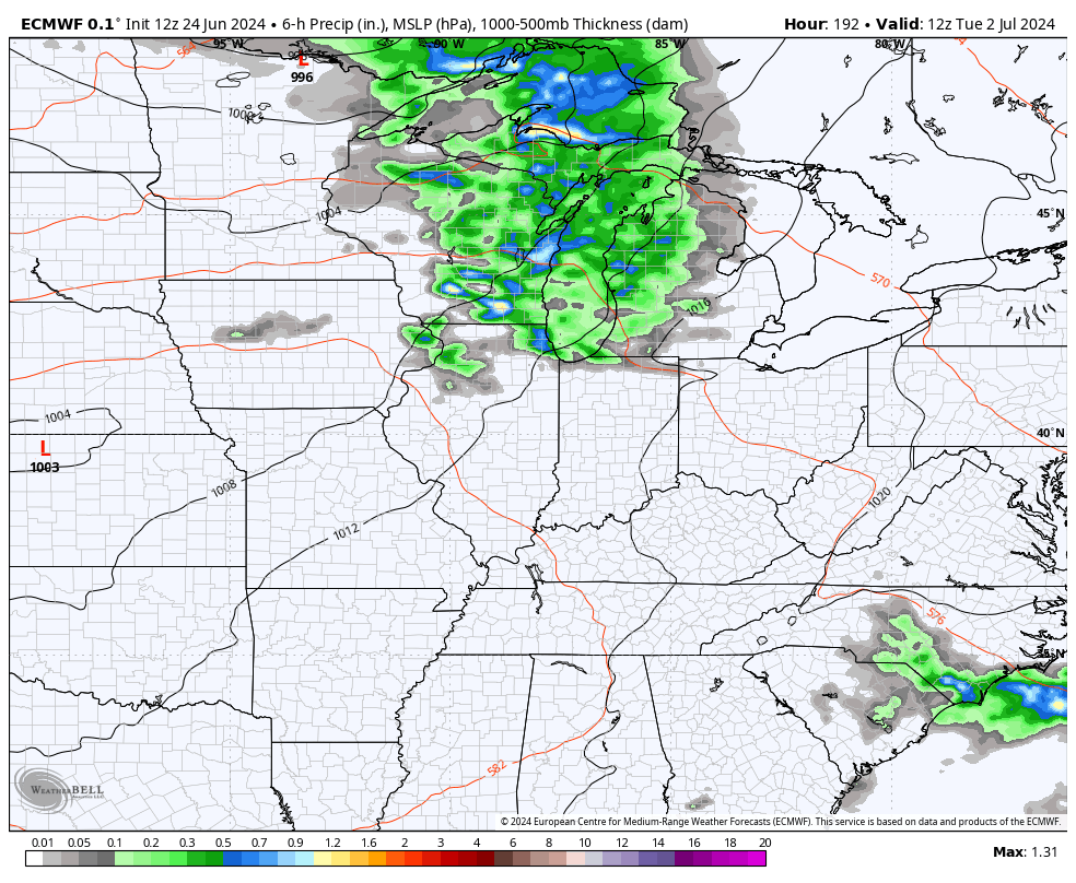
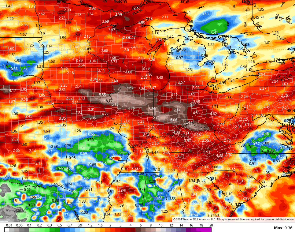
The northwestern sky looks busy into early July and this is something I’ve tried to highlight in recent days. The latest GFS rainfall forecast through the first week of July illustrates this potential…
I leave you with your storm tracking toys to follow any storms in from the north and northwest today…


Current watches

Possible Watch Areas

Have a great day and take care.

I am not going to complain about too much rain. It is better than going over ten days without any rain.
Meh
Here in Maple we haven’t receieved any measurable rain this month.
Thanks Chris. It is worth mentioning that yesterday’s weather was very pleasant. It’s too bad we missed out on the rains this past Sunday, but that’s been our precipitation pattern for several years now. Systems develop to our north and west and break up when they approach the Ohio River. Hoping this changes, and we all get soaked with rain.
Make it a great day everyone !
Adding to the above ; crops in my area are now showing drought stress.
A line of strong storms is moving through the Chicago Metro Area this morning, with numerous severe thunderstorm warnings in effect. Torrential rainfall is also occurring with these storms.
After this line moves through, skies will clear and temps will warm to the low 90s, with more possible severe weather this evening.
We are not in a drought yet.
My area of the state is in a ” short – term drought. “