Good Wednesday to one and all. A cold front is sweeping into the region today and it’s bringing more in the way of clusters of showers and thunderstorms, some of which could be strong or severe. This stormy pattern looks to ramp up a bit in the next week or so.
Today features rounds of showers and storms rolling across the state and a few of these storms can cause a little bit of wind damage. These storms won’t be all day with steamy breaks in between.
The Storm Prediction Center has a Marginal to Slight Risk out for the region…

As mentioned, the damaging wind risk is the main player. Here’s a look at the individual threat probabilities from the SPC…


These storms may also cause local flash flooding issues, too, so keep that in mind.
Temps come way down behind our Front with Thursday looking and feeling VERY NICE. This might be a repeat of what we just had on Monday. Yes, please!
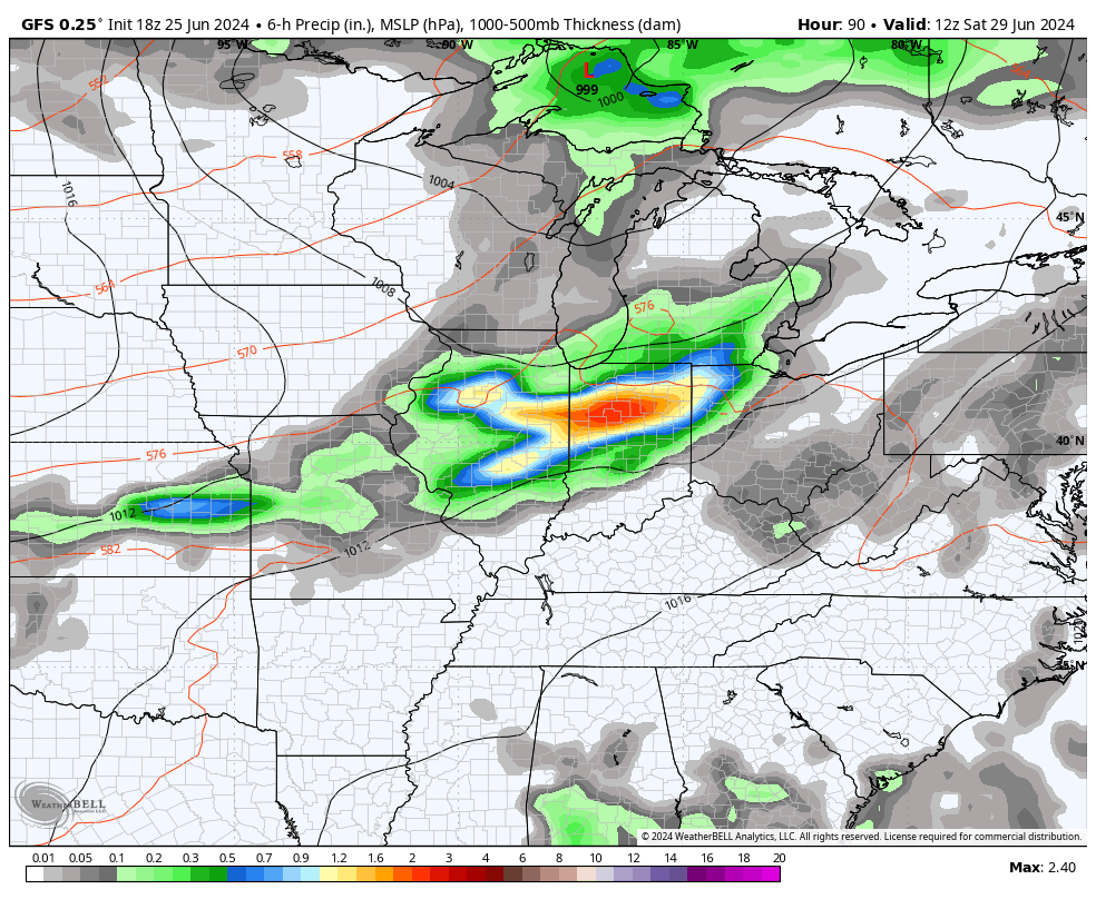
Steamy temps surge back in from west to east Friday into Saturday as we get ready for another cold front to crash in late this weekend. That front also looks pretty active with the chance for a few severe storms and heavy rains as it blows through…
Temps will likely come down behind this but to what extent is still up for discussion. The GFS is blasting some well below normal temps to start July…
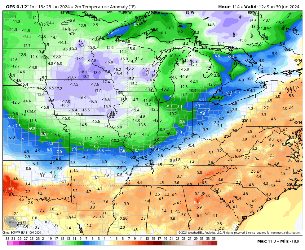
Lows on the GFS would flirt with records for early July…
I’m not sold on that yet folks!!
The heat dome across the plains will flex next week with clusters of big storms rolling around the northern and eastern periphery of the high. These may very well impact our region…
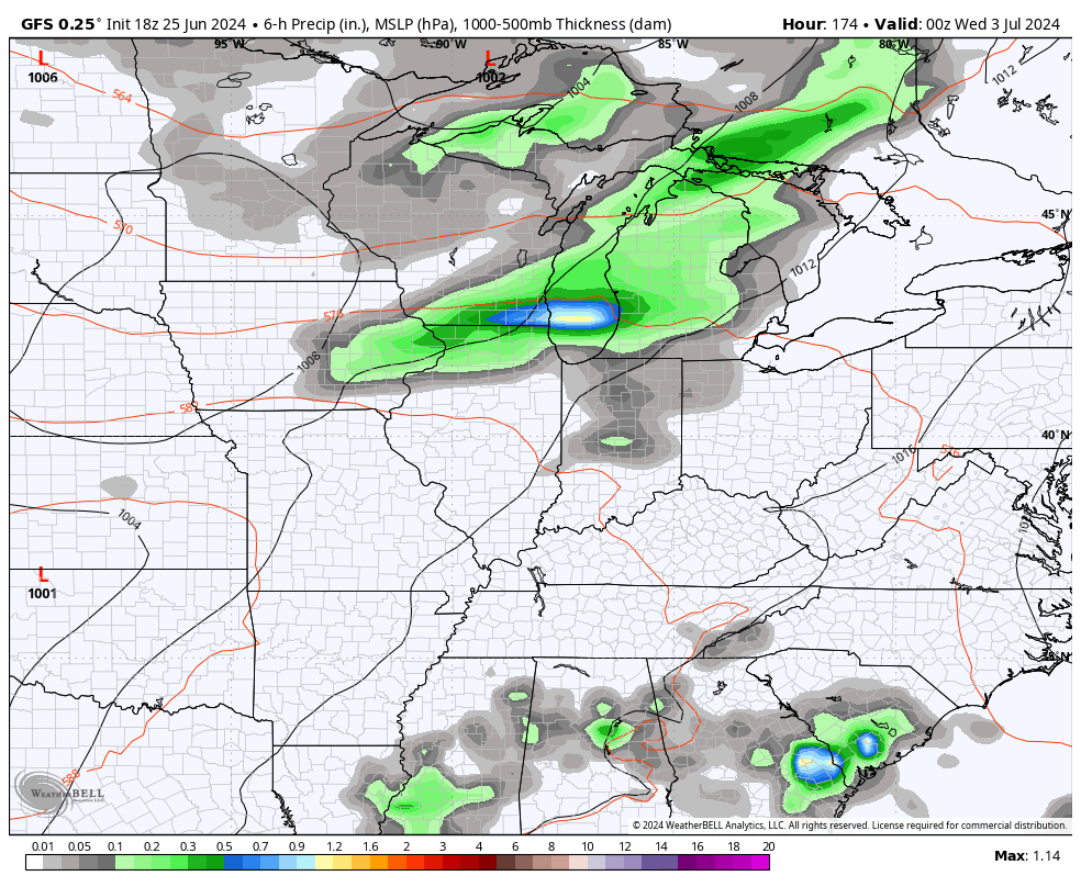
I think we see a lot of this in July as a major heat wave engulfs the central parts of the country, occasionally flexing into our region.
I leave you with your Wednesday severe storms tracker…


Current watches

Possible Watch Areas

Have a great day and take care.

The GFS will not verify.
I received some much needed rain yesterday. Also the temperature dropped about 20 degrees after the storm.
Thanks Chris. Looking forward to the cool down, if it happens. I’ll be ready for Autumn type weather after the Fourth of July. Still waiting for the rains to begin.
Enjoy the day everyone !
At 4:15 pm CDT, my PWS near Bowling Green recorded a temperature of 97.3°F and a heat index of 110.1°F. A line of storms in Western Kentucky looked promising, but dissipated. Over the past 18 days we’ve picked up just 0.21″ of rain in Southern Warren County. Lawns have begun to brown up…
Joe, I can’t remember when we had a good soaking all day rain. Most likely it was from a tropical storm several years ago. La Nina is here, and she doesn’t bring the kind of weather we need.