Good Thursday to one and all. Our cold front has cleared the area and we have some really nice weather out there today. Unfortunately, steam and storms are set to return for the final few days of June. This leads us into quite a few changes into the 4th of July week.
Temps today range from 80-85 for much of central and eastern Kentucky with mid and upper 80s in the west. The air is really comfy with partly to mostly sunny skies taking shape. It may be a slow starter of a day, though, especially in the southeast. That’s where some lingering low-level moisture may spit a shower…

The steam returns from the west on Friday and continues into Saturday as both humidity levels and temps climb. The chance for a few showers and storms will be noted, especially on Saturday. Then, a cold front sweeps across the state on Sunday with a greater concentration of showers and storms.
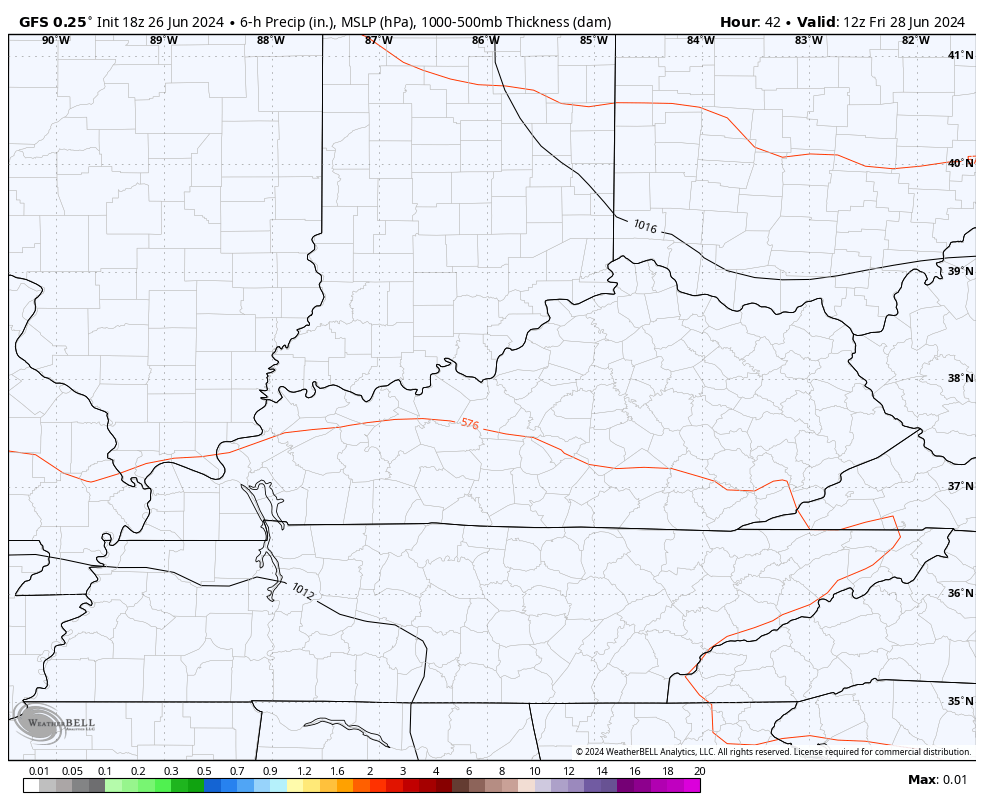
Here’s the GFS from Friday through Sunday…
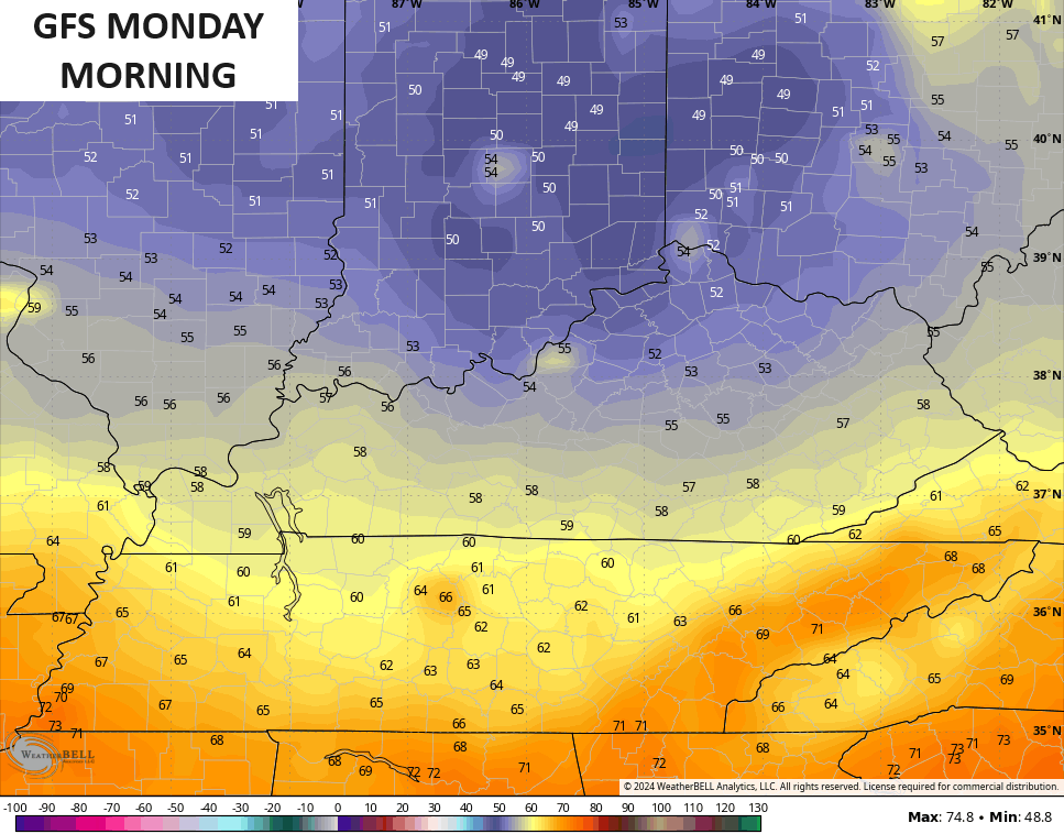
The air behind this looks pretty darn nice for the first day of July. The GFS is still the coolest with readings down into the low and mid 50s…
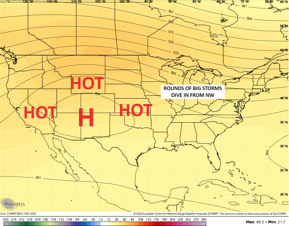
The pattern after this will find the heat trying to make another run at us into the 4th of July holiday period, but the models are not only bringing thunderstorm clusters in from the northwest, but they’re also trying to bring a couple of cold fronts.
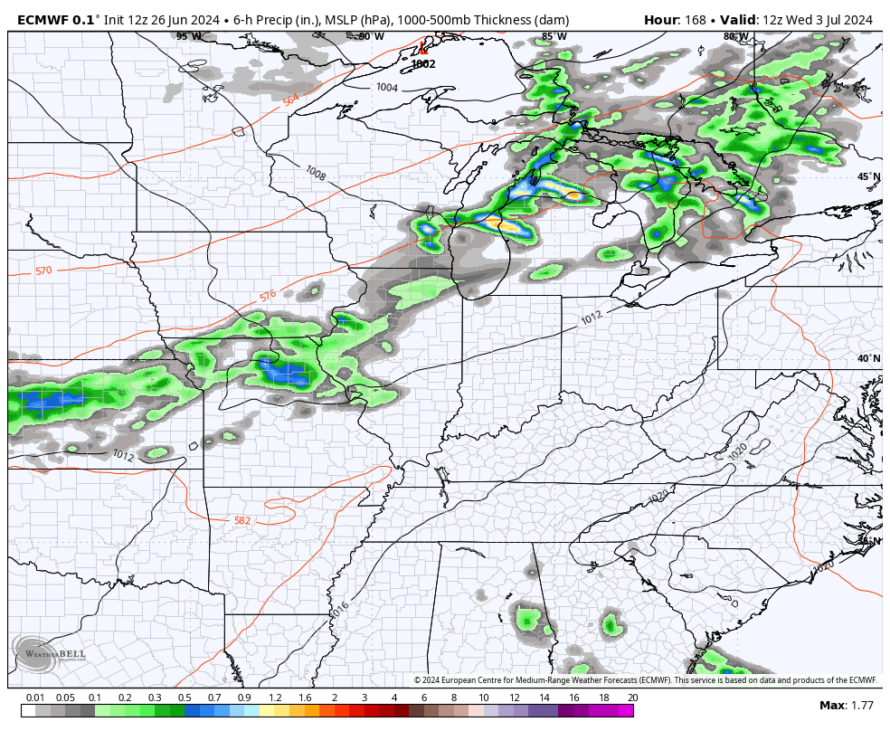
The EURO has one front showing up around the 4th with another a few days later…
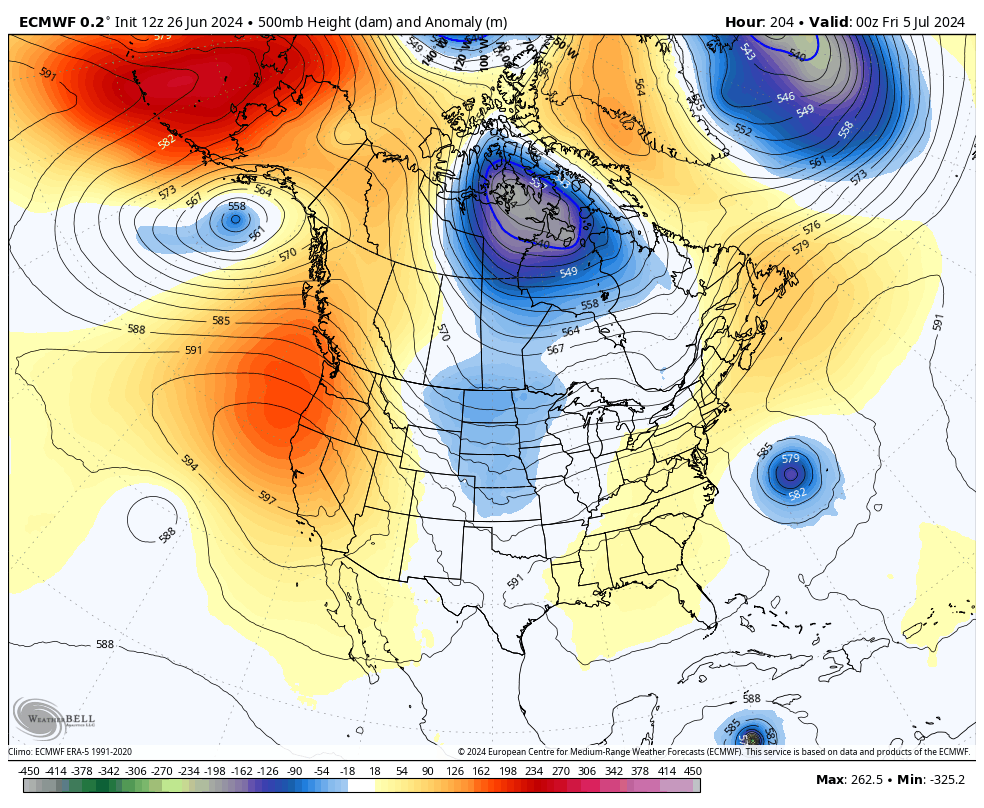
The EURO is going all in on a deep trough trying to take control of the eastern half of the country late next week into the first weekend of July…
The control run of the EURO Ensembles is also on board with this into week 2 of the month…
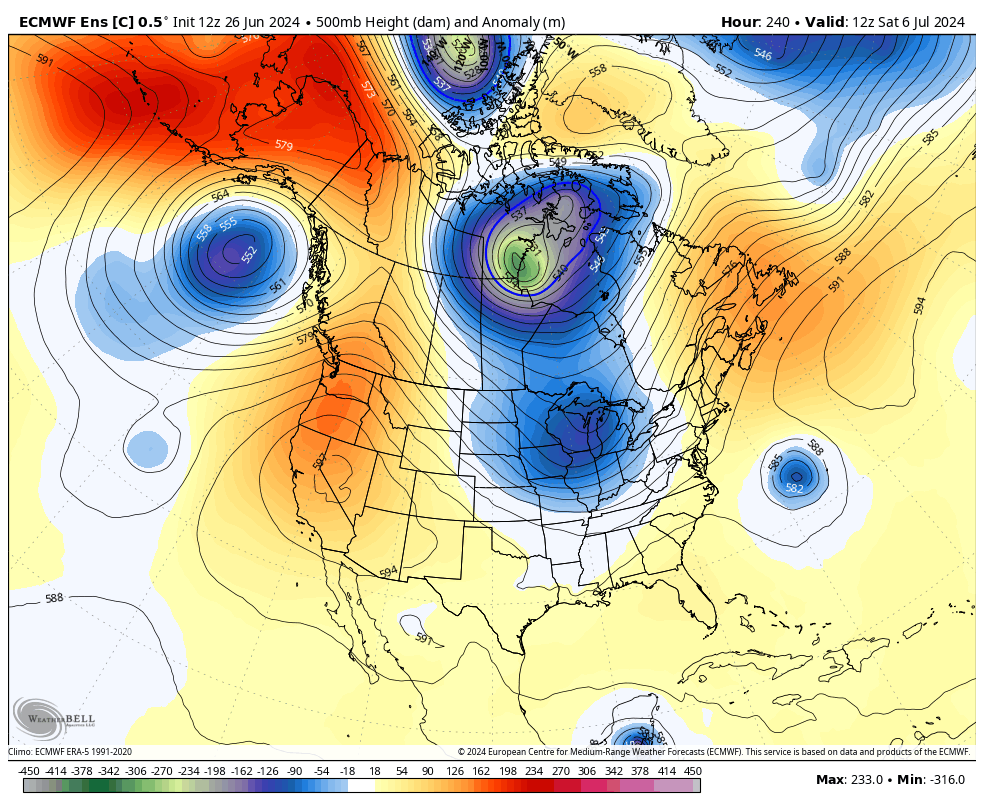
That’s not exactly what I envisioned for the first few weeks of July, but it’s interesting, nonetheless. You also see tropical systems showing up and the National Hurricane Center is highlighting two areas…

The EURO weeklies are also showing some signs of change as we go into July and early August. The 30 day 500mb average height anomaly from July 11 through August 10 shows the heat ridge continuing to set up farther to the west…
That setup would temper the heat around here and increase the threat for big boomers coming at us from the northwest.
Have a great Thursday and take care.

Not buying the models one bit.
My PWS located just south of Bowling Green reported that 1.37 inches of extremely welcome rain had fallen since 6:00pm CDT. I also recorded a peak wind gust of 36mph. I could almost imagine my crispy lawn breathing a sigh of relief.
I’ve been expecting tropical activity to trigger in the equatorial Atlantic, at that’s
…and that’s just what we’re seeing. Expect to see this area trigger some major hurricanes over the coming months.
We received over 1/2 inch here… just heavy rain… not much wind and I heard zero thunder… Better than nothing…
I’m always thankful for ANY clouds in the summer because my house has NO shade… even a partly cloudy day… where you have a few seconds of shade then sun… then shade then sun… makes a HUGE difference in the attic temp.. but straight on full sun beating down with no clouds and a super hot day… UGH
Only 0.25 ” of rain reported here in Maple. Very disappointing.
Thanks Chris. Even though my area didn’t receive the beneficial rains, the temperatures in the extended are not that uncomfortable.
Enjoy the day everyone !
I have hit the rain jackpot over the last two days.
Also yesterday came with a bonus a spectacular rainbow after the rain ended.
During last Saturday night’s severe weather that hit the Chicago Metro Area, four EF-0 tornadoes were confirmed in the Western Suburbs of Chicago between 10:30 PM-11:15 PM, with winds estimated between 70-80 MPH. Here is the link to the summary of the severe weather that night: https://weather.gov/lot/2024_06_22_SevereWeather
Since Saturday night, beneficial rains of between 1.5 – 3 inches have fallen across the Metro area.
Mike, looks like your area is the big winner in the rainfall department. It just shows me that La Nina is already influencing our climate. It will be interesting in the way of Snowfall this Winter, as La Nina can be a real Snow maker in that part of the country. Thanks for sharing the data on the recent storms in your area.
I recorded .81 at my house and my garden is happy this morning.
Glad to see you back posting Dottie. The good soaking rains is ” liquid gold ” to both the lawn and garden.
Crazy… Before the rain yesterday evening…. the yards were just awful looking… this morning I can already see green… it’s amazing how fast that happens
Barely a drop of rain yesterday in Carter County, quite disappointing!