Good Friday to one and all. We’ve made it to the end of the week with the weekend looking rather steamy and, sometimes, stormy. Behind this comes one heck of a blast of cool air for the first day of July on Monday.
Let’s begin with today and roll ahead.
Highs are 85-90 in the eastern half of the state with low 90s in the west. Humidity levels come up with the west feeling 100 or so from time to time. There’s also the chance for a late day isolated shower or storm going up.
Here are your radars for the day…

The humidity surges even more for Saturday and that makes us super steamy. We will also see rounds of showers and storms going up and some of these may be strong or severe. The Storm Prediction Center has a low-end risk for severe weather…

Scattered storms will be around early on Sunday as the front slides in from northwest to southeast late in the day. The air behind this is really cool with 50s for lows a likelihood for the first morning of July on Monday. Both the GFS and NAM are even showing upper 40s in a few spots…

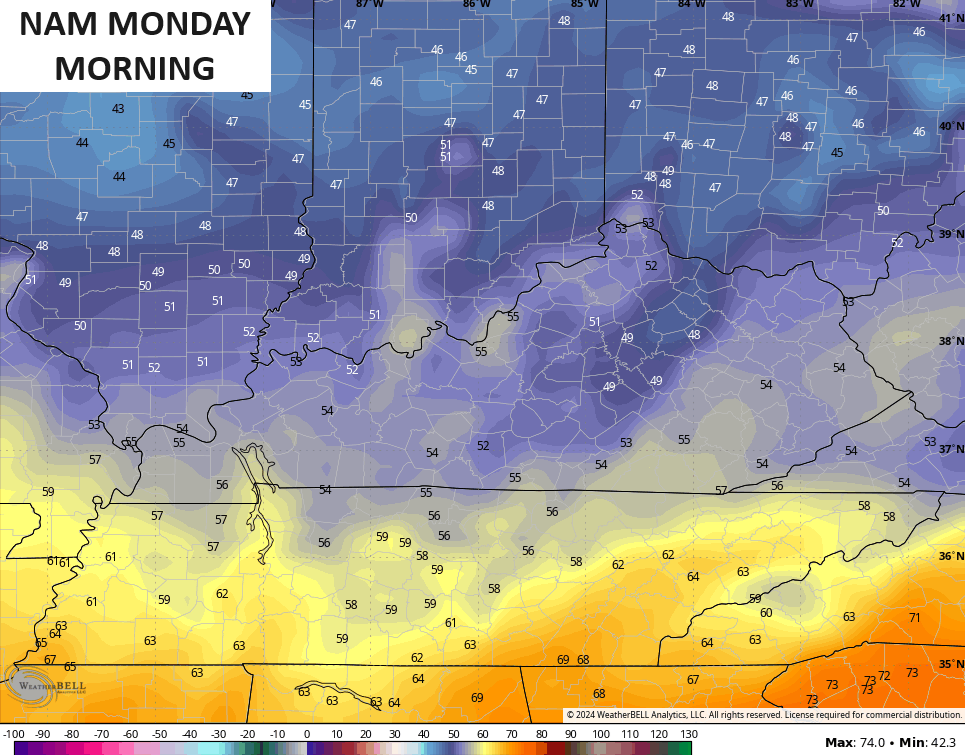
I’m not ready to bite on 40s as those would be in record low territory, but it is still impressive to see a model spitting out 40s in July.
Highs on Monday may not even make it to 80 in parts of eastern Kentucky. Low humidity and lots of sun will have many folks thinking it’s mid-September. Bring on football!
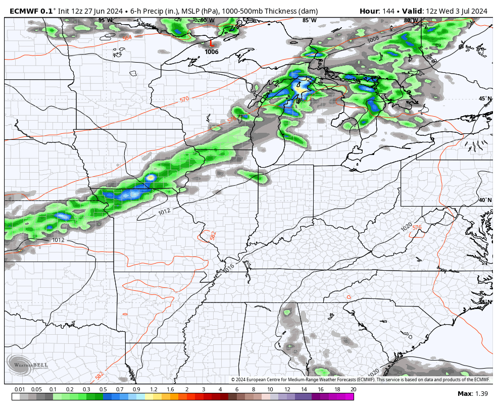
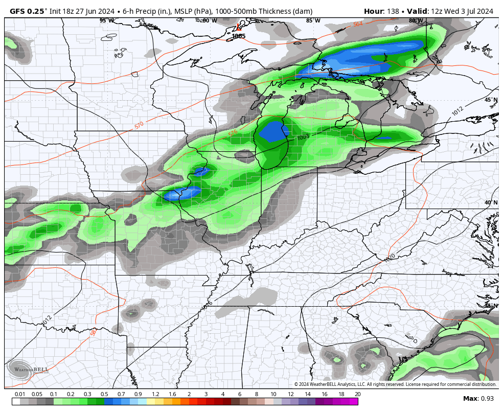
Temps will bounce back up late Tuesday and Wednesday ahead of more showers and storms working in here later Wednesday and into the 4th of July on Thursday. That will then be followed up by another cold front with showers and storms a few days later.
The EURO and GFS are in agreement with this scenario…
EURO
GFS
Both models are seeing that deepening trough the EURO first started to show a few days ago. Here’s the EURO during this time…
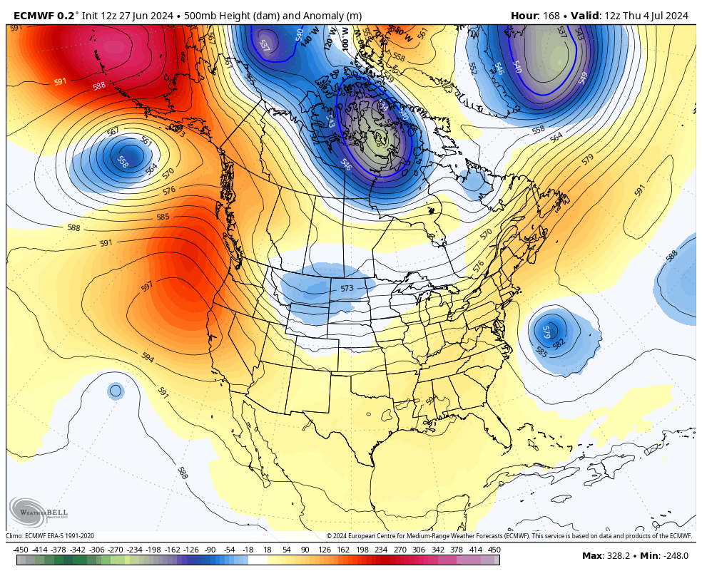
The control run of the EURO Ensembles brings that deep trough all the way in here during the second week of July…
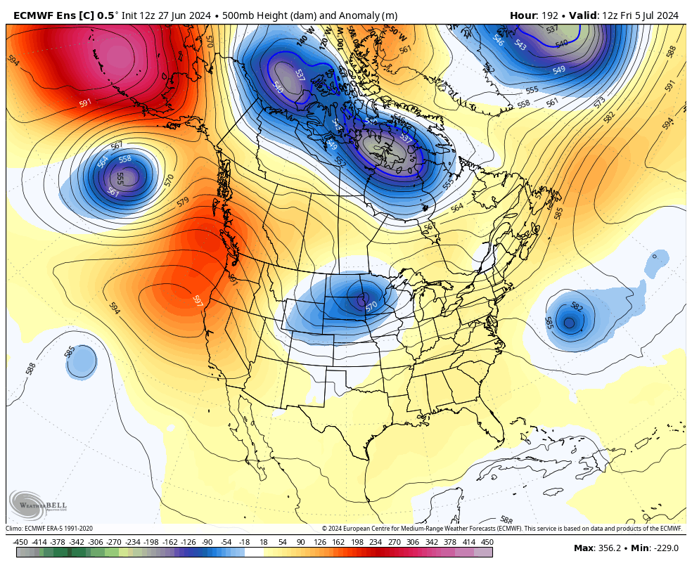
That’s impressive, folks.
Let’s go to the tropics where we have two systems cooking. One may become a named system very soon…

The sat shot shows one impressive look with the system in the Atlantic…

The hurricane models show this going into the Caribbean…

The GFS Ensembles are similar…

Have a fantastic Friday and take care.

The EURO isn’t happening. 🙂
Thanks Chris. Look forward to maybe cooler days and nights ahead, and an end to the ” pocket drought ” in my area. And YES, bring on the Football games.
Tropics look down right scary.
Enjoy the day everyone !
Only 64 days until KY football. I’m looking forward to it, and cooler weather too.
Hopefully, we will have a great Football season.
12 years ago today began a four day stretch of 100 degree plus temperatures (actual, not heat index!) in Bowling Green, with the highest reached on June 29th of 110°F. It was a stretch of heat that I’ll never forget!
Last time I experience temperatures that high was back in the late 1980’s
Thursday’s high temperature of 74 degrees at O’Hare Airport and the NWS Forecast Office in the SW Suburbs broke a string of 15 days in a row of 80+ degree temps in the Metro Area, with eight of those days in the 90s.
More rain is falling here this afternoon… nothing heavy, just a widespread light to occasionally moderate rain.
Mike, temperatures are not that bad here, but my area really needs a couple of weeks of rainy weather to bring up the deposit. Non – irrigated crops are really suffering in my area. Other areas of the state have had plenty of rain. Western Kentucky for example. La Nina is not good for Kentucky.
I don’t mind the heat as long we get a cool spell in between,. Have a great weekend!
Up and down ain’t bad.
Your not in a drought, like we are here.
Your right Schroeder were not hurting for moisture here, We had good timely rainfall here as matter of fact i think we’re above average as far rainfall for the year.