Good Saturday, folks. We have a very toasty day out there as some strong storms flare up ahead of a potent cold front. This front sweeps in with a blast of September air coming in behind it to kick off the month of July.
As always, we kick things off with what’s happening out there today. Highs range from the upper 80s to low 90s for many areas with a few spots a bit above those digits. Humidity levels are sky high, making it feel the part of mid and upper 90s for many.
Scattered showers and storms go up through the day and a few of those may be strong or severe, especially this afternoon and evening. The Storm Prediction Center continues with a low-end threat for severe storms today…

Damaging wind is the main threat.
The cold front itself won’t move through until Sunday afternoon and this may fire off a broken line of storms along and ahead of it with the best threat being across the southern half of the state and into eastern Kentucky.
This is where we have another low-end severe weather threat for Sunday…

Much cooler and drier air sweeps in behind this front for Monday, giving us one of the coolest July days you’re ever going to get around here without clouds and rain. Lows Monday morning will drop into the low and middle 50s for many with the chance for a few upper 40s to show up in the coldest valleys…
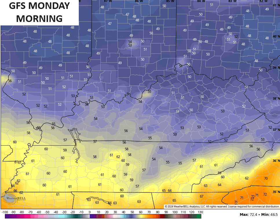
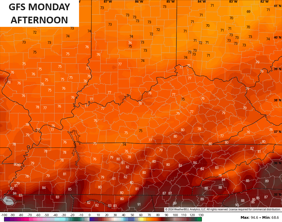
Highs Monday have a real chance to stay in the 70s for a lot of the region…
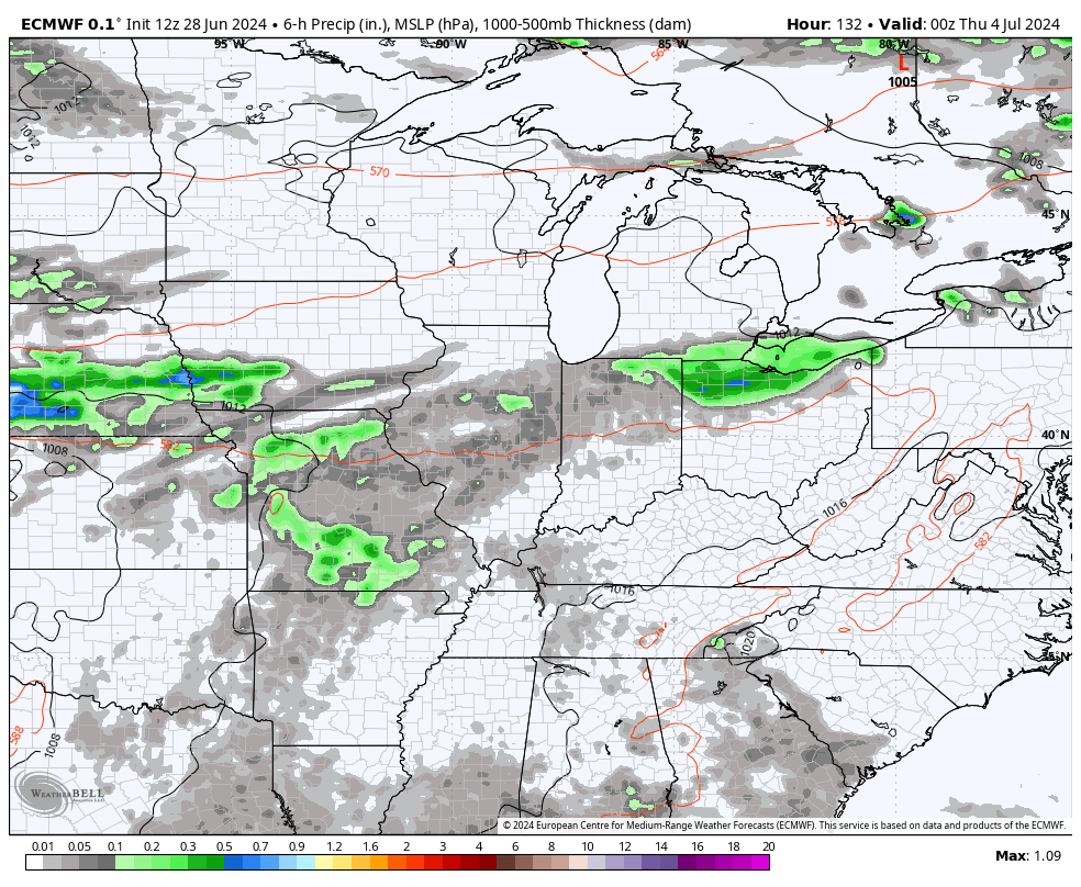
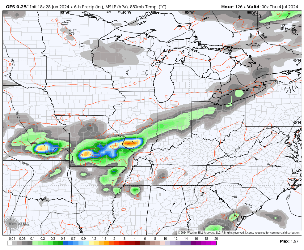
After another start in the 50s for Tuesday, highs head back into the mid and upper 80s by Tuesday afternoon as our southwest flow returns. This flow boosts temps back into the upper 80s and low 90s for Wednesday with a few storms going up. From there, rounds of showers and storms will be possible for the 4th of July and into the rest of the holiday weekend.
The models are in decent agreement on this…
EURO
GFS
CANADIAN
We now have Tropical Storm Beryl in the Atlantic and this is expected to become a hurricane over the next few days as it crosses into the Caribbean…

Here’s what that system looks like on Satellite…

The GFS Ensembles have a few members getting into the Gulf of Mexico…

The National Hurricane Center is tracking two more systems that may develop over the next week…

I leave you with your Saturday storm trackers…


Current watches

Possible Watch Areas

Have a sensational Saturday and take care.

I might end up working the 4th, so let it rain. 😉
I can’t believe it’s 430 am and still 81 at KLEX…. and one of the mesonets is 80….
76 currently in Richmond
A broken line of rain along & ahead of the front means that many areas are going to miss out on the rain.
You would think with all the humidity in the air it would not take much instability to trigger a downpour.
Rain only occurs when the warm air is rising against the cold air aloft. Scattered showers form in only those areas of the high pressure.
Thanks Chris. One can really feel the atmosphere pressing down on us this morning. Thanks to La Nina amplifying the Bermunda High. This is also weakening storm systems as they move southeast out of the Midwest. A good thing, but a bad thing that only scattered showers for some areas of the state. It seems we can’t receive a good soaking all day rain anymore.
Tropics are beginning to flare up. Just hope No area receives a Major Hurricane this season, and the storms that do form remain just tropical. I can’t remember when we had a tropical storm come our way, bringing widespread soaking rains.
Enjoy the day everyone !
We do receive all day rains… just NOT usually in the summer… Summer is more like quick hitting rains or a couple of hours of thunderstorms…give or take…with random flooding here and there… of course there are always exceptions… tropical remnants.. etc
I’ve yet to understand the bermuda High weakening systems as they come toward us from the midwest… Yet, at the same time storms clusters happening in coastal south carolina (closer to the bermuda high… I don’t get it
Mark, We can have weak areas within the high pressure, where the warm air is rising, thus rainfall occurs, but it’s not widespread. The north Midwest ( on the edge of the high ) has been receiving the severe weather and plenty of rain. They are in the weakest part of the high pressure ridge. It’s like this every time we have La Nina in place. If El Nino was in place, plus a positive Pacific Decadal Oscillation the Bermuda High would not be as dominate.
Trying really hard to NOT become concerned about my panhandle beach trip scheduled the 7th-12th!!
Very muggy Saturday morning, temps already mud 80’s not going to be a pleasant day to do chores outside.
The current temperature here in Maple is 88 degrees, with a dew point of 73 degrees. Very muggy, but there’s a breeze. I’ve experience worse conditions when I had my nursery in Indiana. The Fourth of July, 1976 the high temperature was 105 degrees. My help and I worked that day in the Sun, but took a lot of water breaks.
Got up to 93° in Richmond today, which is ten degrees above average for June 29, yet it gets downplayed. The upcoming cooler spell is being overblown by comparison. Highs in the upper 70s are hardly a big deal.