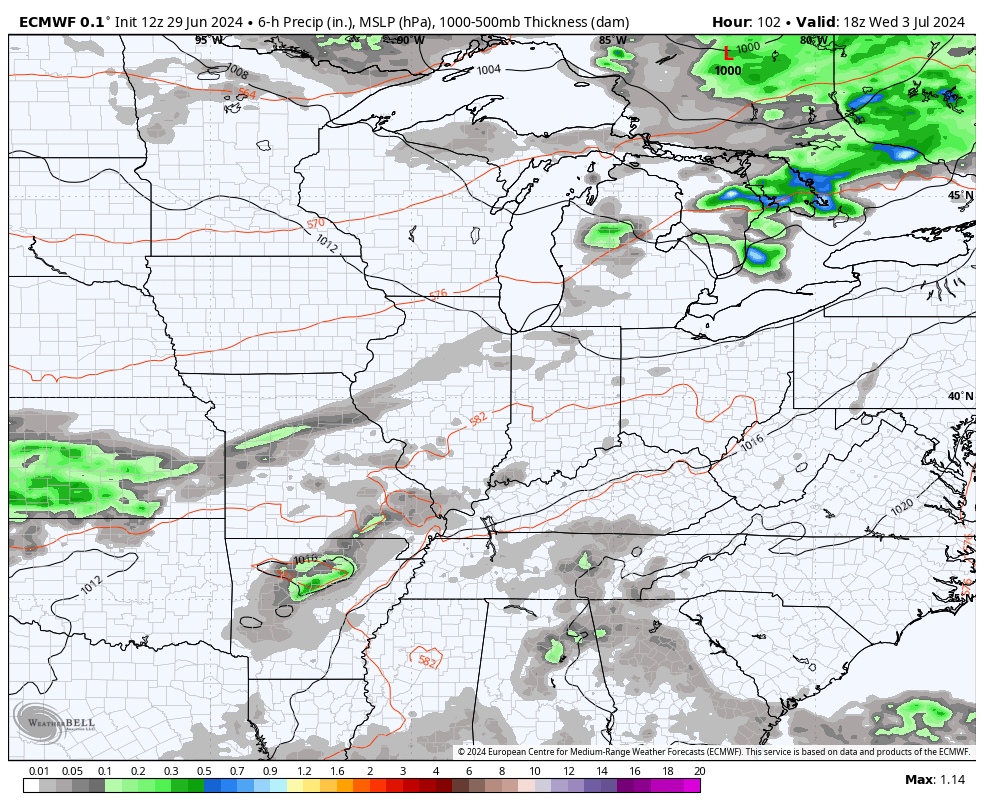
Good Sunday, folks. It’s the final day of June and we have a major cold front sweeping through the region. This is bringing a few more storms ahead of it but the focus of the forecast is on the blast of September air coming in behind it to start July.
Temps ahead of the front reach 85-90 across the southern half of the state today with temps spiking then falling into the low 80s late in the north. The boundary will touch off another broken line or two of thunderstorms and a few of those may be strong or locally severe.
Once again, the Storm Prediction Center has a low-end risk for severe storms in southeastern Kentucky…

Just like yesterday, any storm that’s out there can put down enough torrential rain to cause local high-water issues.
The cooler, drier wind kicks in from the north this evening and really settles in for one of the coolest starts to July you will ever find around here. We have some Barney colors blowing in to illustrate just how far below normal the numbers are from this evening through Tuesday morning…
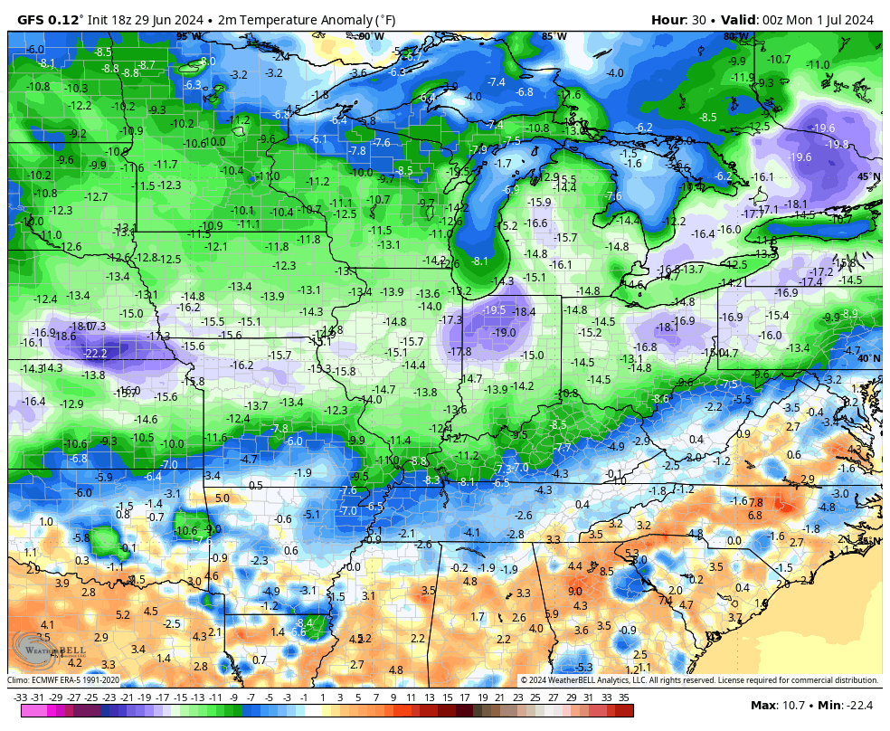
Lows by Monday morning will likely reach the low and mid 50s to start July. There’s the chance for a few upper 40s to show up in the colder valleys…
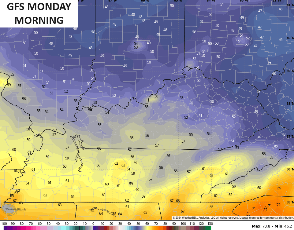
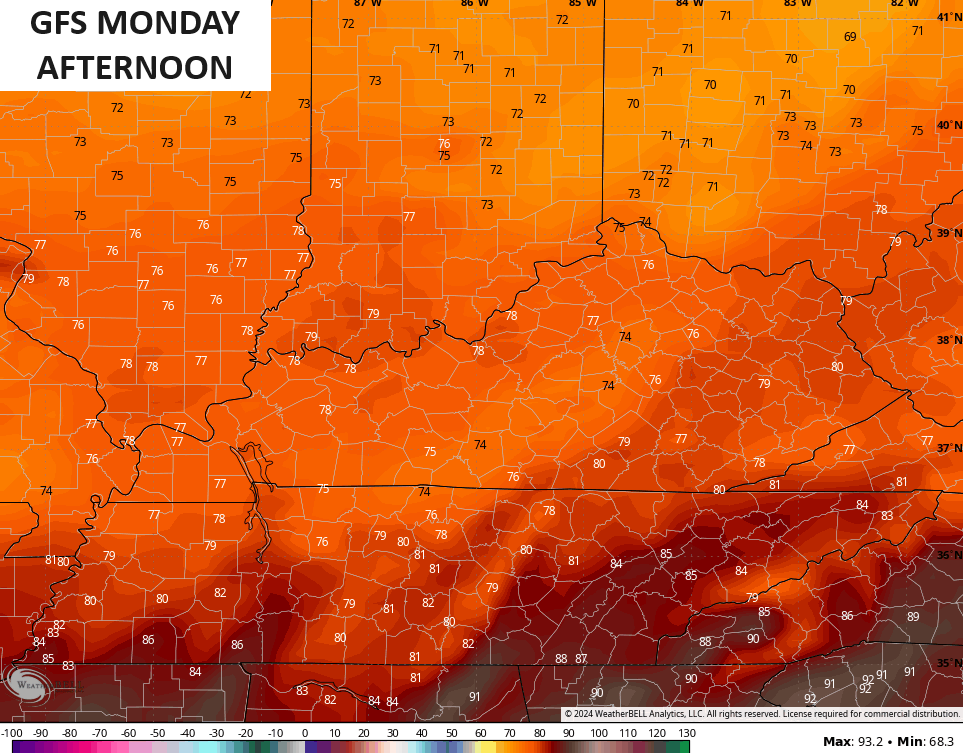
Monday’s high temps may very well stay in the 70s for most of the region…
That sets the stage for another morning in the 50s to start the 2nd day of the month…
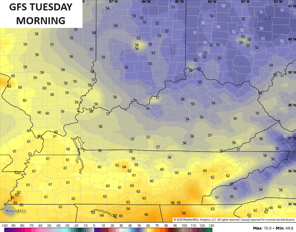
Temps rebound very quickly by Tuesday afternoon and turn downright steamy again by Wednesday. That’s when the numbers are back into the low 90s for some. Humidity levels come up as scattered storms fire back up. Those storms are the beginning of a rather stormy setup taking shape for the 4th of July and through much of the holiday weekend.
That will be followed up by another fairly strong cold front…
We will need to watch this setup from Thursday into the weekend as it can produce areas of flash flooding with local severe storms possible.
All of this happens as a deep trough drops into the region from the northwest…
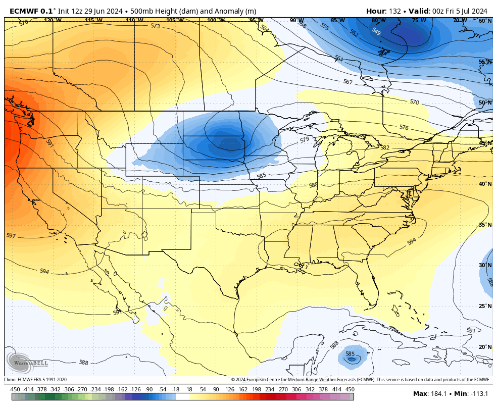
That’s another below normal temperature setup from the holiday weekend into the start of the second week of July.
Overall, this July may not turn out as hot as I originally thought but I think I’m good with above normal rain and storms. As we know all to well, this is our flash flood season here in Kentucky and this season may be pretty active.
We have our first Hurricane of the season as Beryl has formed in the Atlantic as it churns into the Caribbean. This is forecast to become a major hurricane later tonight or Monday…

Beryl will be only the 3rd major hurricane on record before the 4th of July, joining Audrey from 1957 and Alma in 1966.
The GFS Ensembles and Hurricane Models are pretty much in lock step with one another as this system toward the Yucatan Peninsula and Central America…


A look at the satellite shows the beast that is Beryl and two other systems of interest…

The one behind Beryl will become Chris very soon…

I leave you with your Sunday storm trackers…


Current watches

Possible Watch Areas

Have a sensational Sunday and take care.

July will be hotter than we think. The models lie.
Not a bad forecast. A mix of heat,comfort & rain.
Although a possible wildcard could be Beryl if it makes a curl and heads toward the states.
Thanks Chris. Some scattered showers just to my south this morning. Looks like another day of zero precipitation for my area. This was the driest month I’ve ever experience, might as well store the lawn mowers away for the season.
With the increase activity in the Tropics, that will only take away our chances for good soaking rains in the coming days, but there’s always that chance of a late afternoon and evening thundershower.
I kind of wonder if we will ever see ENSO / El Nino operating in a positive PDO anymore ? Or is La Nina the permanent ENSO fixture in our climate ?
Make it a peaceful and restful Sunday everyone.
In patterns like this, everyone endures the heat while only a few get beneficial rain, and even fewer get rain at anything like regular intervals. To echo Schroeder’s comment, the sound of commercial mowers in the neighborhood has all but ceased.
I am bullish that we will have a decent weather week.
The rain chances look decent for Thursday & Friday.
Only two days are forecasted to be in the nineties.
My fingers are crossed.
We are VERY fortunate to have received 0.85 inches of rain over the past hour from a t-storm moving through central Warren County. The cooler temps this morning are a welcome relief from yesterday’s heat. At 5:55pm CDT, my PWS just south of Bowling Green recorded a high temperature of 95.5°F, which combined with a dewpoint of 81.3°F gave us a heat index of 118.3°F!