Good Wednesday to one and all. Our long 4th of July holiday period is kicking off with very steamy temps out there today. The steam will help fuel some late day strong and severe storms with rounds of storms likely through the 4th and the 5th.
My main concern with the storms of the next few day is the torrential rain threat. Flash flooding issues may develop and that’s something we will need to keep a very close eye on.
Much of the day today is dry with highs reaching the upper 80s to middle 90s. High humidity levels will make it feel 100 or a little better across the western half of the state.
Thunderstorms start to develop this afternoon and evening along and north of the Ohio River before settling into the region. Some of these storms may be strong or severe and the Storm Prediction Center has much of the region in the Marginal Risk to Slight Risk for severe storms today…

This risk for areas of wind damage continues into the 4th of July. Here’s the Independence Day Severe Weather Outlook from the Storm Prediction Center…

I mentioned the threat for torrential rains and how that’s my biggest worry over the next few days. The setup is there for storms to produce pockets of flash flooding and some of the models are seeing the potential.
The WRF is showing some areas of hefty rainfall numbers…
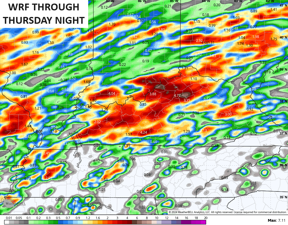
Watch the flash flood threat, folks!
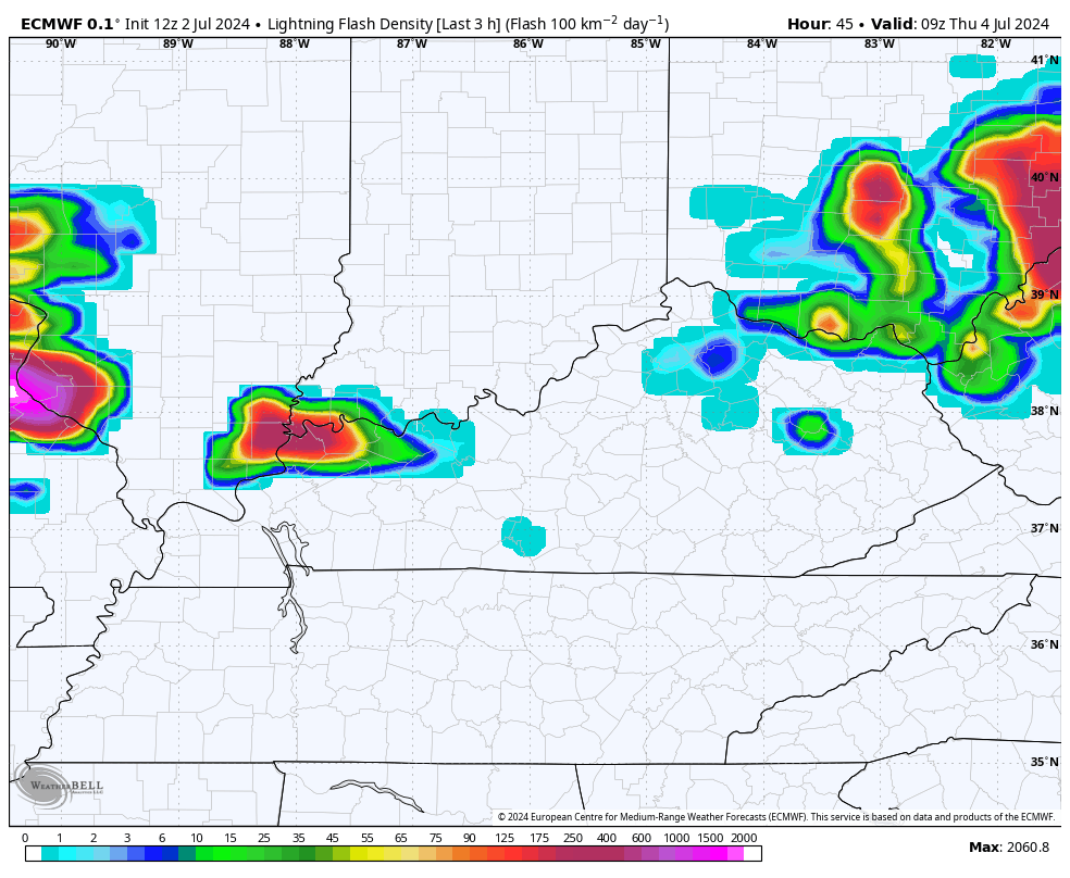
These storms will be LOL (Lots Of Lightning) storms, as well. Check out the lightning density forecast from the EURO from late tonight through Friday…
Saturday and Sunday continue to look good before more storms rumble in with a few systems sweeping in next week…
Hurricane Beryl continues to be a beast, but it is weakening some as it hits Jamacia today. The track then goes toward the Yucatan before getting into the southern Gulf of Mexico with a possible Texas impact by Sunday. Here’s the current forecast from the National Hurricane Center…
Here’s what our storm looks like on satellite…

More of the Hurricane Models are trending toward Texas later in the weekend…

The GFS Ensembles continue to be the farthest north with several members bringing the remnants all the way into Kentucky…

A few of the EURO Ensembles members try to turn this a bit farther north as well…

As usual, I leave you guys with all the storm tracking tools you need for the day…


Current watches

Possible Watch Areas

Have a great Wednesday and take care.

The heat is definitely on for Warren County. At 6:05pm yesterday, my PWS just south of Bowling Green hit a high temperature of 95°F, but the dew point (78°F) and heat index (110°F) continue to track crazy high. Today all of South Central Kentucky is under a Heat Advisory, which calls for heat index readings to top 109°F.