Good Friday to one and all. We’ve made it to the end of the week and ready to roll into a toasty weekend. As temps climb, we will be looking for some relief and it looks to show up in the form of a cold front later next week.
Our short term forecast deals with temps in the upper 80s and low 90s out there today. Skies are mainly dry but there’s the chance for isolated showers and storms going up. Here are your Friday radars…

Highs are into the low 90s over the weekend with a shower or storm going up. There’s an outside chance for a cluster of storms to dive in from the northwest at some point and I’ll be watching for this possibility.
The threat for showers and storms will increase Tuesday before kicking into high gear Wednesday into Thursday as a strong cold front drops in from the north and northwest. The EURO takes this front all the way through the region before trying to develop low pressure along it to our southeast…
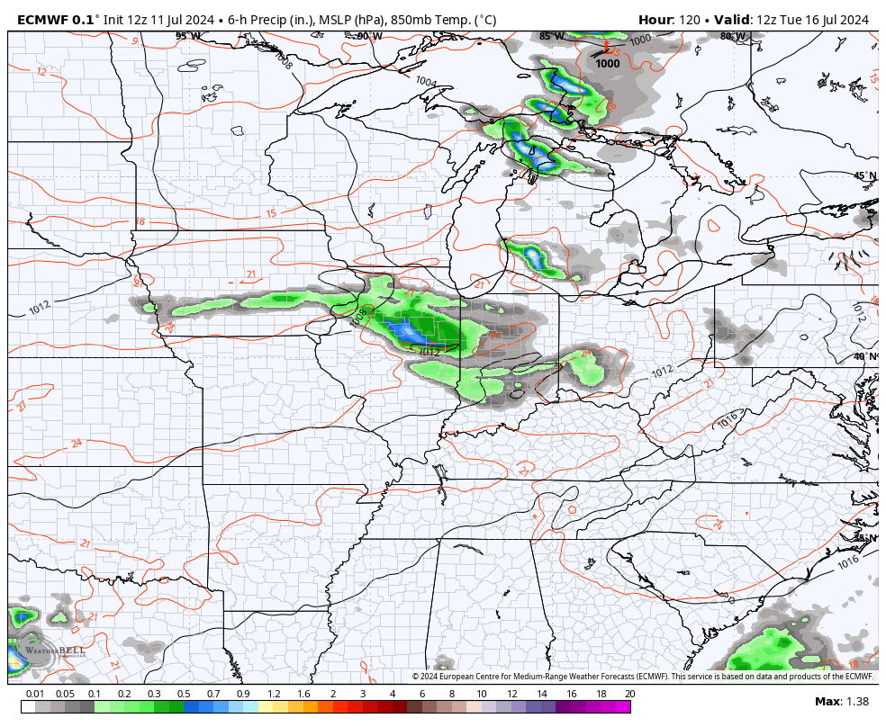
The GFS stalls this front on top of us and keeps the the threat for showers and storms rolling through next weekend…
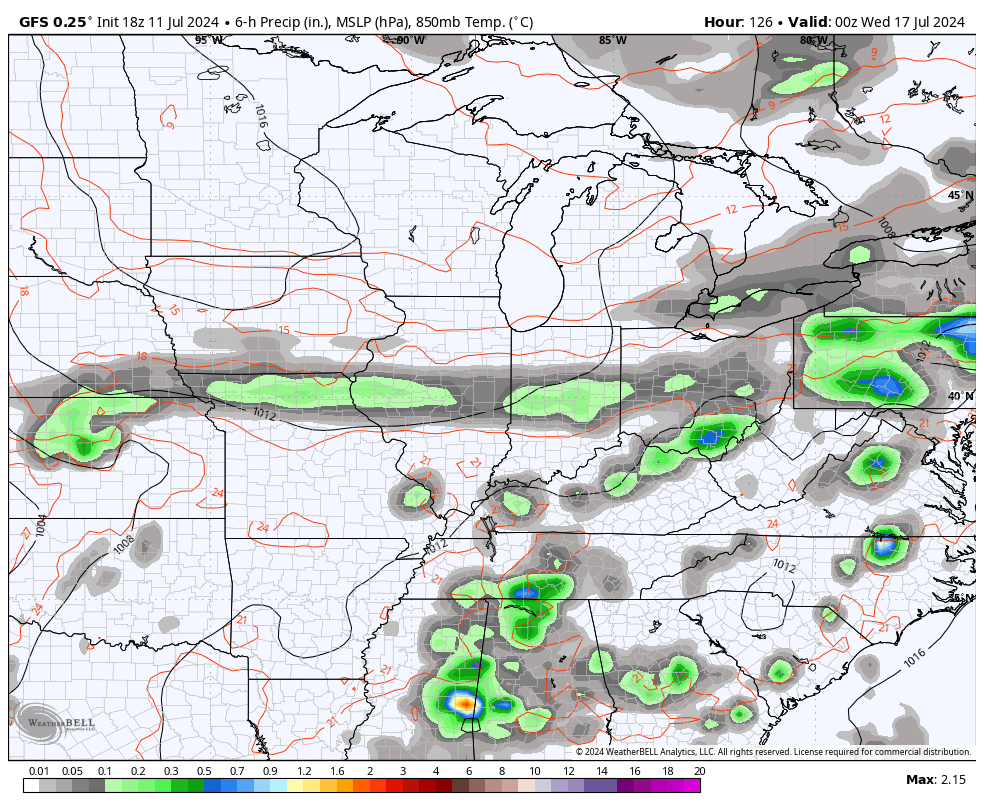
Either way, temps come way down during this time.
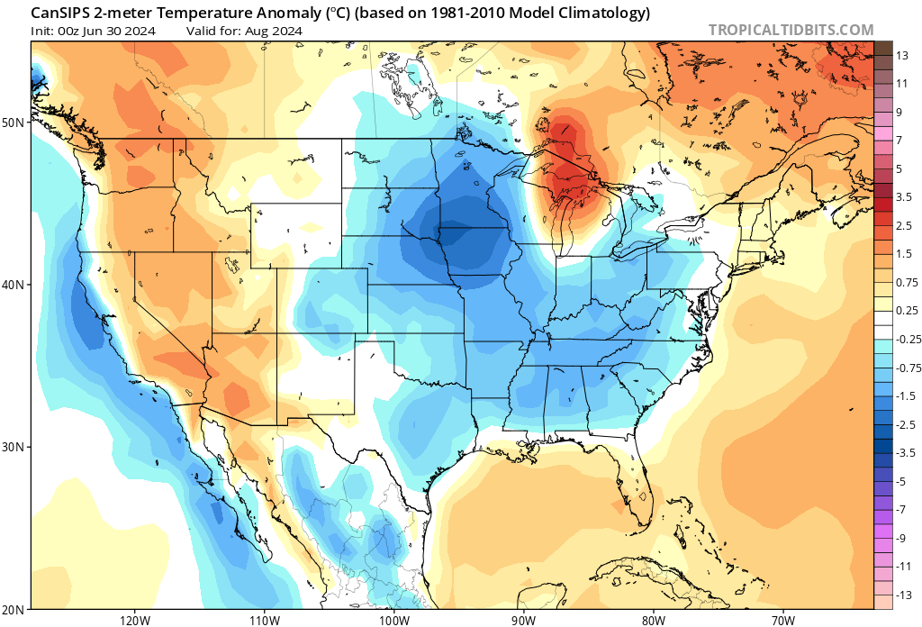
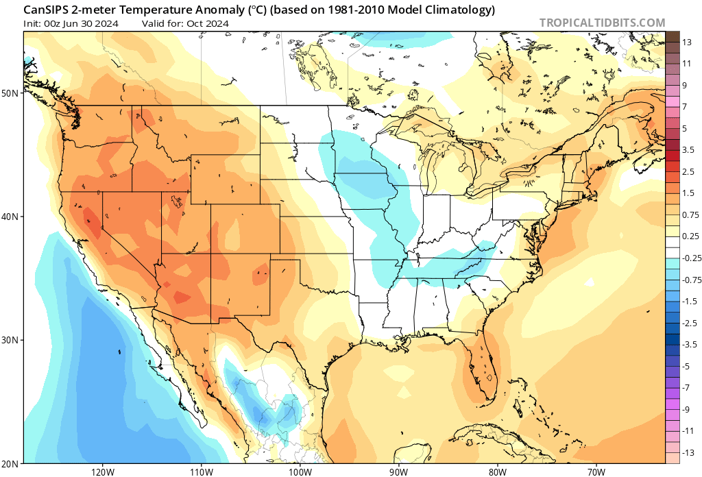
The new Canadian seasonal forecast model known as the CanSIPS is out and is showing cooler than normal temps for much of the country into August…
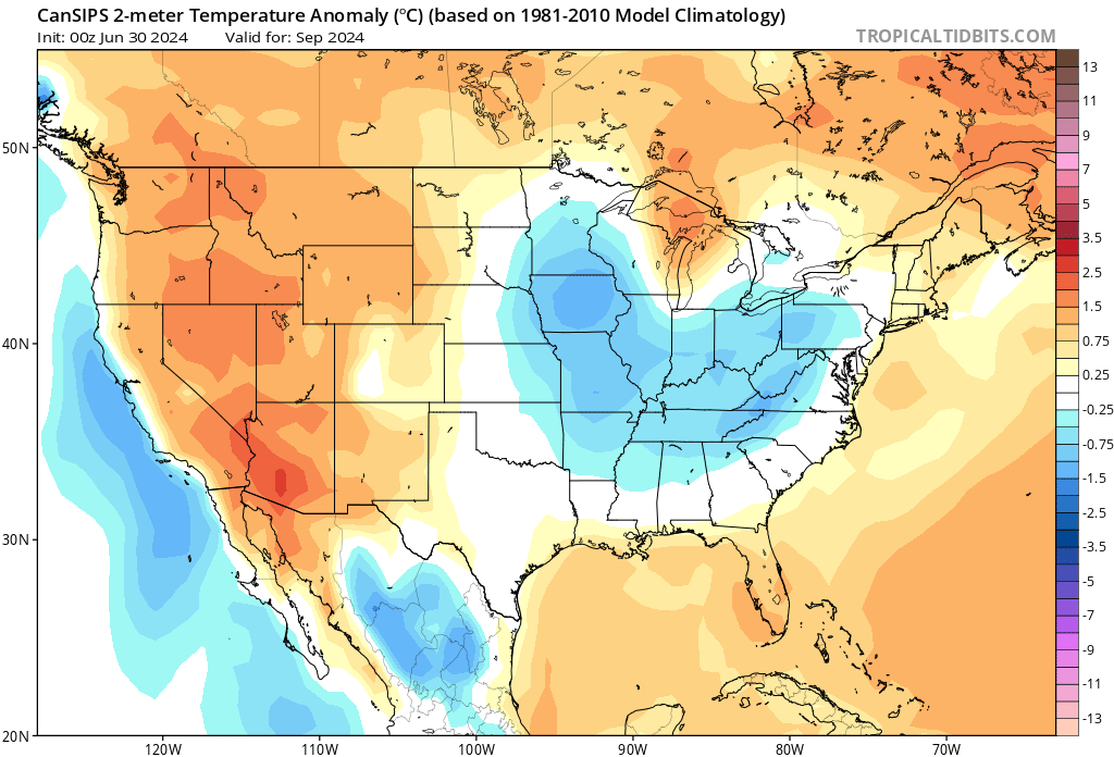
It keeps us in the cooler than normal bullseye for September…
That pocket of cool continues to shrink into October…
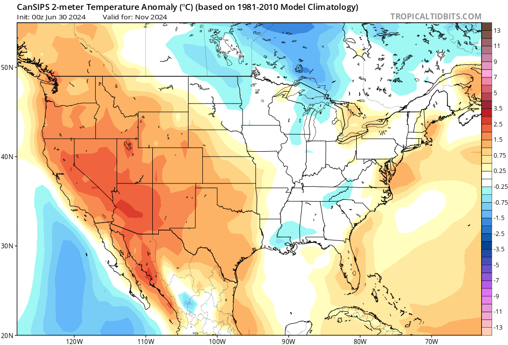
November keeps us closer to normal, but you can see hints of really cold air building across southern Canada…
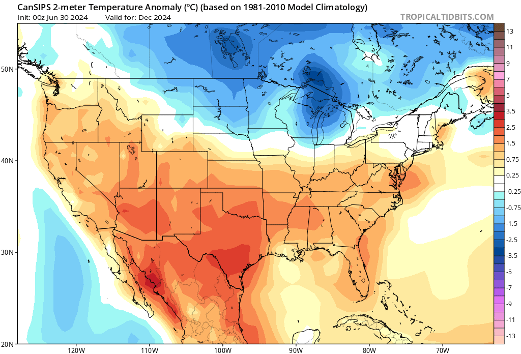
That cold builds and spreads out for December as the model puts us on the northern edge of southern warmth…
By January, the cold grows in the north and presses a bit farther south…
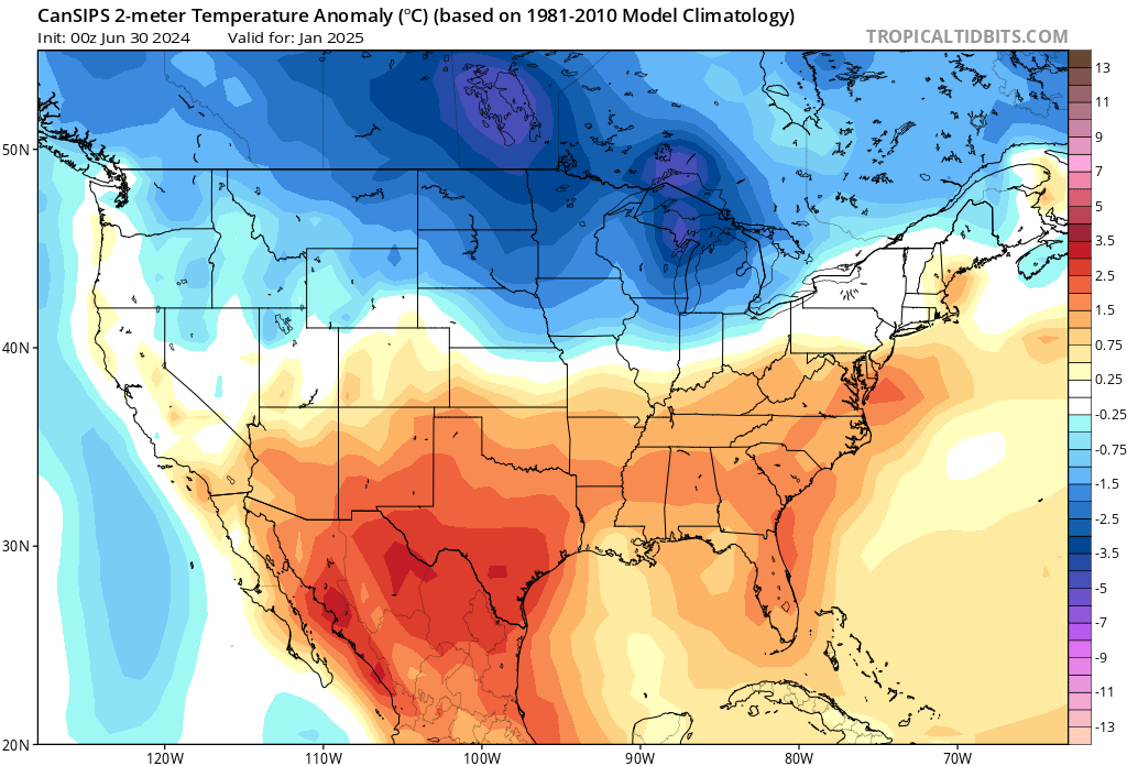
If you check out the departure scale on the right hand side, you can clearly see how our numbers are under a degree above normal. Verbatim, the December and January maps would mean some west to east moving storm systems rolling across our region. Of course, it’s only July so it’s just fun to look at from this far out.
Enjoy the day and take care.

August and September won’t be too cool.
A little cell popped up last night and dropped .28” in our sector of Fayette County. This morning the plants look as though they’ve been aroused from their stupor. Thankful.
My side only got .02. Hoping things change next week.