Good Saturday, everyone and welcome to the weekend. It’s a hot one across the Commonwealth as some summer sizzle takes control for a few days. If you’re already tired of it, I have some great news as a blast of cooler than normal air is on the way into the week ahead.
Highs today are mainly 90-95 in most areas with humidity levels coming up just a bit. That will give us the chance for some scattered showers and storms going up, similar to what’s happened over the past few days.
Any storm that goes up can put down some hefty rain totals on the local scale.
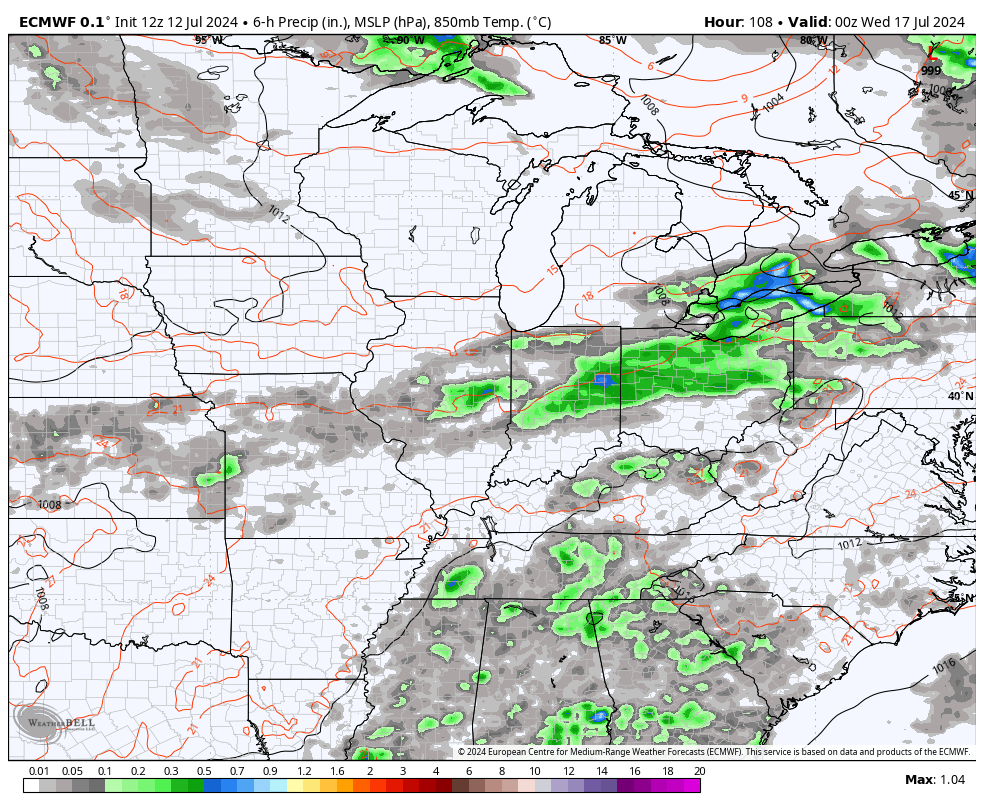
Here are your radars to follow along…

Sunday’s temps are similar to today and I’m going to watch to see if a cluster of storms develops to our north and northwest. This has the chance to drop into parts of Kentucky later in the afternoon and evening.
Monday sees more of the same before we see those big time changes rolling in. A few storms will be noted on Tuesday as we watch a front dropping in from the north and northwest. This front settles in with a good shot of showers and storms for Wednesday and early Thursday. A few of the storms may be strong before the front pushes to our south…
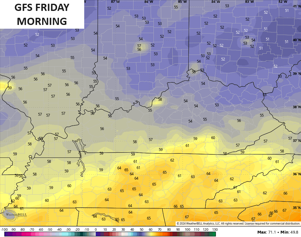
That ushers in temps that are well below normal from Thursday through next weekend…
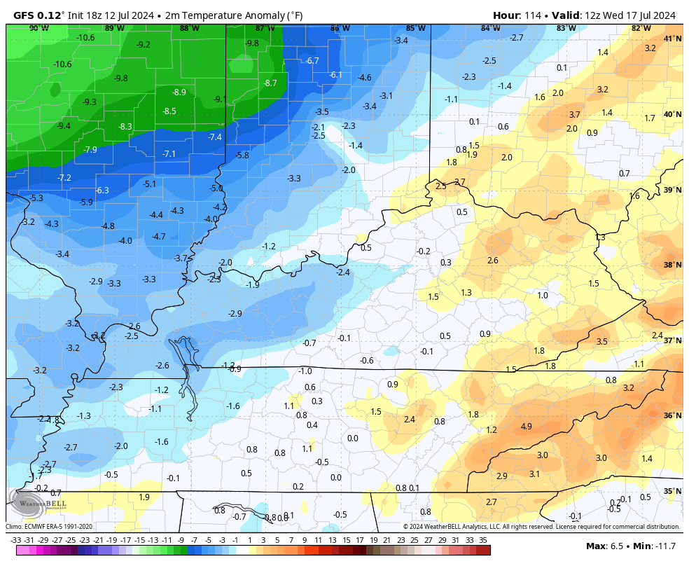
Highs in the upper 70s and low 80s will be noted for a few days with lows that can reach the 50s by Friday morning…
We will need to watch that front as it may develop a wave of low pressure along it to bring another chance of rain into parts of the region at some point next weekend.
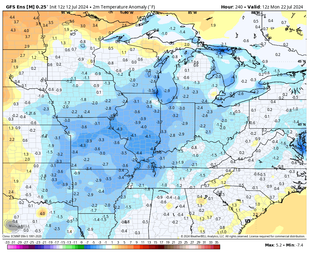
Looking farther down the road, the GFS Ensembles try to linger the below normal and normal temps around into the following week…
Make it a sensational Saturday and take care.

How come when it was ten degrees above normal recently was the heat downplayed? Upper 70s is not as below average, but gets called “well below normal”?
Too me today’s media over hype when we have hot spell, they advertise it act like it’s hasn’t been this hot before . Back in my growing up days we had extreme hot days like today it just part of nature.
Could be to raise awareness amongst people who may be susceptible to heat-related trauma, especially when those temperatures extend over several days. On the other hand, below normal temperatures during the height of Summer are a welcome relief.
Good point. Some medicines & health conditions make you extra-susceptible to high temps (especially high humidity when the body cant cool off as well), so maybe they want to make sure people are aware. Also, in past heat waves, the temps have remained very high overnight, so those without shelter or in homes with no air conditioner couldnt rely on falling nighttime temps to cool down, raising the threat of heat-related illness. That doesnt seem to be the case so much this summer, as thankfully, temps have been dropping when the sun goes down so there is some relief (at least in my region). I can remember some muggy nights over the past few years where the temps remained as high as uper 70’s or even low 80’s over night, which we arent seeing this year (so far).