Good Sunday to one and all. It’s another toasty day in the Bluegrass state as we get set for a big time pattern change. This comes in the form of a September cold front arriving by the middle of the week. This ushers in a below normal pattern that’s likely to hang around for a while. It should also bring us some needed rains.
Speaking of rain, there’s the chance for a few storms to crank once again today. I’m also watching the northwestern sky for a complex of storms that develops and attempts to cross into Kentucky out of Indiana and Ohio.
The future radar from the Hi Res NAM shows the greatest potential for this across central and eastern Kentucky. Notice how this weakens as it moves in…
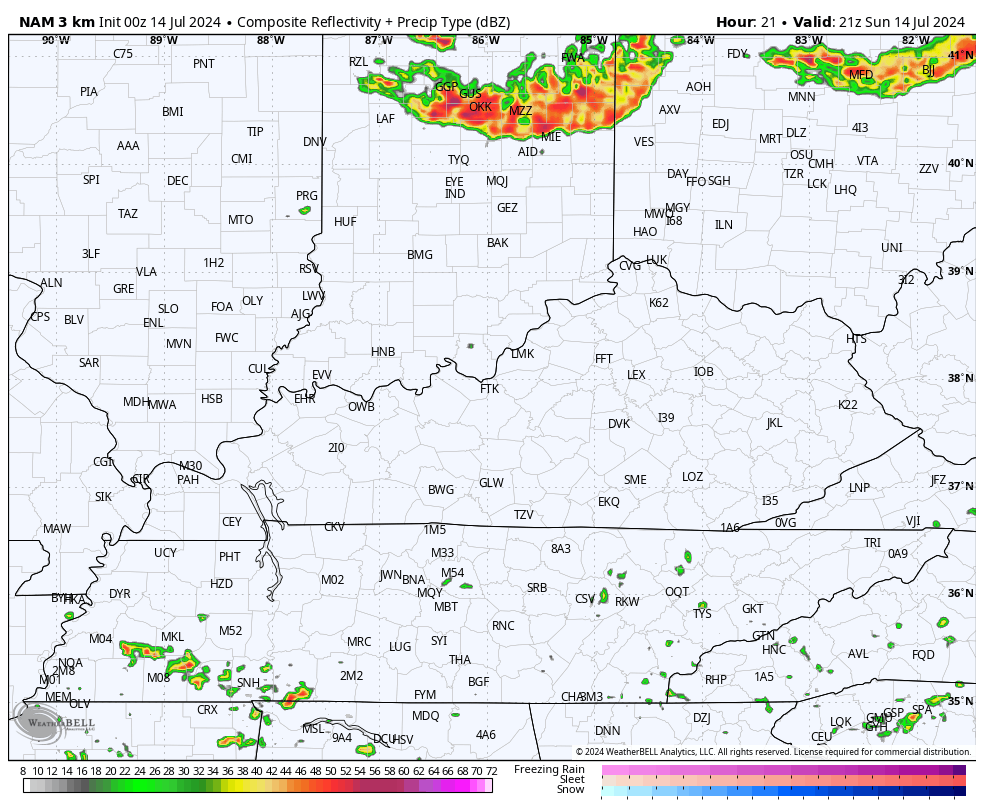
Here are your radars to follow along…

Outside of the storms, temps are back into the 90-95 degree range. We should reach those same numbers again on Monday with another chance for a storm or two.
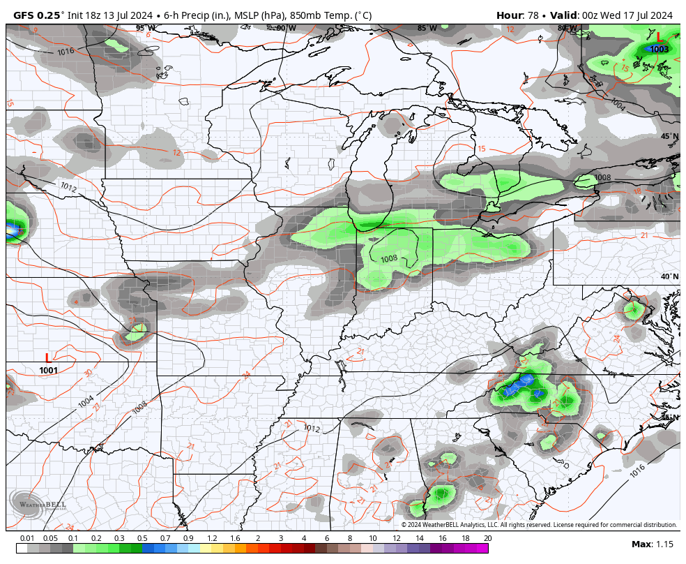
The chance for storms will increase a bit on Tuesday as we track a cold front toward the region from the north and northwest. This boundary slides in with what may be widespread showers and storms Wednesday through early Thursday. This front should slow-down just to our south and may very well stall close enough for a wave of low pressure to pop along it and bring another rain threat at some point next weekend.
The GFS has been hinting at this for a while…
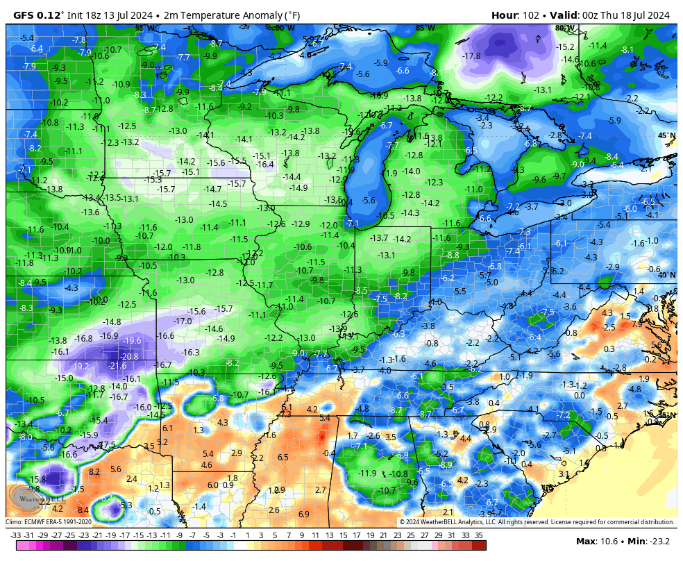
Temps behind this front are really cool for the second half of July. Highs may not get out of the 70s on a few days with lows reaching the 50s by Friday morning. Check out just how far the numbers are from Wednesday evening through next weekend…
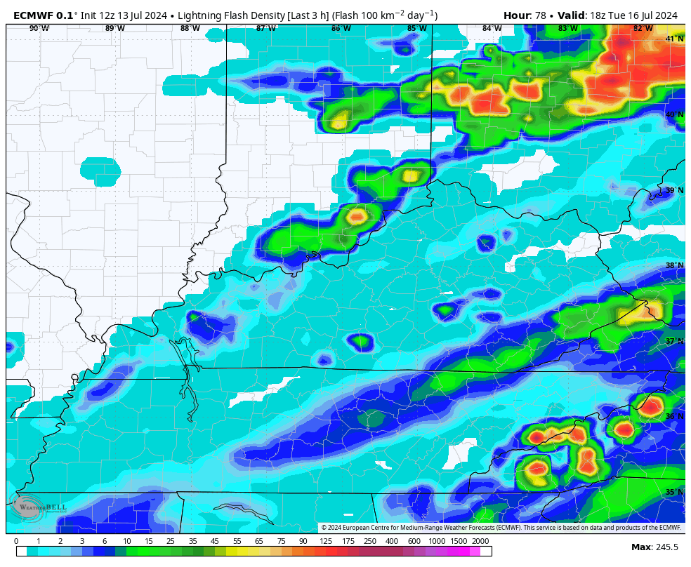
Back to the cold front. Can we get some strong or severe storms ahead of this bad boy? That’s a possibility and something I’ll be watching closely over the next few days. The EURO is showing a lot of lighting with the rounds of storms along and ahead of the front…
Looking into the following week, there’s the chance for another shot of below normal air pushing into our part of the world.
Enjoy your Sunday and take care.

These “cold” fronts are overrated.
Wow… Picture it: afternoon temps 95… Oppressive humidity…. a line of storms to the northwest… they move into an atmosphere that would seem to be loaded…. and yet…. *poof*…. they weaken….
Most of the time this happens when the temperature of the atmosphere at mid levels is the same as at the surface. It chokes off convection, because the rising air can’t condense.
So then why wouldn’t the storms in progress create “outflow boundaries”?
Mark, the boundary would provide shear, but it would ultimately run into the same, inability to trigger condensation problem. We had one do that in Bowling Green on Friday. It looked very promising, but all we ended up with was a nice breeze!
You were right…big bow-front echo headed this way (and it is showing a gust-front now out ahead of it)…it’s still together & about to cross the Ohio River & hit Charleston, WV. Huntington getting rocked now…
We been fortune as for moisture here in Union. Co. We’re above average and had a scare from remnants of Beryl toss a tornado near my house that did minimal damage. But just up north over Indiana it did quite of damage at Posey Co Indiana. Stay cool everyone