Good Monday, everyone. Hot temps are back in the Bluegrass state as we kick off the new week, but the trend is your friend. Rounds of showers and storms are on the way as a much cooler than normal pattern gets established across much of the country.
Temps today are back into the 90-95 degree range for many as we track some scattered storms going up. There’s likely another complex or two of strong to severe storms rolling across the Ohio Valley today and those may impact parts of Kentucky, especially the north.
The Storm Prediction Center brings the low-end risk for severe storms into this area later today into the evening…

A cold front inches closer to the region on Tuesday and brings a slightly better chance for some late day strong or severe storms. Here’s the Tuesday Severe Weather outlook from the Storm Prediction Center…

Rounds of showers and storms will be likely around here Wednesday into Wednesday night and there’s still the risk for a few strong to severe storms. Here’s the Wednesday Severe Weather Outlook from the Storm Prediction Center…

This action takes us into the first part of Thursday before the cold front finally slides to our south. This type of setup can also bring areas of torrential rains that can cause flash flooding in a few areas and the models are picking up on this potential. No, this doesn’t mean everyone gets in on a lot of rain. Sorry, folks.
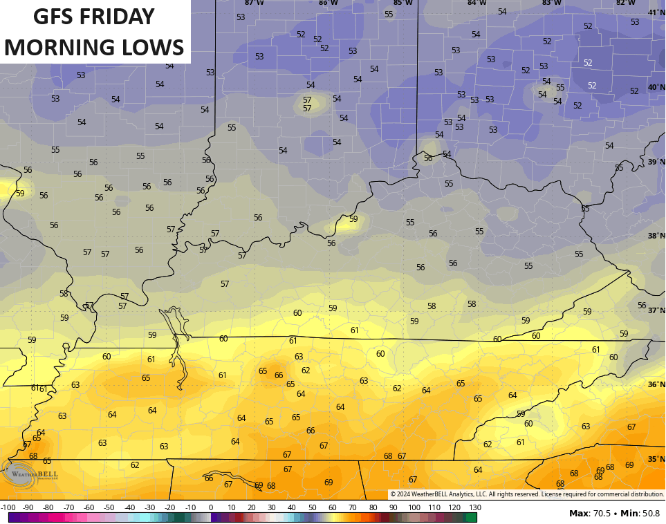
As mentioned, much below normal temps are likely through the weekend. Lows by Friday morning can drop into the 50s…
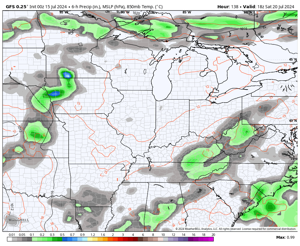
The front checks up just to our south with a wave of low pressure forming along it. That looks to bring more showers and storms in here over the weekend with an upper level system trying its best to turn us much wetter next week.
You can see this from the GFS that starts this Saturday and goes through the following week…
I leave you with your Monday storm trackers…


Current watches

Possible Watch Areas

Have a magnificent Monday and take care.

Low and mid 80s isn’t really “much” cooler than normal with averages of 86 or 87.
Over the weekend, several clusters of strong to severe thunderstorms went through Northern IL and the Chicago area, producing multiple Severe Thunderstorm Warnings and Flash Flood Warnings, along with reports of wind damage in some areas. O’Hare Airport received 3.24 inches of rain over the weekend, while the NWS Forecast Office in the SW Suburbs received 1.21 inches of rain Sunday.
Before a cluster of severe t-storms moved through the area Sunday night just after 10 PM, the dew point at the NWS Forecast Office was a beyond-oppressive 81 degrees, with an air temp of 82 and humidity at 94 percent.
This afternoon and evening, the entire Northern half of IL is in the Enhanced Risk of severe weather, with forecasters warning of a possible derecho developing with winds of 75+ MPH, along with the possibility of tornadoes. A Heat Advisory is also in effect for the area today, with heat index readings possibly exceeding 105 degrees.
I just want cooler weather.