Good Wednesday to one and all. We continue to track a strong cold front across the region as it brings along a big blast of September air behind it. The front is also pretty active with showers and storms showing up along and ahead of it, bringing a high water threat to some
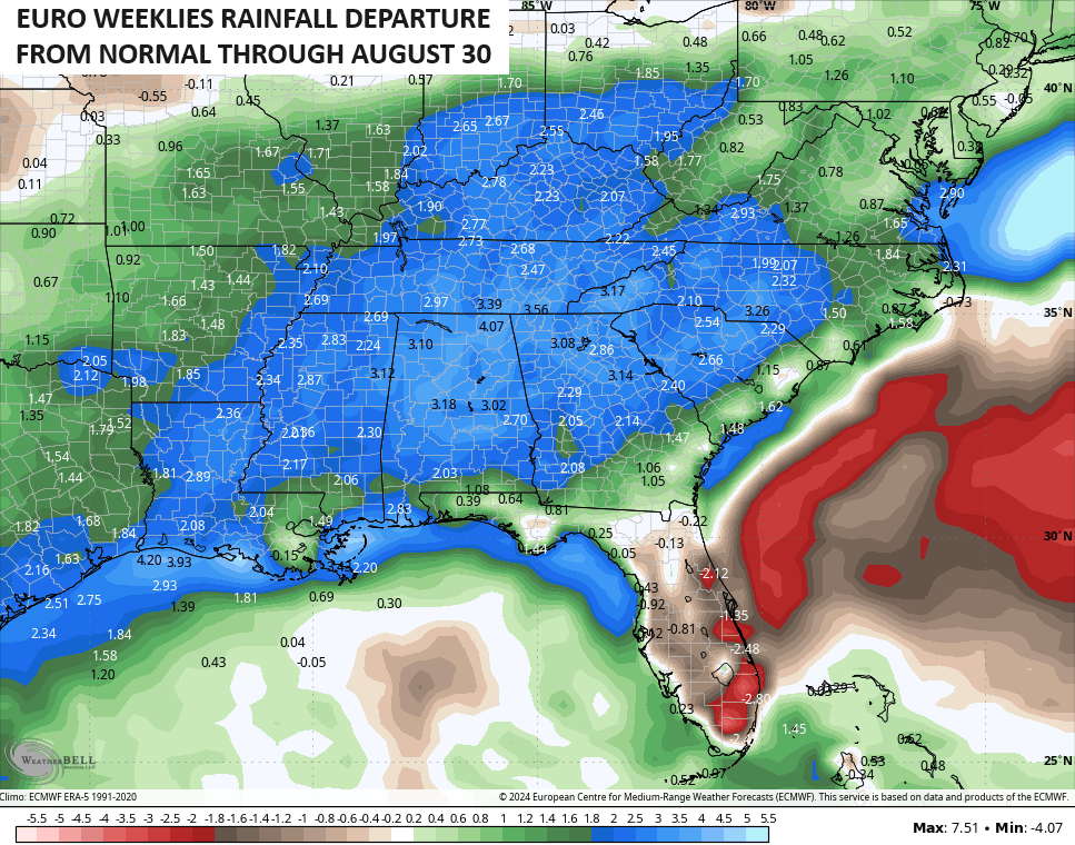
The longer range pattern is one I continue to think trends wetter than normal for the second half of summer.
Let’s start with today’s storms and roll forward.
A few showers and storms are blowing through the state today and putting down a ton of rain in some areas. Not everyone gets a lot of rain, but some spots can see flash flooding issues develop. A few of these storms may also be strong or severe with pockets of wind damage possible.
Here are your storm tracking tools for the day…


Leftover showers and storms continue into tonight and early Thursday, especially across the south and southeast. Those taper off as our cold front sweeps through here with much cooler air Thursday afternoon. Skies become partly to mostly sunny with low humidity and highs from the upper 70s to low 80s.
With clear skies Thursday night, watch for temps to reach the 50s by Friday morning…
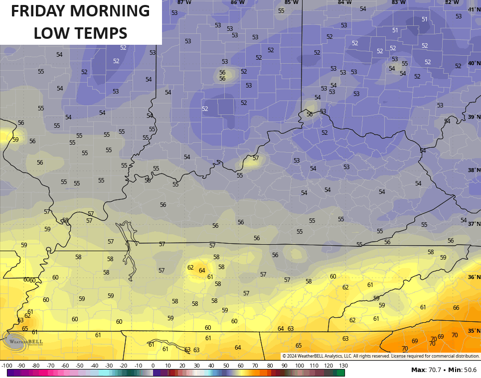
More in the way of awesome air continues through the rest of Friday with a mix of sun and clouds.
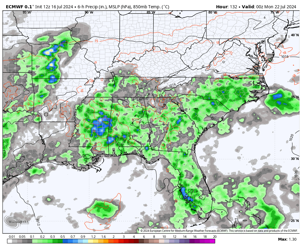
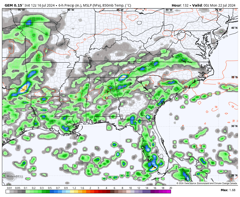
Scattered showers and storms try to press back in over the weekend with the best chance across the eastern half of the state. This kicks off a pattern featuring rounds of showers and storms that carry us through much of next week.
The models are in pretty good agreement with this…
EURO
CANADIAN
This is likely the beginning of a wetter pattern that takes us through the rest of the month and into August. The EURO Weeklies are growing more emphatic with above normal rainfall during this time…
Have a wonderful Wednesday and take care.

At least things are changing… We had a really decent rain that lasted about 20 min’s… had a lot of wind too… It was a good short drenching. What blows my mind is yesterday the organized storms were north of here…. Now they’re south of here… LOL
Richmond getting a great soaker.
.62” since midnight. Chris’s forecast sounds lovely. Faded greens and desert camo may begin to revert if hot days and scorching breezes indeed give way to cooler and damper.
1.10 inches of rain near Bowling Green since Midnight. Thunderstorm in the area right now, but the main action seems to be north or south of BG. Glad to see some relief… this recent stretch of heat has been hard to take!
A total of 11 tornadoes have been confirmed so far in the NWS Chicago forecast area from the derecho that slammed through the area Monday night. Six of the tornadoes were rated EF-0, five were rated EF-1.
One tornado occurred about five miles north of where I live in the SW Suburbs. On my block, there was no major damage, just lots of broken tree branches. Miraculously, the power did not go out. In the derecho of August 2020, my power was out for 32 hours.
Great weather here for the next several days, with sunny skies, low humidity, and temps in the upper 70s to low 80s. Hopefully you guys in KY will be getting the rain you need in the coming days.
Here is the link for the summary of the severe weather that took place here Monday night, which is in the process of being updated as the NWS completes all the storm surveys. https://weather.gov/lot/2024_07_15_Derecho
It’s certainly been a memorable year, Mike!