Good Friday to one and al. A cold front is now pressing to our south and it’s bringing a better brand of air behind it. This boundary won’t stay to our south very long as it lifts back to the north late this weekend, bringing a stormy setup for the closing days of July.
Clouds will be around for much of the region today with a little hazy sun from time to time. We are still seeing a few showers and storms hanging around the west and south through the day.
Your friendly Kentucky weather radars are on duty…

Humidity levels are down, making the day feel pretty comfy with temps in the 80s for this last Friday of the month.
The threat for showers and storms will gradually increase from southwest to northeast over the weekend. The Saturday stuff is scattered in the south and west before it ramps up on Sunday and continues through Sunday night…
Some pretty good rains will be likely starting late Sunday into Sunday night.
The trend of showers and storms then continues into Monday as we kick off a pretty active week of weather. These showers and storms come at us in waves from the northwest through the week and into next weekend…
This comes from a couple of upper level systems moving through during the week and the potential for a stronger upper level system to move in from the northwest for the first weekend of August…
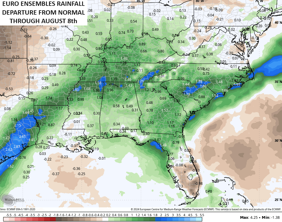
The long range from the EURO WEEKLIES continues to feature above normal rainfall…
Have a great Friday and take care.
