Good Saturday and welcome to the final weekend of July. How crazy is that??!! Temps continue to run on the pleasant side for this time of year as we get set for an increase in showers and storms for the closing days of the month. It’s a pattern that can produce some hefty rain totals for parts of Kentucky.
Let’s kick things off with what’s going on out there today.
Highs are generally in the 80s again with a mix of sun and clouds. Once again, that bit of a milky sky is courtesy of upper level smoke showing up from those wildfires burning out west and up into Canada. If you recall, this was a common occurrence last summer.
There’s also the threat for a few showers and storms to go up again out west and across far southern Kentucky. This action is pretty scattered but begins to pick up later tonight ahead of a healthy slug of moisture rolling up the Mississippi River and into the lower Ohio Valley.
This means rounds of showers and storms press in Sunday and continue into Monday.
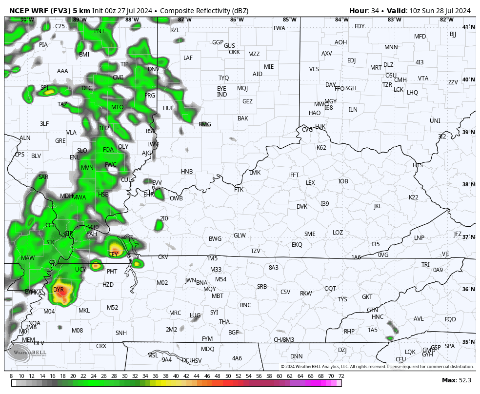
This future radar from the WRF starts Sunday morning and goes through Sunday evening…
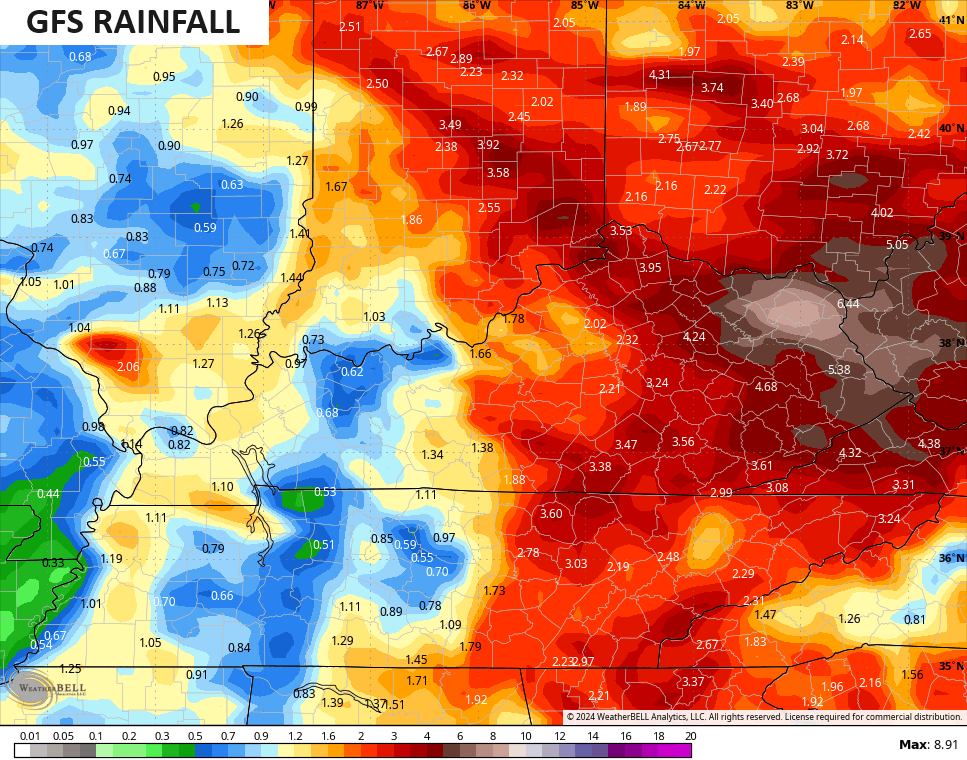
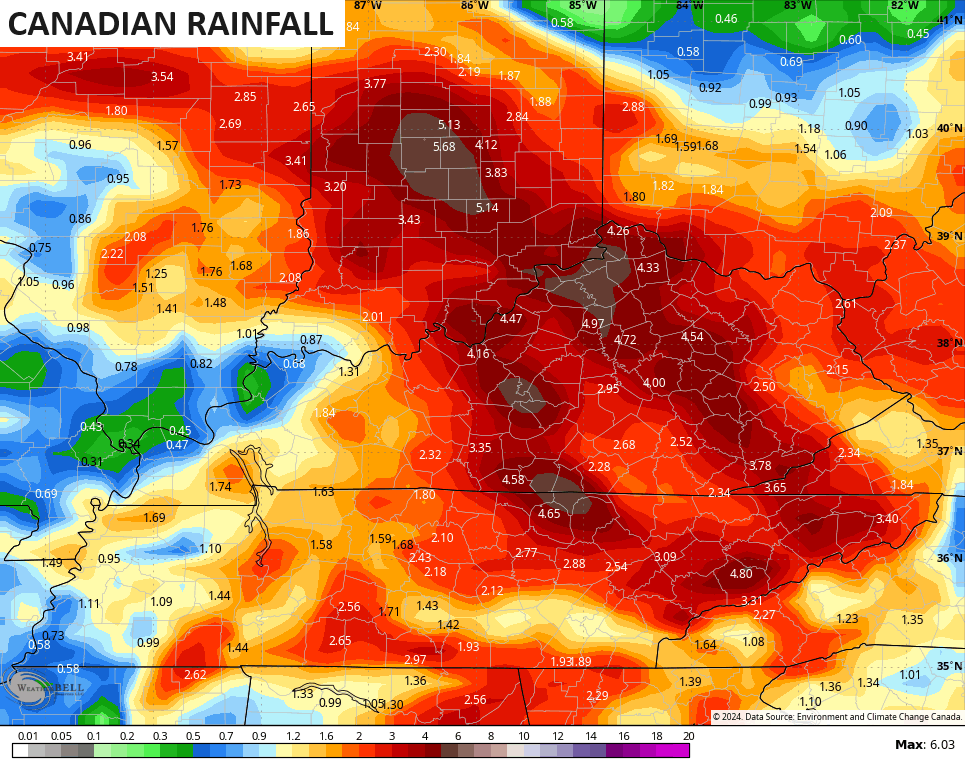
This same model run shows the potential for some big rain totals…
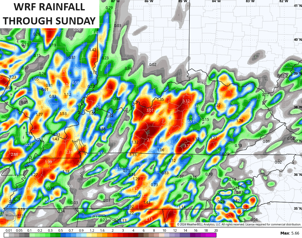
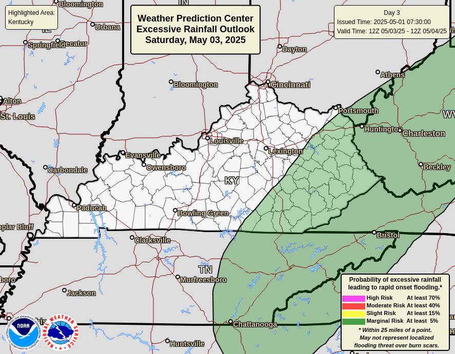
The chance is there for torrential rains from some of these storms and the Weather Prediction Center is highlighting this potential Sunday into Sunday night. They place Kentucky in the Marginal Risk to Slight Risk for excessive rainfall…
The pattern for the week ahead features rounds of thunderstorms dropping in from the northwest. I made this map for you guys on Tuesday of last week to illustrate the pattern I expected to see…
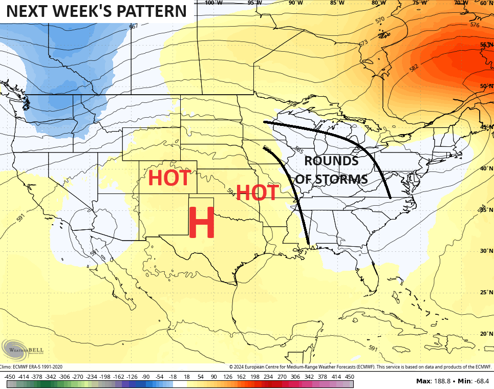
This kind of a setup can lead to some significant rainfall totals through this time next weekend and the models are seeing this potential, but have the usual placement disagreements…
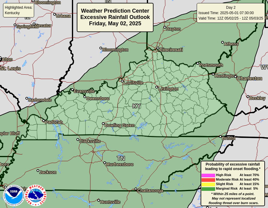
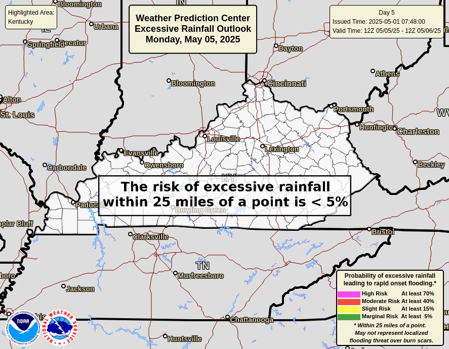
The Weather Prediction Center continues to highlight the chance for excessive rainfall through the middle of the week…

Here are your radars to track any action to our west and south…


Have a great day and take care.

Not buying the models. Heat wins.
Was in Middle Tennessee most of the week, driving home yesterday afternoon. From Danville on south, there was a spring-like, greenish cast to the landscape, whereas Fayette County has mostly a beatdown, burnt look.