Good evening, folks. Rounds of heavy rain and thunderstorms have already dropped 1″-2″ across parts of the state and we have more to come in the week ahead. This will up the chances for flash flooding and there’s even the chance for a few strong to severe storms.
Here’s my updated map showing where the heaviest rains may focus from Monday through Friday…
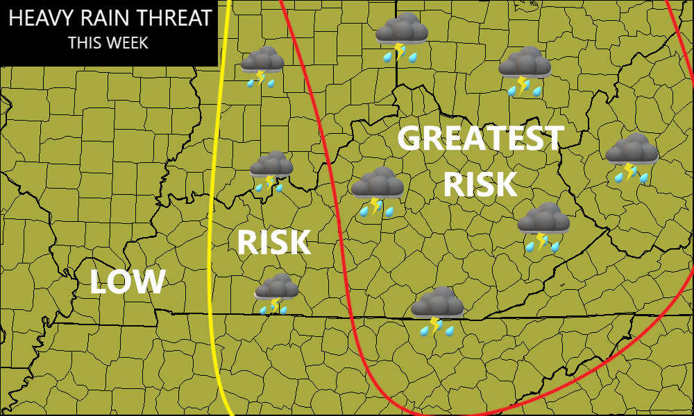
I’ve expanded that to include areas farther west and it may still need to go west just a bit.
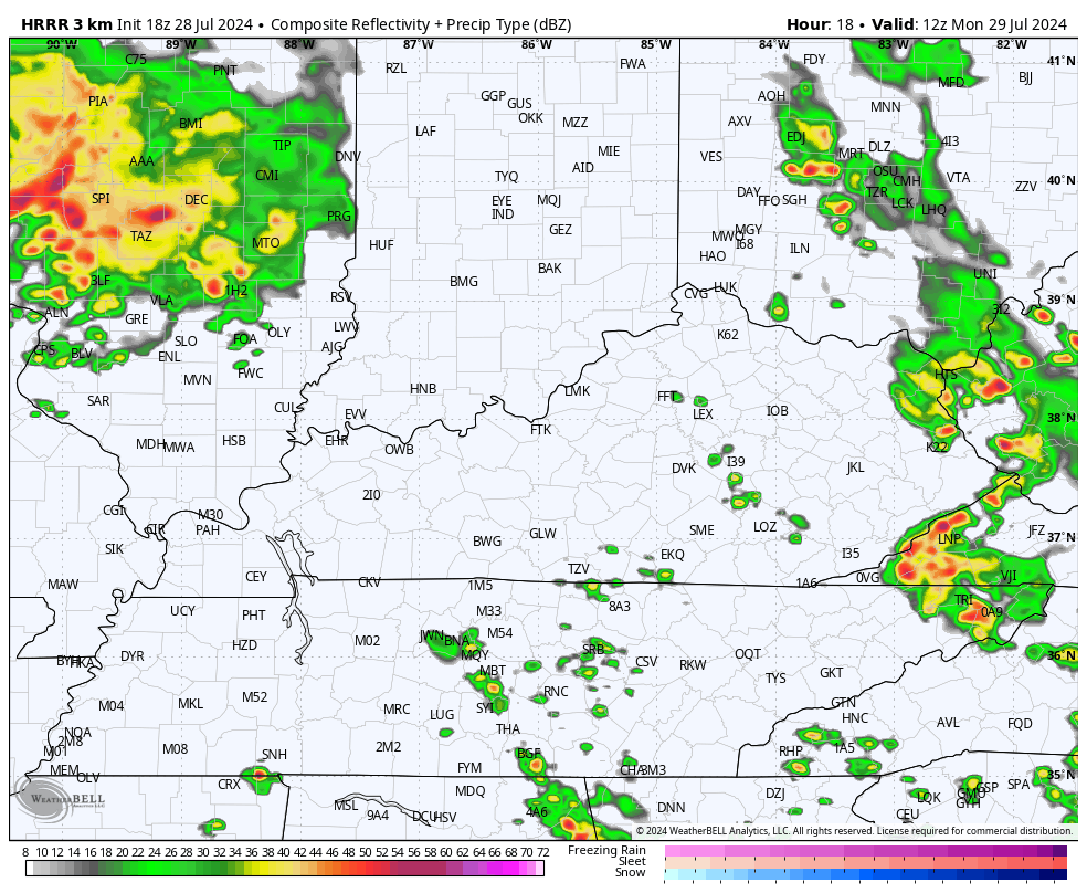
I’m watching Monday afternoon into Monday night for a few complexes of storms to drop in from the northwest, likely targeting central and eastern Kentucky. The Future Radar from the HRRR shows this action well…
Torrential rains may cause flash flooding with those storms, especially if they move over the same areas one right after another.
I’m also a little more concerned about severe weather during this same time. The Storm Prediction Center has a Marginal Risk for severe storms out for central and eastern parts of the state…

That may very well get bumped up to a Slight Risk later tonight or early Monday.
Damaging wind is the main threat, but there’s enough shear available for a tornado or two to spin up. The SPC shows our low-end tornado risk…

The threat for a few severe storms will then continue into Tuesday…

Additional rounds of northwest to southeast moving clusters of strong to severe storms will likely show up for the rest of the week. While the overall true severe storms threat isn’t the greatest in the world, some wind damage may show up.
My main concern continues to be with the flash flood threat as several inches of rain are likely in the coming days.
Here are your Sunday evening storm tracking toys to keep you company the rest of the day…


Enjoy the evening and take care.
