Good Wednesday to one and all. A weak cold front is dropping through the region and touching off scattered storms out there today. I’m tracking the storms, the chance Debby could have some impact in the east, and a blast of cooler air for the weekend.
I mentioned how the wet ground was helping out temps this week and the Kentucky Mesonet high temps from Tuesday shows exactly what I’m talking about. Areas that picked up the most rain over the past week could only hit the upper 80s to near 9o. Areas that didn’t pick up as much rain, especially north and east, were much hotter…

A wet ground doesn’t care what your computer says the temps will be.
Temps are down area-wide today with mid and upper 80s for many. Scattered storms go up from time to time, but won’t be terribly widespread. Here are your Kentucky radars to follow whatever goes up…

Scattered showers and storms may still be noted on Thursday, especially across the eastern half of the state. Temps edge back up just a bit.
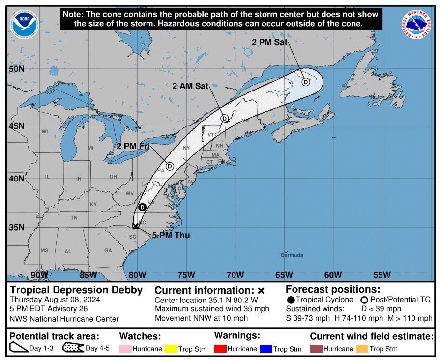
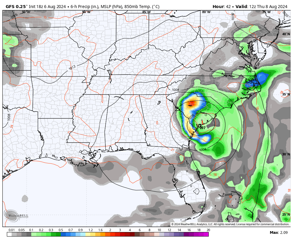
Tropical Storm Debby is just off the South Carolina coastline and will make another landfall later tonight. From there, this storm pushes through North Carolina and then all the way to New England.
Here’s the latest information and track forecast from the National Hurricane Center…
The sat shot shows just how much real estate this storm is covering across the southeast…

There’s the chance for what’s left of Debby to bring a few showers into far eastern Kentucky as it lifts to the north on Friday…
This is ahead of a deep trough that has below normal temps settling in for the weekend and into early next week. The GFS has the coolest look of the bunch…
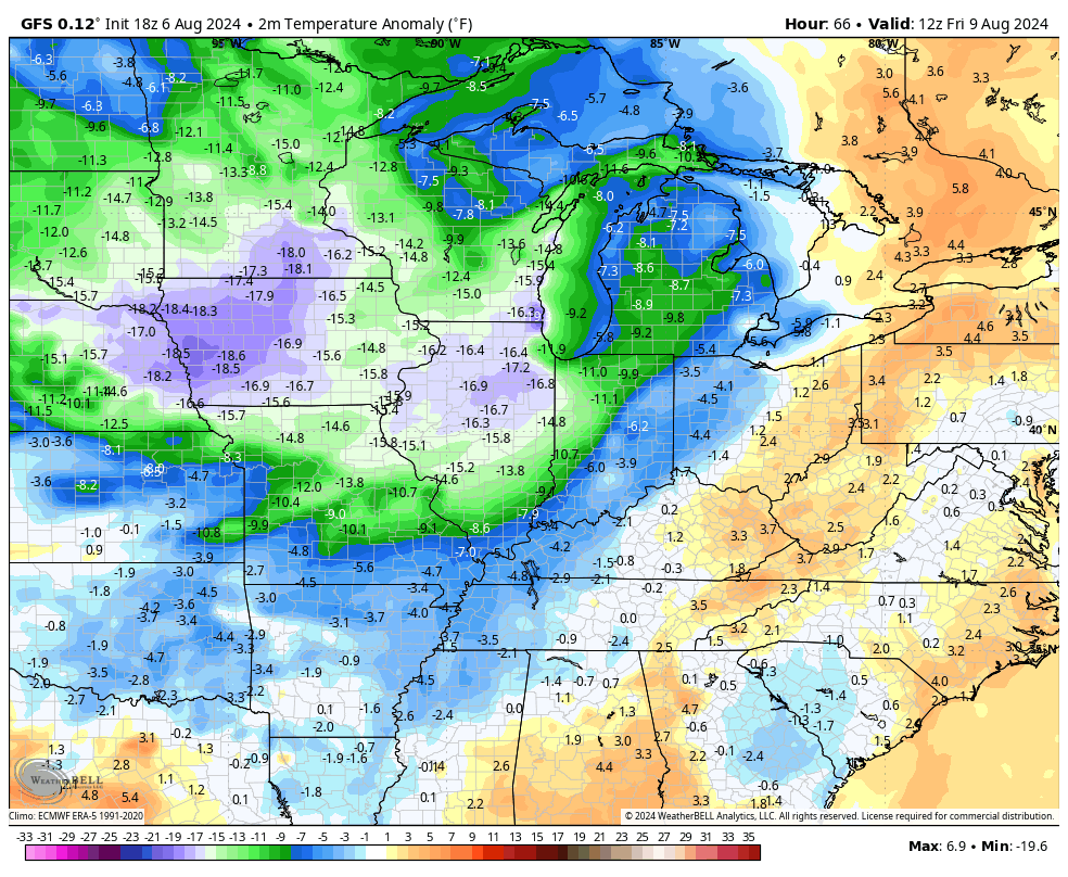
Lows by Saturday and Sunday should reach the 50s for much of the region with the GFS showing the chance for temps to reach the low 50s…
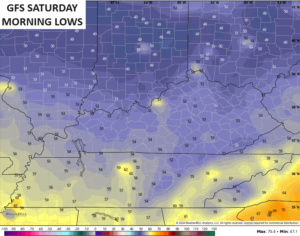
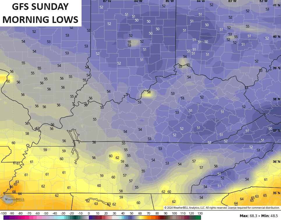
Those may be just a bit too cool, but you get the idea.
Highs over the weekend reach the upper 70s and low 80s with low humidity and plenty of sunshine. Overall, this is a great looking and feeling weekend.
Have a great Wednesday and take care

It was 92-94 so far this week in Richmond.
Temps will be more comfy, but not a true “blast” of cool air when August normally has a few mornings well into the 50s.
We hit a heat index for several hours yesterday afternoon of 101 degrees. Stepped outside this morning and verified the instrument readings (72 degrees dew point & 94% humidity). It felt like being wrapped in a warm, wet blanket.
Thanks Chris. I hope this cold front travels far enough south that we receive those morning lows in the low 50’s. And it doesn’t swing back so quick as a warm front. Also, I notice the atmosphere has just been plain dirty this
Summer. Never seen it so dirty in my life. Hoping the cold front will turn our skies blue agin, so we may be able to see the stars and planets on these late Summer evenings.
Enjoy the day everyone !