Good Thursday, everyone. It’s another day of some steamy temps and scattered storms, but a BIG change is on the way. We have a serious blast of September air blowing into the bluegrass state for the upcoming weekend. Bring. It. On.
Temps today range from the mid 80s to the low 90s depending on where you are in Kentucky. Clouds will be filtering in from east to west as Debby works through the Carolinas and toward Virginia. These clouds will spit out some scattered storms across central and eastern Kentucky and there may be a narrow band of torrential rain makers setting up.
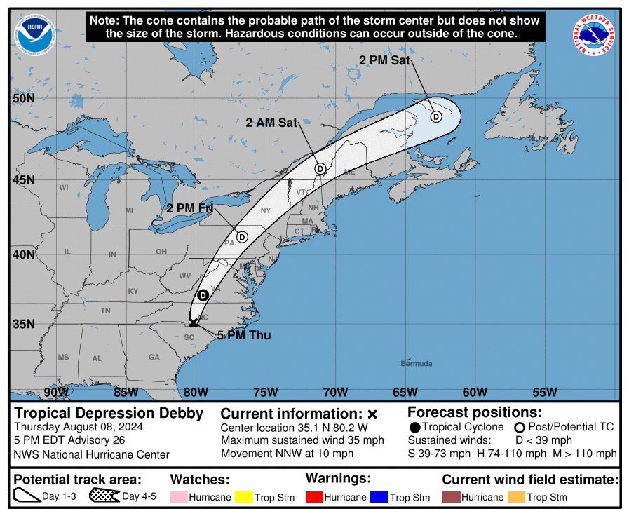
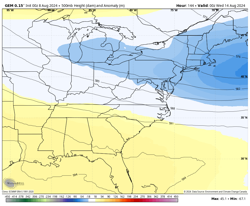
Here are your radars to track those storms and to watch Debby to our east…

Speaking of Debby, this storm came ashore overnight in South Carolina and slowly works to the north. The track on this takes the leftovers through New England and into easter Canada…
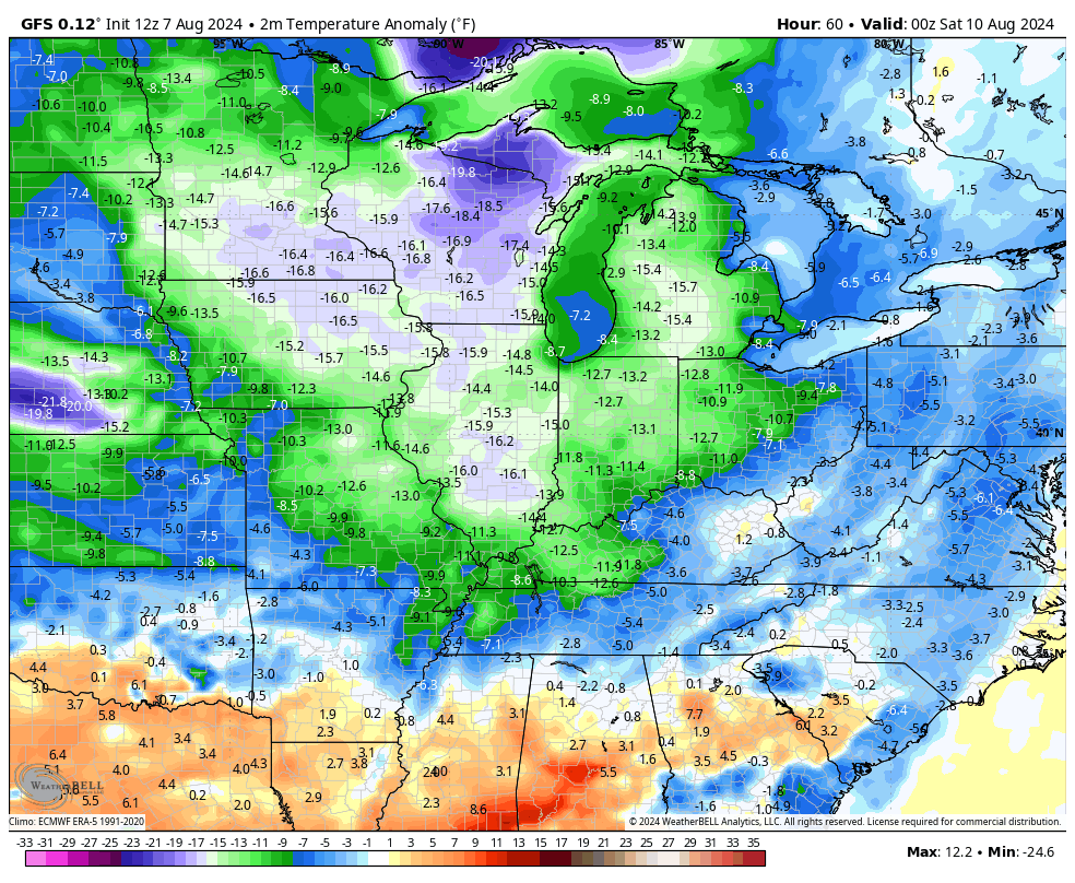
A MAJOR cold front sweeps in here on Friday with much cooler air blasting in from west to east. This takes our temps well below normal from late Friday through Monday, at least. Take a look at just how far below normal…
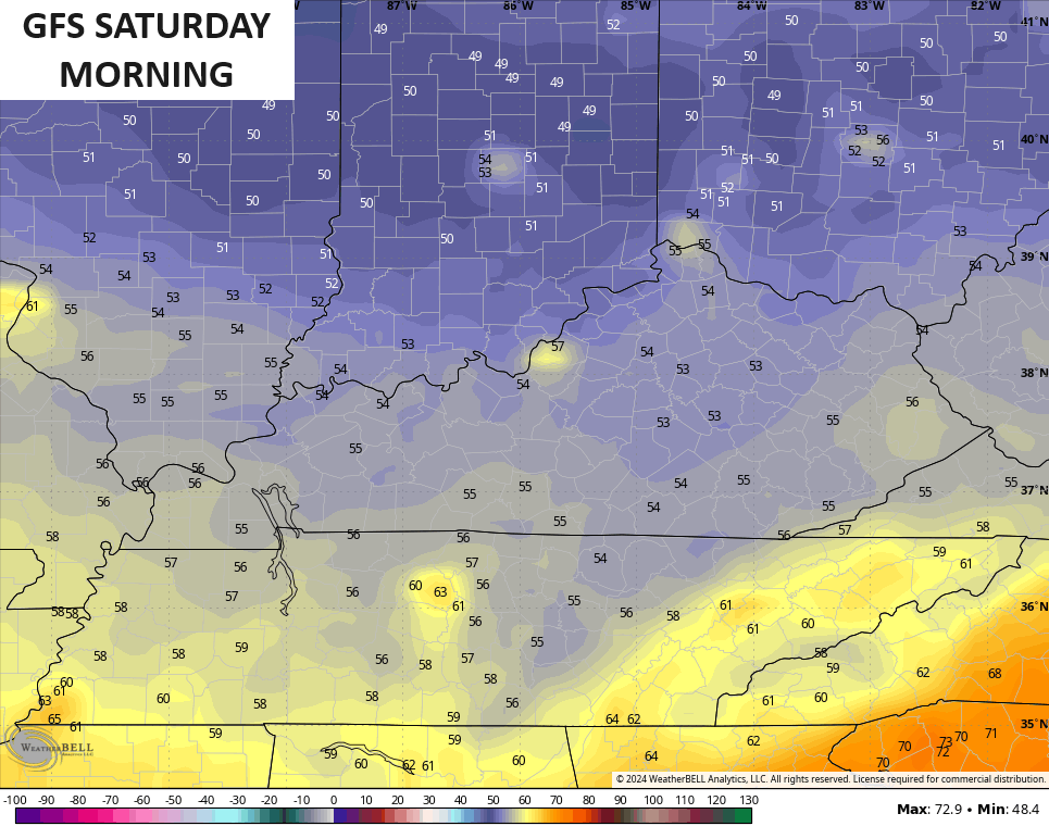
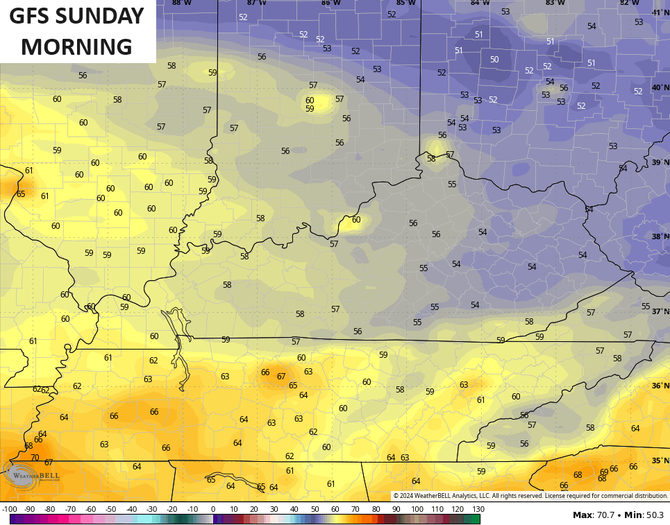
Highs reach the upper 70s to low 80s for Saturday and Sunday as humidity levels bottom out. Lows can reach the low 50s in some spots both Saturday and Sunday mornings…
Moral of the story is… This weekend will get your fall juices flowing!
Another trough may try to dig in later next week…
Make it a great day and take care.

It’s really not “well below normal” at all.
Thanks Chris. Glad to see weather systems beginning to move. Tired of the stagnation in our atmosphere. The Pacific Decadal Oscillation is ever so slightly moving from it’s negative long play. This could indicate a change in our precipitation pattern. We shall see next month.
Have a great day everyone !
I mean…. me too! Just like yesterday… the forecast high was for 88…. and it just had to get to 90… and it seemed to do it with EASE… even after the rains…. I remember one summer where we never made it to 90… not even once (I think)… Possibly once… but I feel like it never happened that summer. This was a few years ago… I LOVED IT
Glad the temps will be cooler… This time of year the tropics can make the weather SOO BORING here unless we get remnants
2004 was the year
I remember 2004 quite well. It wasn’t the temperature soo much, but the two feet of Snow that fell just in time for Christmas. That ocurred in Vanderburgh county in Indiana. I read a post sometime on here that Kentucky didn’t receive any Snow, but freezing rain and a power failure that Christmas. Snow is not what Christmas is about, but missing Snow at Christmas is just plain sad.
Pulled saws, saw horses, & tools yesterday onto the driveway and set up for a day-long project. “Scattered showers” looked like anywhere but here. By early afternoon, thickening clouds and fitful puffs of wind convinced me to pack it in. Not a moment too soon. Got .27” over the next 2 hours. Took a nap. Going to resume this morning with a weather eye on the skies. Looking forward to the weekend weather.
Yesterday only got up to 81 degrees for the high coolest day of the summer so far. Looking forward even better temps over the weekend. Ready for fall to roll in.
Bring on Fall it can’t come soon enough for me.
I was ready for Fall weather on July 5th.