Good Friday to one and all. Our amazing stretch of early October weather in the middle of August is coming to an end. The end will lead us into a steamier pattern that turns stormy into the last week of the month.
This run of cooler than normal temps has been nothing short of incredible, if not historic. The month of August has been a very cool one around here and for much of the surrounding areas…
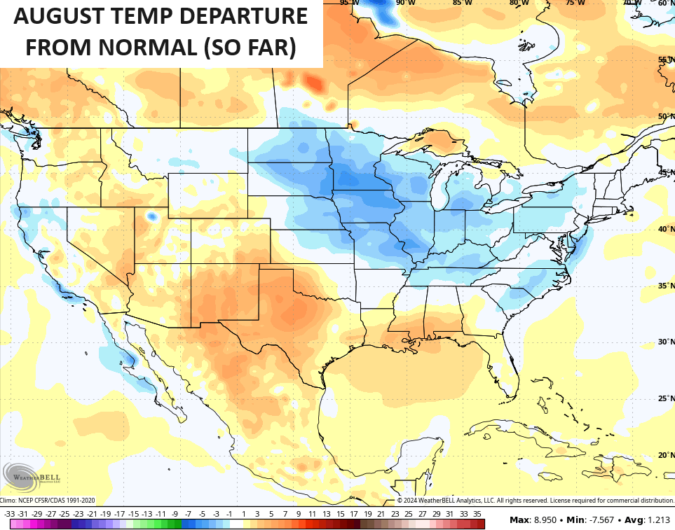
Temps today start in the upper 40s and low 50s for central and eastern Kentucky with upper 50s to around 60 in the west. Afternoon temps reach the low 80s central and eastern Kentucky with mid and upper 80s west. Humidity levels stay low as a few clouds stream in.
The weekend feels more like August should, especially in the west. Highs in the west will push 90 or so with 80s in the eastern half of the state. Humidity levels still won’t be too bad, but those numbers climb some by early next week. That’s when 90 degree temps show up, but some thunderstorms will develop and try to knock the numbers down.
The models are trying to figure out exactly how to handle the end of next week and that trough working through the country.
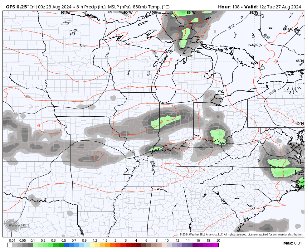
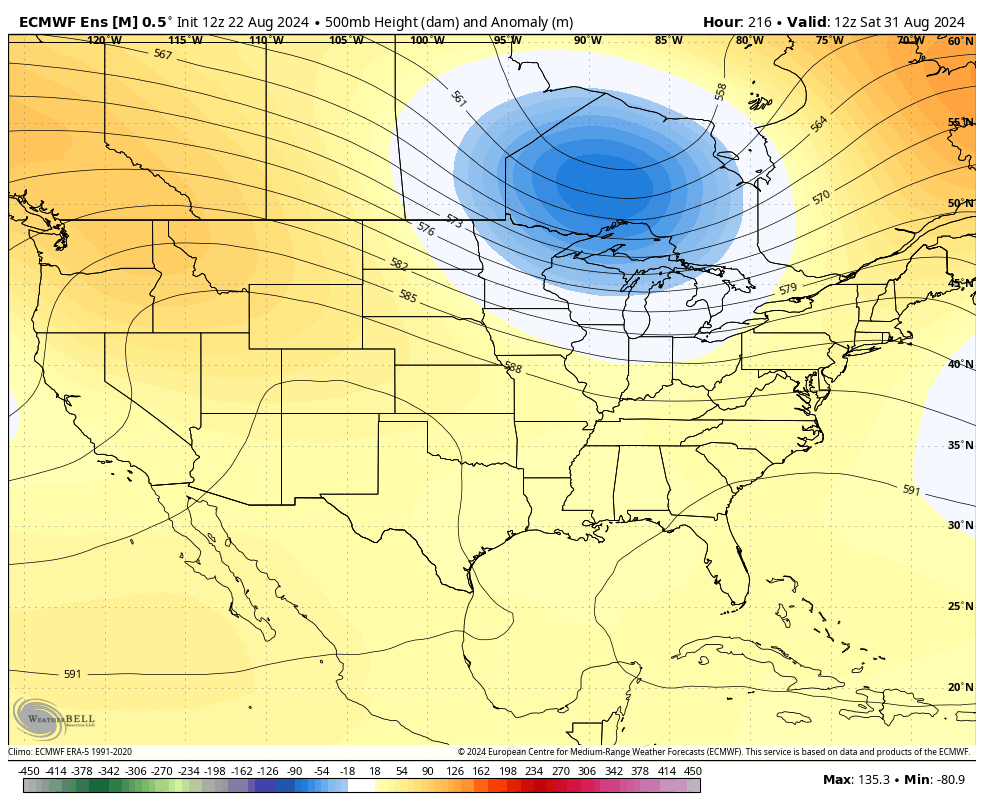
The GFS is now ramping up the storm chances next week and through the Labor Day Weekend as it brings a slow-moving upper-level system through the region…
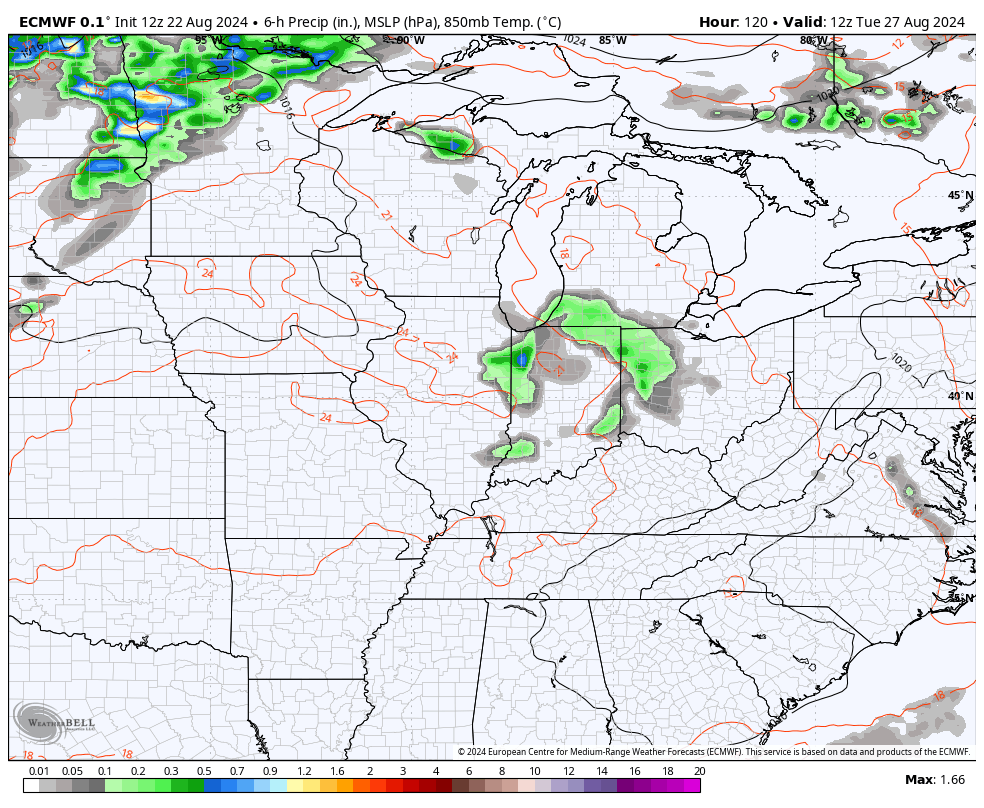
The EURO has some midweek storms but continues to bring an active cold front in here to kick off the Labor Day weekend…
That comes from what the EURO Ensembles show as the first in a series of troughs diving into the eastern half of the country.
The Control Run shows this very well…
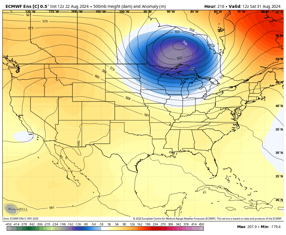
You can also see how the average of the 100 member EURO Ensembles is also going in that direction…
Have a fantastic Friday and take care.

A/C off; sprinkler on.
Thanks Chris. Really enjoyed the brief period of early Autumn weather. Yesterday morning we had a low temperature of 45 degrees. That is amazing for our part of the state. I hate to here that the temperature may reach a 100 degrees next week. I been watching what is going on with solar cycle # 25, and everytime we have a magnetic storm ( sunpots, ) intensifies the high presure systems that have dominated our Summer 2024.
Here’s NOAA outlook for ( S O N. ) These long range forecast are about as accurate as any I can find. They have been reliable for many years and predicted the hard Winter from 1976 to 1978. Looks like a very warm and dry Autumn 2024. UGH !
https://www.cpc.ncep.noaa.gov/products/predictions/long_range/seasonal.php?lead=1
Adding to the above ENSO / neutral will likely give way to ENSO / La Nina just in time for another Mild Winter in our part of the nation. Looks Cold and Snowy for parts of the Northwest. Anymore, I look at it this way at lease our heating bills will be lower and we want have to worry about being Snowbound.
Enjoy the day everyone !
Watch out for a heat spell such as late September 2019.
It’s a possibility Jeff, But who know what mother nature will do.
Truth